File:Bread street ward and Cordwainer ward 1720 john stow with streets highlighted.jpg
Original file (1,059 × 612 pixels, file size: 249 KB, MIME type: image/jpeg)
Captions
Captions
| Description |
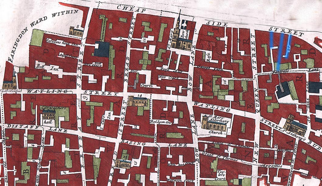
English: The Wards of Breadstreet and Cordwainer
The overlaid streets are from Holt, Richard; Baker, Nigel (2001), Lynne Bevan, ed., Indecent Exposure - sexuality, society and the archaeological record - Prostitution in English Medieval Towns, Glasgow: Cruithne Press, ISBN 1-873448-19-8Including Bow Lane, Friday Street, New Queen St., Watling St, Distaff Lane and Budge Row. Grope Countelane in the middle (blue) is bordered by Bordhawlane on the right, and Puppekirtylane on the left. Although these streets are mostly gone, the map does demonstrate the number of narrow streets in the area. The 1720 map is from John Stow (John Strype, editor), Survey of the Cities of London and Westminster London, 1720, 2 volumes |
| Date | |
| Source | http://www.oldlondonmaps.com/stowpages/broad.html |
| Author | John Stow |
Licensing
[edit]
|
This work is in the public domain in its country of origin and other countries and areas where the copyright term is the author's life plus 100 years or fewer. This work is in the public domain in the United States because it was published (or registered with the U.S. Copyright Office) before January 1, 1929. | |
| This file has been identified as being free of known restrictions under copyright law, including all related and neighboring rights. | |
File history
Click on a date/time to view the file as it appeared at that time.
| Date/Time | Thumbnail | Dimensions | User | Comment | |
|---|---|---|---|---|---|
| current | 13:37, 21 April 2009 | | 1,059 × 612 (249 KB) | Parrot of Doom (talk | contribs) | {{Information |Description={{en|1=== Summary == {{Information |Description={{en|1=The Wards of Breadstreet and Cordwainer Including Bow Lane, Friday Street, New Queen St., Watling St, Distaff Lane and Budge Row from John Stow (John Strype, editor), Surv |
You cannot overwrite this file.
File usage on Commons
There are no pages that use this file.
File usage on other wikis
The following other wikis use this file:
- Usage on en.wikipedia.org
- Usage on es.wikipedia.org
- Usage on fr.wikipedia.org
- Usage on it.wikipedia.org
- Usage on ja.wikipedia.org
- Usage on pt.wikipedia.org
- Usage on www.wikidata.org