File:Brazil states1789 eo.svg
Jump to navigation
Jump to search

Size of this PNG preview of this SVG file: 308 × 303 pixels. Other resolutions: 244 × 240 pixels | 488 × 480 pixels | 781 × 768 pixels | 1,041 × 1,024 pixels | 2,082 × 2,048 pixels.
Original file (SVG file, nominally 308 × 303 pixels, file size: 79 KB)
Captions
Captions
Add a one-line explanation of what this file represents

|
This file has been superseded by Brazil (1789).svg. It is recommended to use the other file. Please note that deleting superseded images requires consent.
|

|
.svg)
| Description |
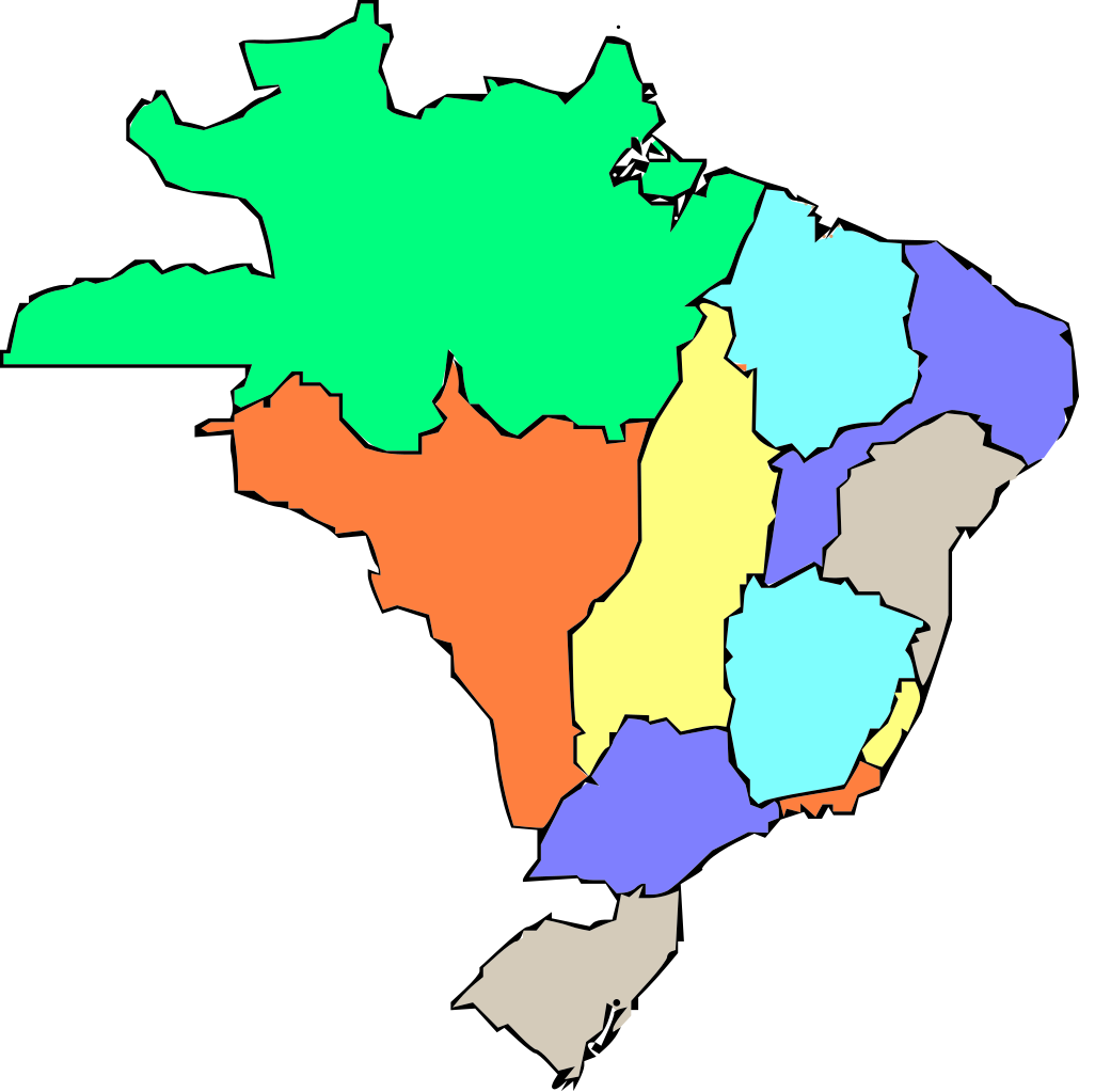
English: Map of Brazilian administrative division as of 1789. Esperanto: Mapo de la administra divido de Brazilo en 1789.
Português: Mapa da divisão administrativa do Brasil em 1789.
Русский: Карта административного деления Бразилии в 1789 г. |
| Date | (UTC) |
| Source | |
| Author |
|
| This is a retouched picture, which means that it has been digitally altered from its original version. Modifications: eo. The original can be viewed here: Brazil states1789 rus.svg:
|
I, the copyright holder of this work, hereby publish it under the following licenses:
This file is licensed under the Creative Commons Attribution-Share Alike 2.5 Generic, 2.0 Generic and 1.0 Generic license.
- You are free:
- to share – to copy, distribute and transmit the work
- to remix – to adapt the work
- Under the following conditions:
- attribution – You must give appropriate credit, provide a link to the license, and indicate if changes were made. You may do so in any reasonable manner, but not in any way that suggests the licensor endorses you or your use.
- share alike – If you remix, transform, or build upon the material, you must distribute your contributions under the same or compatible license as the original.
| This file is licensed under the Creative Commons Attribution-Share Alike 3.0 Unported license. | ||
| ||
| This licensing tag was added to this file as part of the GFDL licensing update. |

|
Permission is granted to copy, distribute and/or modify this document under the terms of the GNU Free Documentation License, Version 1.2 or any later version published by the Free Software Foundation; with no Invariant Sections, no Front-Cover Texts, and no Back-Cover Texts. A copy of the license is included in the section entitled GNU Free Documentation License. |
You may select the license of your choice.
Original upload log
[edit]
This image is a derivative work of the following images:
- File:Brazil_states1789_rus.svg licensed with Cc-by-sa-2.5,2.0,1.0, Cc-by-sa-3.0-migrated, GFDL
- 2009-05-14T09:45:57Z Nekto 308x303 (176757 Bytes) {{Information |Description=Map of Brazilian administrative division as of 1789. (made by wiki user [[pt:usuário:Pedro Aguiar]] |Source=*[[:File:Brazil_states1789.png|]] |Date=2009-05-14 10:43 (UTC) |Author=*[[:File:Brazil_s
Uploaded with derivativeFX
File history
Click on a date/time to view the file as it appeared at that time.
| Date/Time | Thumbnail | Dimensions | User | Comment | |
|---|---|---|---|---|---|
| current | 23:58, 26 August 2011 | | 308 × 303 (79 KB) | Richard Melo da Silva (talk | contribs) | {{Information |Description={{en|1=Map of Brazilian administrative division as of 1789.}} {{eo|1=Mapo de la administra divido de Brazilo en 1789.}} {{pt|1=Mapa da divisão administrativa do Brasil em 1789.}} {{ru|1=Карта административно |
You cannot overwrite this file.
File usage on Commons
There are no pages that use this file.