File:Brazil CentroOeste physical map.png
Jump to navigation
Jump to search

Size of this preview: 597 × 599 pixels. Other resolutions: 239 × 240 pixels | 478 × 480 pixels.
Original file (800 × 803 pixels, file size: 51 KB, MIME type: image/png)
Captions
Captions
Add a one-line explanation of what this file represents
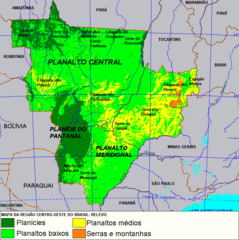
| Description | Center-West of Brazil physical map. |
| Date | |
| Source | Deyvid Aleksandr Raffo Setti. |
| Author | Deyvid Aleksandr Raffo Setti. |
| Permission (Reusing this file) |
This geographic map can be used for any educational, personal or commercial purposes. |
| I, the copyright holder of this work, release this work into the public domain. This applies worldwide. In some countries this may not be legally possible; if so: I grant anyone the right to use this work for any purpose, without any conditions, unless such conditions are required by law. |
Original upload log
[edit]
| Date/Time | Dimensions | User | Comment |
|---|---|---|---|
| 26 January 2006, 00:26:41 | 800 × 803 (53850 bytes) | Deyvid Setti (talk · contribs) | {{Information| |Description = Center-West of Brazil physical map. |Source = Deyvid Aleksandr Raffo Setti. |Date = created 25. Jan. 2006. |Author = Deyvid Aleksandr Raffo Setti. }} {{PD-self}} |
File history
Click on a date/time to view the file as it appeared at that time.
| Date/Time | Thumbnail | Dimensions | User | Comment | |
|---|---|---|---|---|---|
| current | 09:54, 26 August 2014 | | 800 × 803 (51 KB) | GifTagger (talk | contribs) | Bot: Converting file to superior PNG file. (Source: Brazil_CentroOeste_physical_map.gif). This GIF was problematic due to non-greyscale color table. |
You cannot overwrite this file.
File usage on Commons
The following page uses this file:
- File:Brazil CentroOeste physical map.gif (file redirect)
File usage on other wikis
The following other wikis use this file:
- Usage on de.wikipedia.org
- Usage on gl.wikipedia.org
- Usage on io.wikipedia.org
- Usage on pt.wikipedia.org