File:Brazil-Guyana Border (14081736074).jpg
Jump to navigation
Jump to search

Size of this preview: 800 × 600 pixels. Other resolutions: 320 × 240 pixels | 640 × 480 pixels | 1,024 × 768 pixels.
Original file (1,024 × 768 pixels, file size: 140 KB, MIME type: image/jpeg)
Captions
Captions
Add a one-line explanation of what this file represents
Summary
[edit].jpg&action=edit§ion=1)
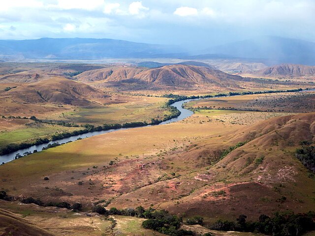
| Description | The Ireng River (Rio Mau) marks the border between the rolling grasslands of southwestern Guyana and those of northern Brazil. |
| Date | |
| Source | Brazil-Guyana Border |
| Author | David Stanley from Nanaimo, Canada |
| Camera location | | View this and other nearby images on: OpenStreetMap |
|---|
.jpg¶ms=004.733062_N_-060.025520_E_globe:Earth_type:camera_source:Flickr_&language=en)
Licensing
[edit].jpg&action=edit§ion=2)
This file is licensed under the Creative Commons Attribution 2.0 Generic license.
- You are free:
- to share – to copy, distribute and transmit the work
- to remix – to adapt the work
- Under the following conditions:
- attribution – You must give appropriate credit, provide a link to the license, and indicate if changes were made. You may do so in any reasonable manner, but not in any way that suggests the licensor endorses you or your use.
| This image was originally posted to Flickr by D-Stanley at https://flickr.com/photos/79721788@N00/14081736074. It was reviewed on 23 November 2020 by FlickreviewR 2 and was confirmed to be licensed under the terms of the cc-by-2.0. |
File history
Click on a date/time to view the file as it appeared at that time.
| Date/Time | Thumbnail | Dimensions | User | Comment | |
|---|---|---|---|---|---|
| current | 23:40, 23 November 2020 | | 1,024 × 768 (140 KB) | Matlin (talk | contribs) | Transferred from Flickr via #flickr2commons |
You cannot overwrite this file.
File usage on Commons
The following 2 pages use this file:
- File:Guyana and Brazil.jpg (file redirect)
- Category:Relations of Brazil and Guyana
File usage on other wikis
The following other wikis use this file:
- Usage on en.wikipedia.org
- Usage on nl.wikipedia.org
- Usage on uk.wikipedia.org
- Usage on www.wikidata.org
.jpg&oldid=841148149)