File:Bratislava Region - physical map.png
Jump to navigation
Jump to search

Size of this preview: 494 × 600 pixels. Other resolutions: 198 × 240 pixels | 560 × 680 pixels.
Original file (560 × 680 pixels, file size: 1.09 MB, MIME type: image/png)
Captions
Captions
Add a one-line explanation of what this file represents
| Description |
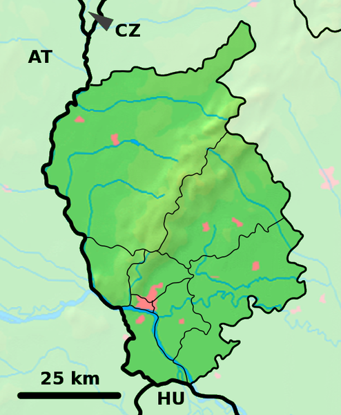
Background map of the Bratislava Region, Slovakia, ready for the Geobox template, calibrated at en:Template:Geobox locator Bratislava Region Outline map of the Bratislava Region, Slovakia, ready for the Geobox template, calibrated at en:Template:Geobox locator Bratislava Region |
| Date | (UTC) |
| Source | |
| Author |
|
| This is a retouched picture, which means that it has been digitally altered from its original version. Modifications: fusion. The original can be viewed here: Bratislava Region - outline map.svg:
|
This file is licensed under the Creative Commons Attribution-Share Alike 3.0 Unported license.
- You are free:
- to share – to copy, distribute and transmit the work
- to remix – to adapt the work
- Under the following conditions:
- attribution – You must give appropriate credit, provide a link to the license, and indicate if changes were made. You may do so in any reasonable manner, but not in any way that suggests the licensor endorses you or your use.
- share alike – If you remix, transform, or build upon the material, you must distribute your contributions under the same or compatible license as the original.
Original upload log
[edit]
This image is a derivative work of the following images:
- File:Bratislava_Region_-_background_map.png licensed with PD-Demis
- 2007-10-28T23:14:11Z Caroig 560x680 (333118 Bytes) fixing alignment
- 2007-10-27T19:44:14Z Caroig 560x680 (335827 Bytes) == Summary == {{Information |Description=Background map of the Bratislava Region, Slovakia, ready for the [[:en:Template:Geobox|Geobox]] template, calibrated at [[:en:Template:Geobox locator Bratislava Region]] |Source=Made m
- File:Bratislava_Region_-_outline_map.svg licensed with Cc-by-sa-3.0,2.5,2.0,1.0, GFDL
- 2007-10-27T19:47:14Z Caroig 700x850 (120252 Bytes) == Summary == {{Information |Description=Outline map of the Bratislava Region, Slovakia, ready for the [[:en:Template:Geobox|Geobox]] template, calibrated at [[:en:Template:Geobox locator Bratislava Region]] |Source=self-made
Uploaded with derivativeFX
File history
Click on a date/time to view the file as it appeared at that time.
| Date/Time | Thumbnail | Dimensions | User | Comment | |
|---|---|---|---|---|---|
| current | 18:01, 19 September 2010 | | 560 × 680 (1.09 MB) | Adehertogh (talk | contribs) | {{Information |Description=Background map of the Bratislava Region, Slovakia, ready for the Geobox template, calibrated at en:Template:Geobox locator Bratislava Region Outline map of the Bratislava Region, Slovakia, ready for |
You cannot overwrite this file.
File usage on Commons
The following 22 pages use this file:
- File talk:Trnava Region - physical map.png
- Category:Births in Bratislava Region
- Category:Bodies of water in Bratislava Region
- Category:Bratislava, Eslovaquia por Axel Cotón Gutiérrez
- Category:Bratislava Region
- Category:Burials in Bratislava Region
- Category:Churches in Bratislava Region
- Category:Culture of Bratislava Region
- Category:Deaths in Bratislava Region
- Category:Events in Bratislava Region
- Category:History of Bratislava Region
- Category:Hotels in Bratislava Region
- Category:Lakes of Bratislava Region
- Category:Organizations of Bratislava Region
- Category:Protected areas in Bratislava Region
- Category:Religion in Bratislava Region
- Category:Schools in Bratislava Region
- Category:Sports in Bratislava Region
- Category:Stations of the Cross in Bratislava Region
- Category:Train stations in Bratislava Region
- Category:Transport in Bratislava Region
- Category:Villages and municipalities in the Bratislava Region
File usage on other wikis
The following other wikis use this file:
- Usage on bg.wikipedia.org
- Usage on en.wikipedia.org
- Pezinok
- Gajary
- Malacky
- Petržalka
- Modra
- Svätý Jur
- Dunajská Lužná
- Senec, Slovakia
- Vysoká pri Morave
- Jakubov
- Kostolište
- Suchohrad
- Jablonové, Malacky District
- Pernek
- Kuchyňa
- Rusovce
- Jarovce
- Blatné
- Rohožník, Malacky District
- Borinka
- Zohor
- Láb
- Lozorno
- Marianka
- Plavecké Podhradie
- Plavecký Mikuláš
- Plavecký Štvrtok
- Sološnica
- Studienka
- Veľké Leváre
- Závod, Slovakia
- Budmerice
- Báhoň
- Doľany, Pezinok District
- Dubová, Pezinok District
- Jablonec, Pezinok District
- Slovenský Grob
- Vinosady
- Limbach, Slovakia
- Viničné
- Vištuk
- Štefanová, Pezinok District
- Šenkvice
- Častá
- Bernolákovo
- Boldog, Slovakia
View more global usage of this file.