File:Brandhorn.jpg
From Wikimedia Commons, the free media repository
Jump to navigation
Jump to search
Size of this preview: 797 × 600 pixels. Other resolutions: 319 × 240 pixels | 638 × 480 pixels | 1,021 × 768 pixels | 1,280 × 963 pixels | 2,020 × 1,520 pixels.
Original file (2,020 × 1,520 pixels, file size: 662 KB, MIME type: image/jpeg)
File information
Structured data
Captions
DescriptionBrandhorn.jpg |
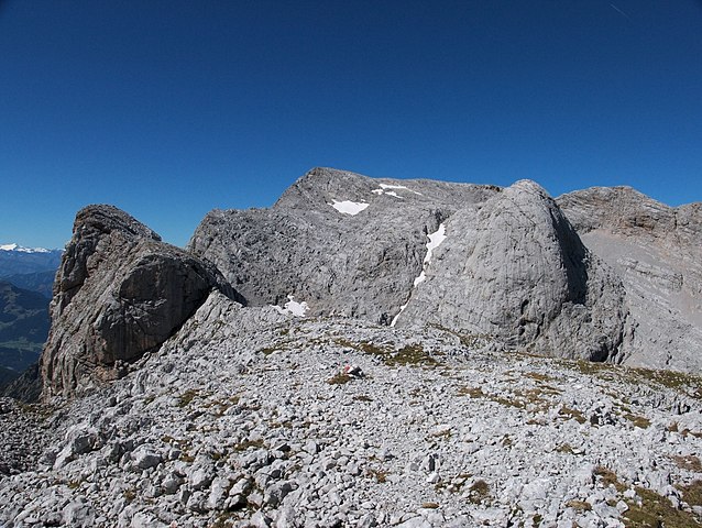
Deutsch: Kleines Brandhorn (links), Brandhorn (Mitte) und Kohlhaufen (rechts) |
Date | |
Source | Own work |
Author | Kogo |
Permission (Reusing this file) |
This file is licensed under the Creative Commons Attribution-Share Alike 3.0 Germany license. Attribution: kogo
|
Camera location | 47° 26′ 53.38″ N, 13° 00′ 47.14″ E | View this and other nearby images on: OpenStreetMap | 47.448160; 13.013094 |
---|
Annotations InfoField | This image is annotated: View the annotations at Commons |
887
436
94
68
2020
1520
Brandhorn
File history
Click on a date/time to view the file as it appeared at that time.
Date/Time | Thumbnail | Dimensions | User | Comment | |
---|---|---|---|---|---|
current | 17:46, 21 November 2015 | 2,020 × 1,520 (662 KB) | Kogo (talk | contribs) | {{Information |Description={{de|Kleines Brandhorn (links), Brandhorn (Mitte) und Kohlhaufen (rechts)}} |Source={{own}} |Date=2011-08-14 |Author= Kogo |Permission= |other_versions= }} {{Cc-by-sa-3.0-de |1=kogo }} [[Category:Berchtesgaden... |
You cannot overwrite this file.
File usage on Commons
There are no pages that use this file.
File usage on other wikis
The following other wikis use this file:
- Usage on ceb.wikipedia.org
- Usage on de.wikipedia.org
- Usage on en.wikipedia.org
- Usage on fr.wikipedia.org
- Usage on lld.wikipedia.org
- Usage on nl.wikipedia.org
- Usage on www.wikidata.org
- Usage on zh.wikipedia.org
Metadata
This file contains additional information such as Exif metadata which may have been added by the digital camera, scanner, or software program used to create or digitize it. If the file has been modified from its original state, some details such as the timestamp may not fully reflect those of the original file. The timestamp is only as accurate as the clock in the camera, and it may be completely wrong.
Camera manufacturer | Canon |
---|---|
Camera model | Canon PowerShot G15 |
Exposure time | 1/400 sec (0.0025) |
F-number | f/8 |
ISO speed rating | 80 |
Date and time of data generation | 11:49, 4 September 2013 |
Lens focal length | 6.1 mm |
Latitude | 47° 26′ 53.37″ N |
Longitude | 13° 0′ 47.14″ E |
Altitude | 2,500.256 meters above sea level |
City shown | Hinterthal |
Width | 4,040 px |
Height | 3,040 px |
Compression scheme | Uncompressed |
Pixel composition | RGB |
Orientation | Normal |
Number of components | 3 |
Horizontal resolution | 72 dpi |
Vertical resolution | 72 dpi |
Data arrangement | chunky format |
Software used | RawTherapee |
File change date and time | 11:49, 4 September 2013 |
Exif version | 2.3 |
Date and time of digitizing | 11:49, 4 September 2013 |
APEX shutter speed | 8.65625 |
APEX aperture | 6 |
APEX exposure bias | −0.33333333333333 |
Maximum land aperture | 1.6875 APEX (f/1.79) |
Metering mode | Pattern |
Flash | Flash did not fire, compulsory flash suppression |
Focal plane X resolution | 13,651.877133106 |
Focal plane Y resolution | 13,636.363636364 |
Focal plane resolution unit | inches |
Sensing method | One-chip color area sensor |
File source | Digital still camera |
Custom image processing | Normal process |
Exposure mode | Manual exposure |
White balance | Auto white balance |
Digital zoom ratio | 1 |
Scene capture type | Standard |
GPS time (atomic clock) | 09:49 |
Geodetic survey data used | WGS-84 |
GPS date | 4 September 2013 |
GPS tag version | 0.0.2.2 |
Keywords |
|
Sublocation of city shown | Berg Dienten |
Province or state shown | Salzburg |
Code for country shown | AUT |
Country shown | Österreich |
IIM version | 4 |