File:Boundary wall on Diffwys ridge - geograph.org.uk - 1754932.jpg
Jump to navigation
Jump to search
Size of this preview: 800 × 600 pixels. Other resolutions: 320 × 240 pixels | 640 × 480 pixels | 1,024 × 768 pixels.
Original file (1,024 × 768 pixels, file size: 240 KB, MIME type: image/jpeg)
Captions
Captions
Add a one-line explanation of what this file represents
Summary
[edit]
| Description |
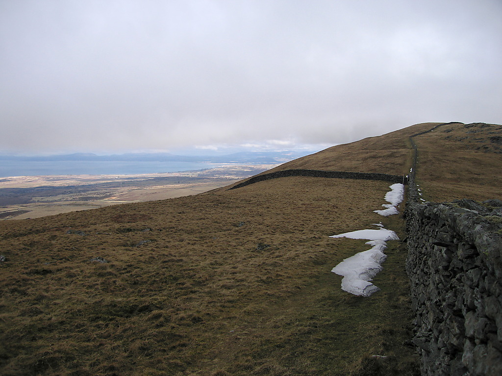
English: Boundary wall on Diffwys ridge The wall runs along the crest of the ridge for 13km from Abermaw/Barmouth all the way to Rhinog Fach. Although there is no formal Public Right of Way registered along the ridge, stiles are provided at all intersecting walls. Despite the warm and sunny weather over the previous week, some snow is left in places next to the wall above 500m, where it would have formed deep drifts during the unusually cold and snowy winter 2009/10. |
| Date | |
| Source | From geograph.org.uk |
| Author | Rudi Winter |
| Attribution (required by the license) | Rudi Winter / Boundary wall on Diffwys ridge / |
| Camera location | | View this and other nearby images on: OpenStreetMap |
|---|
_heading:0.00&language=en)
| Object location | | View this and other nearby images on: OpenStreetMap |
|---|
_heading:0.00&language=en)
Licensing
[edit]

|
This image was taken from the Geograph project collection. See this photograph's page on the Geograph website for the photographer's contact details. The copyright on this image is owned by Rudi Winter and is licensed for reuse under the Creative Commons Attribution-ShareAlike 2.0 license.
|
This file is licensed under the Creative Commons Attribution-Share Alike 2.0 Generic license.
Attribution: Rudi Winter
- You are free:
- to share – to copy, distribute and transmit the work
- to remix – to adapt the work
- Under the following conditions:
- attribution – You must give appropriate credit, provide a link to the license, and indicate if changes were made. You may do so in any reasonable manner, but not in any way that suggests the licensor endorses you or your use.
- share alike – If you remix, transform, or build upon the material, you must distribute your contributions under the same or compatible license as the original.
File history
Click on a date/time to view the file as it appeared at that time.
| Date/Time | Thumbnail | Dimensions | User | Comment | |
|---|---|---|---|---|---|
| current | 22:06, 5 March 2011 | | 1,024 × 768 (240 KB) | GeographBot (talk | contribs) | == {{int:filedesc}} == {{Information |description={{en|1=Boundary wall on Diffwys ridge The wall runs along the crest of the ridge for 13km from Abermaw/Barmouth all the way to Rhinog Fach. Although there is no formal Public Right of Way registered along |
You cannot overwrite this file.
File usage on Commons
There are no pages that use this file.