File:Boundary Wall between Far Fell and Out Fell - geograph.org.uk - 247950.jpg
Jump to navigation
Jump to search
No higher resolution available.
Boundary_Wall_between_Far_Fell_and_Out_Fell_-_geograph.org.uk_-_247950.jpg (640 × 480 pixels, file size: 119 KB, MIME type: image/jpeg)
Captions
Captions
Add a one-line explanation of what this file represents
Summary
[edit]
| Description |
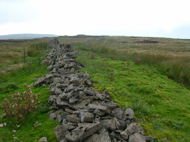
English: Boundary Wall between Far Fell and Out Fell. There is a deal more of a kink in the boundary wall here than is shown on the OS map. The new electric fence cuts through the old wall and provides presumably a cheaper way of keeping the sheep in than by repairing this remote section of wall, which runs on across Fountains Fell |
| Date | |
| Source | From geograph.org.uk |
| Author | William Bartlett |
| Attribution (required by the license) | William Bartlett / Boundary Wall between Far Fell and Out Fell / |
| Camera location | | View this and other nearby images on: OpenStreetMap |
|---|
_heading:315.00&language=en)
| Object location | | View this and other nearby images on: OpenStreetMap |
|---|
_heading:315.00&language=en)
Licensing
[edit]

|
This image was taken from the Geograph project collection. See this photograph's page on the Geograph website for the photographer's contact details. The copyright on this image is owned by William Bartlett and is licensed for reuse under the Creative Commons Attribution-ShareAlike 2.0 license.
|
This file is licensed under the Creative Commons Attribution-Share Alike 2.0 Generic license.
Attribution: William Bartlett
- You are free:
- to share – to copy, distribute and transmit the work
- to remix – to adapt the work
- Under the following conditions:
- attribution – You must give appropriate credit, provide a link to the license, and indicate if changes were made. You may do so in any reasonable manner, but not in any way that suggests the licensor endorses you or your use.
- share alike – If you remix, transform, or build upon the material, you must distribute your contributions under the same or compatible license as the original.
File history
Click on a date/time to view the file as it appeared at that time.
| Date/Time | Thumbnail | Dimensions | User | Comment | |
|---|---|---|---|---|---|
| current | 22:38, 31 January 2010 | | 640 × 480 (119 KB) | GeographBot (talk | contribs) | == {{int:filedesc}} == {{Information |description={{en|1=Boundary Wall between Far Fell and Out Fell. There is a deal more of a kink in the boundary wall here than is shown on the OS map. The new electric fence cuts through the old wall and provides presu |
You cannot overwrite this file.
File usage on Commons
There are no pages that use this file.