File:Boulangerie du château de Tocqueville, Tocqueville, France.jpg
From Wikimedia Commons, the free media repository
Jump to navigation
Jump to search
Size of this preview: 400 × 600 pixels. Other resolutions: 160 × 240 pixels | 320 × 480 pixels | 512 × 768 pixels | 682 × 1,024 pixels | 1,365 × 2,048 pixels | 3,456 × 5,184 pixels.
Original file (3,456 × 5,184 pixels, file size: 17.26 MB, MIME type: image/jpeg)
File information
Structured data
Captions
Summary
[edit]DescriptionBoulangerie du château de Tocqueville, Tocqueville, France.jpg |
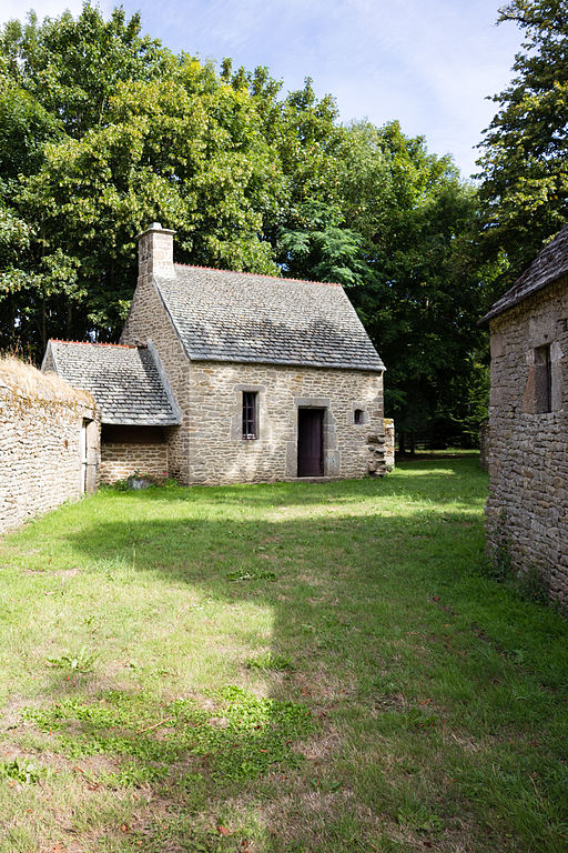
Français : Boulangerie du château de Tocqueville à Tocqueville (France). |
Date | |
Source | Own work |
Author | Édouard Hue (User:EdouardHue) |
Permission (Reusing this file) |
This file is licensed under the Creative Commons Attribution-Share Alike 3.0 Unported license.
|
Camera location | 49° 40′ 03.01″ N, 1° 19′ 44.64″ W | View this and other nearby images on: OpenStreetMap | 49.667503; -1.329067 |
---|
This building is indexed in the base Mérimée, a database of architectural heritage maintained by the French Ministry of Culture, under the reference PA00110618 .
brezhoneg ∙ català ∙ Deutsch ∙ English ∙ español ∙ Esperanto ∙ euskara ∙ français ∙ italiano ∙ magyar ∙ Nederlands ∙ português do Brasil ∙ português ∙ română ∙ sicilianu ∙ slovenščina ∙ suomi ∙ svenska ∙ Ελληνικά ∙ беларуская (тарашкевіца) ∙ македонски ∙ русский ∙ українська ∙ বাংলা ∙ +/− |
File history
Click on a date/time to view the file as it appeared at that time.
Date/Time | Thumbnail | Dimensions | User | Comment | |
---|---|---|---|---|---|
current | 20:34, 25 August 2013 | 3,456 × 5,184 (17.26 MB) | EdouardHue (talk | contribs) | Uploaded with ComeOn! |
You cannot overwrite this file.
File usage on Commons
There are no pages that use this file.
File usage on other wikis
The following other wikis use this file:
- Usage on fr.wikipedia.org
- Usage on zh.wikipedia.org
Metadata
This file contains additional information such as Exif metadata which may have been added by the digital camera, scanner, or software program used to create or digitize it. If the file has been modified from its original state, some details such as the timestamp may not fully reflect those of the original file. The timestamp is only as accurate as the clock in the camera, and it may be completely wrong.
Camera manufacturer | Canon |
---|---|
Camera model | Canon EOS 60D |
Exposure time | 1/500 sec (0.002) |
F-number | f/5 |
ISO speed rating | 100 |
Date and time of data generation | 10:56, 17 August 2013 |
Lens focal length | 20 mm |
Latitude | 49° 40′ 3.01″ N |
Longitude | 1° 19′ 44.64″ W |
Online copyright statement | http://creativecommons.org/licenses/by-sa/3.0/deed |
Author | Édouard Hue |
Short title |
|
Copyright holder |
|
Image title |
|
Usage terms |
|
City shown | Tocqueville |
Horizontal resolution | 96 dpi |
Vertical resolution | 96 dpi |
Software used | Adobe Photoshop Lightroom 5.0 (Windows) |
File change date and time | 21:43, 25 August 2013 |
Exposure Program | Aperture priority |
Exif version | 2.3 |
Date and time of digitizing | 10:56, 17 August 2013 |
APEX shutter speed | 8.965784 |
APEX aperture | 4.643856 |
APEX exposure bias | −0.33333333333333 |
Maximum land aperture | 3.75 APEX (f/3.67) |
Metering mode | Center weighted average |
Flash | Flash did not fire, compulsory flash suppression |
DateTimeOriginal subseconds | 00 |
DateTimeDigitized subseconds | 00 |
Focal plane X resolution | 5,728.1767955801 |
Focal plane Y resolution | 5,808.4033613445 |
Focal plane resolution unit | inches |
Custom image processing | Normal process |
Exposure mode | Auto exposure |
White balance | Auto white balance |
Scene capture type | Standard |
GPS tag version | 0.0.2.2 |
Serial number of camera | 1280614195 |
Lens used | 20mm |
Date metadata was last modified | 23:43, 25 August 2013 |
Unique ID of original document | E23A3747D43BBDDF3D62BC953991B4EF |
Copyright status | Copyrighted |
Keywords |
|
Contact information | edouard.hue@gmail.com
|
Province or state shown | Basse-Normandie |
Country shown | France |
IIM version | 4 |
Structured data
Items portrayed in this file
depicts
49°40'3.01199"N, 1°19'44.64001"W
17 August 2013
image/jpeg
9c59ad591397b81af912690820db94696a1aca63
18,100,314 byte
5,184 pixel
3,456 pixel
Hidden categories:
- CC-BY-SA-3.0
- Base Mérimée
- Mérimée without type parameter
- Mérimée with PA parameter
- Cultural heritage monuments in France with known IDs
- Wikis take Val de Saire
- Photographs taken with Voigtländer 20 mm F3.5 Color Skopar SL II
- Taken with Canon EOS 60D
- Files by EdouardHue
- France photographs taken on 2013-08-17
- Pages with maps