File:Bonifatius route.jpg
Jump to navigation
Jump to search

Size of this preview: 449 × 599 pixels. Other resolutions: 180 × 240 pixels | 360 × 480 pixels | 576 × 768 pixels | 767 × 1,024 pixels | 2,430 × 3,242 pixels.
Original file (2,430 × 3,242 pixels, file size: 2.61 MB, MIME type: image/jpeg)
Captions
Captions
Add a one-line explanation of what this file represents
Summary
[edit]
| Camera location | | View this and other nearby images on: OpenStreetMap |
|---|
| Description |
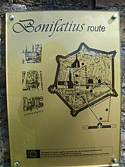
Nederlands: Bonifatius route. |
| Date | |
| Source | Own work |
| Author | Krinkle |
Licensing
[edit]
| I, the copyright holder of this work, release this work into the public domain. This applies worldwide. In some countries this may not be legally possible; if so: I grant anyone the right to use this work for any purpose, without any conditions, unless such conditions are required by law. |
File history
Click on a date/time to view the file as it appeared at that time.
| Date/Time | Thumbnail | Dimensions | User | Comment | |
|---|---|---|---|---|---|
| current | 19:21, 5 May 2010 | | 2,430 × 3,242 (2.61 MB) | Krinkle (talk | contribs) | == {{int:filedesc}} == {{location|53|19|19.69|N|6|0|11.77|E|region:NL_dim:7_heading:ENE}} {{Information | Description = {{nl| nl:Bonifatius route.}} | Date = 2010-05-05 | Source = {{Own}} | Author = [[User:Krinkle|Krinkle |
You cannot overwrite this file.
File usage on Commons
There are no pages that use this file.