File:Bonaire map 1915 (general view).jpg
Jump to navigation
Jump to search

Size of this preview: 488 × 599 pixels. Other resolutions: 195 × 240 pixels | 391 × 480 pixels | 626 × 768 pixels | 834 × 1,024 pixels | 1,669 × 2,048 pixels | 4,368 × 5,360 pixels.
Original file (4,368 × 5,360 pixels, file size: 15.12 MB, MIME type: image/jpeg)
Captions
Captions
Add a one-line explanation of what this file represents
Summary
[edit]| Description |
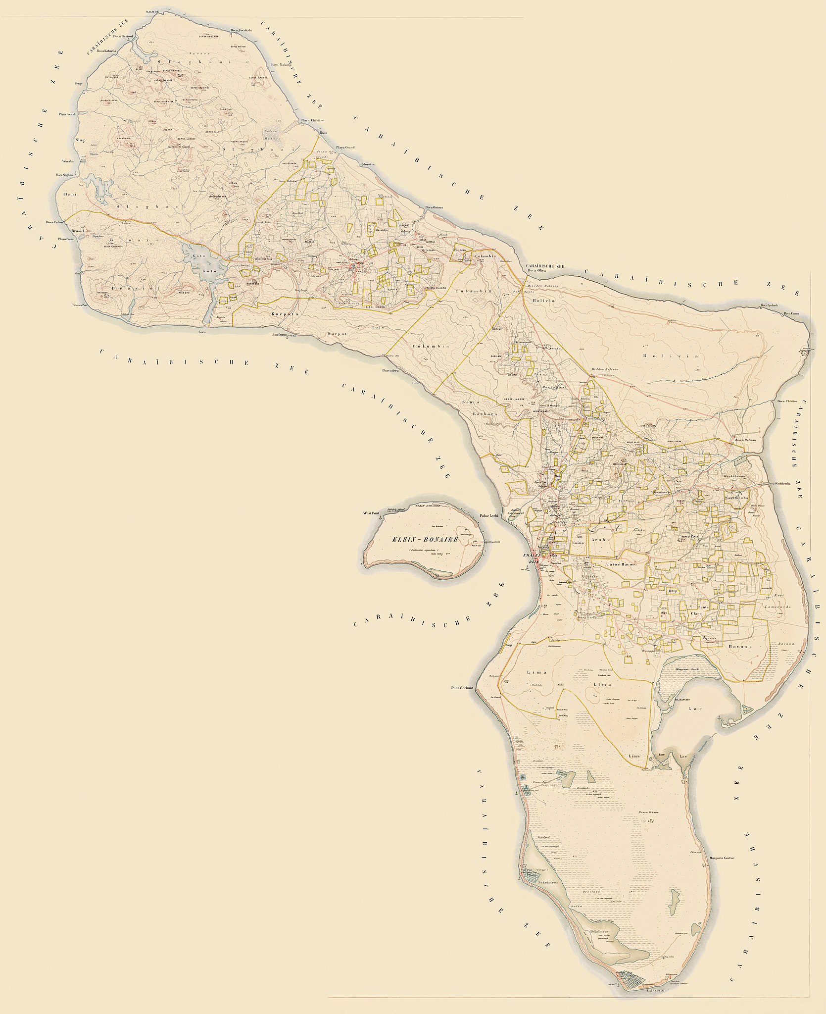
Deutsch: Karte von Bonaire, Insel der Niederländischen Antillen (Karibik). Karte von 1915 im Maßstab 1: 20.000, Gesamtansicht. English: Map of Bonaire, island of the Dutch West Indies (Caribbean). Map of 1915, scale 1:20.000, general view Français : Carte de Bonaire, île des Antilles néerlandaises (Caraïbes). Carte de 1915, à l'échelle 1: 20.000, vue générale. Nederlands: Kaart van Bonaire, eiland van de Nederlandsch West-Indië (Caribische Zee). kaart van 1915, schaal 1: 20.000, grote gok. |
| Date | circa 1915 |
| Source |
This file was derived from:
|
| Author | Topographische Inrichting (Den Haag) |
| Other versions |
|


.jpg)
.jpg&action=edit§ion=1)
| This is a retouched picture, which means that it has been digitally altered from its original version. Modifications: Farb- und Kontrastverbesserung; Neuzusammenstellung mit den angegebenen Quellen; Bildzuschnitt (Vielfaches von 16 px); Photoshop Speicheroptionen: Qualität 12. Modifications made by MagentaGreen.
|
Licensing
[edit].jpg&action=edit§ion=2)
|
This work is in the public domain in its country of origin and other countries and areas where the copyright term is the author's life plus 70 years or fewer. This work is in the public domain in the United States because it was published (or registered with the U.S. Copyright Office) before January 1, 1929. | |
| This file has been identified as being free of known restrictions under copyright law, including all related and neighboring rights. | |
File history
Click on a date/time to view the file as it appeared at that time.
| Date/Time | Thumbnail | Dimensions | User | Comment | |
|---|---|---|---|---|---|
| current | 16:01, 6 January 2016 | | 4,368 × 5,360 (15.12 MB) | MagentaGreen (talk | contribs) | =={{int:filedesc}}== {{Information |description={{en|1=Bonaire, Netherlands island in the Caribbean Sea, map of 1915, scale 1:20,000, sheet 11}} |date={{other date|~|1915}} |source={{Derived fromn|Bonaire_map_1915_sheet_2.jpg |Bonaire_map_1915_sheet_3.... |
You cannot overwrite this file.
File usage on Commons
The following 2 pages use this file:
File usage on other wikis
The following other wikis use this file:
- Usage on de.wikipedia.org
.jpg&oldid=833706699)