File:Bodruzal cerkov 1658 ZeliPVL.JPG
Jump to navigation
Jump to search

Size of this preview: 800 × 546 pixels. Other resolutions: 320 × 219 pixels | 640 × 437 pixels | 1,024 × 699 pixels | 1,280 × 874 pixels | 2,362 × 1,613 pixels.
Original file (2,362 × 1,613 pixels, file size: 1.3 MB, MIME type: image/jpeg)
Captions
Captions
Add a one-line explanation of what this file represents
| Description |
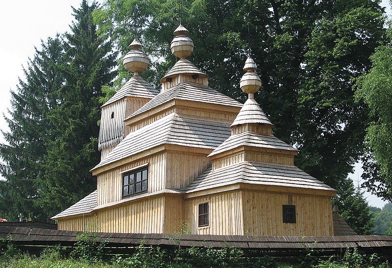
Slovenčina: Bodružalská drevená cerkev je prototypom cerkvi tzv. lemkovského typu. Bola postavená v roku 1658 na východnom svahu Pelepče. Jej základ tvoria 3 spojené zrubové stavby v tvare troch štvorcov, postavených na jednej osi od východu na západ. Každý z troch zrubov je pokrytý stupňovanou ihlanovitou šindľovou strechou o dvoch poschodiach a dynamickou kompozíciou veží, ktoré postupne narastajú od malej východnej nad presbytériom cez strednú nad loďou k veľmi vyvinutej veží nad západným zrubom (babincom), kde je umiestnená aj zvonica. Nad stupňovitou ihlanovou strechou stredného a východného zrubu sú pristavené aj barokové makovičky s barokizujúcimi krížmi.
|
||
| Date | Taken on 29 September 2006 | ||
| Source | Self-photographed | ||
| Author | Peter Zelizňák | ||
| Permission (Reusing this file) |
|
||
| Other versions |
 |
| Object location | | View this and other nearby images on: OpenStreetMap |
|---|
File history
Click on a date/time to view the file as it appeared at that time.
| Date/Time | Thumbnail | Dimensions | User | Comment | |
|---|---|---|---|---|---|
| current | 22:48, 23 May 2008 | | 2,362 × 1,613 (1.3 MB) | Peter Zelizňák (talk | contribs) | Summary == Bodružalská drevená cerkev je prototypom cerkvi tzv. lemkovského typu. Bola postavená v roku 1658 na východnom svahu Pelepče. Jej základ tvoria 3 spojené zrubové stavby v tvare troch obdlžníkov, postavených na jednej osi od východ |
You cannot overwrite this file.
File usage on Commons
The following 3 pages use this file:
File usage on other wikis
The following other wikis use this file:
- Usage on azb.wikipedia.org
- Usage on be-tarask.wikipedia.org
- Usage on bg.wikipedia.org
- Usage on ca.wikipedia.org
- Usage on ce.wikipedia.org
- Usage on cs.wikipedia.org
- Usage on de.wikipedia.org
- Usage on en.wikipedia.org
- Usage on en.wikivoyage.org
- Usage on eo.wikipedia.org
- Usage on es.wikipedia.org
- Usage on eu.wikipedia.org
- Usage on fi.wikipedia.org
- Usage on ha.wikipedia.org
- Usage on hu.wikipedia.org
- Usage on it.wikipedia.org
- Usage on ja.wikipedia.org
- Usage on lt.wikipedia.org
- Usage on mk.wikipedia.org
- Usage on nl.wikipedia.org
- Usage on ro.wikipedia.org
- Usage on rue.wikipedia.org
- Usage on ru.wikipedia.org
- Usage on sk.wikipedia.org
- Usage on sl.wikipedia.org
- Usage on sr.wikipedia.org
- Usage on tt.wikipedia.org
- Usage on vi.wikipedia.org
- Usage on vls.wikipedia.org
- Usage on www.wikidata.org