File:Bocchetta di Colonno (Spherical panoramics).jpg
From Wikimedia Commons, the free media repository
Jump to navigation
Jump to search
![File:Bocchetta di Colonno (Spherical panoramics).jpg](https://upload.wikimedia.org/wikipedia/commons/thumb/4/42/Bocchetta_di_Colonno_%28Spherical_panoramics%29.jpg/800px-Bocchetta_di_Colonno_%28Spherical_panoramics%29.jpg?20220308151813)
Size of this preview: 800 × 400 pixels. Other resolutions: 320 × 160 pixels | 640 × 320 pixels | 1,024 × 512 pixels | 1,280 × 640 pixels | 2,560 × 1,280 pixels | 5,376 × 2,688 pixels.
Original file (5,376 × 2,688 pixels, file size: 5.22 MB, MIME type: image/jpeg)
File information
Structured data
Captions
Captions
Add a one-line explanation of what this file represents
Bocchetta di Colonno, panorama invernale
Summary
[edit]DescriptionBocchetta di Colonno (Spherical panoramics).jpg |
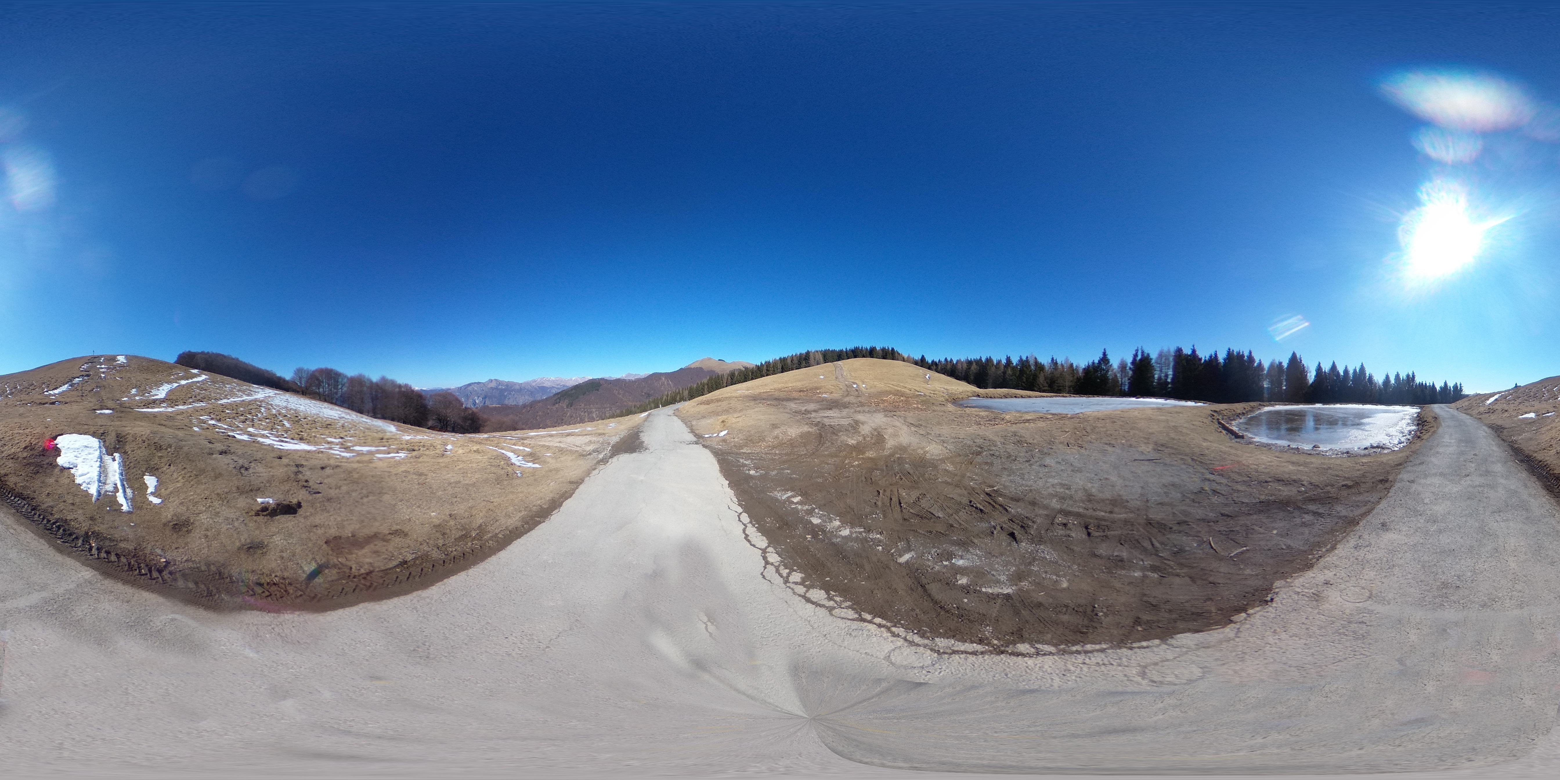
Italiano: Bocchetta di Colonno, panorama invernale con bolle gelate. Qui la Via dei Monti Lariani sezione 2 incrocia la strada militare per il rifugio Venini |
Date | |
Source | Own work |
Author | Kaitu |
Camera location | 45° 58′ 50.91″ N, 9° 08′ 12.68″ E ![]() ![]() | View this and other nearby images on: OpenStreetMap | ![]() |
---|
360°Bocchetta di Colonno (Spherical panoramics).jpg | View in 360° panoramic viewer
|
---|
Licensing
[edit]I, the copyright holder of this work, hereby publish it under the following license:
![w:en:Creative Commons](https://upload.wikimedia.org/wikipedia/commons/thumb/7/79/CC_some_rights_reserved.svg/90px-CC_some_rights_reserved.svg.png)
![attribution](https://upload.wikimedia.org/wikipedia/commons/thumb/1/11/Cc-by_new_white.svg/24px-Cc-by_new_white.svg.png)
![share alike](https://upload.wikimedia.org/wikipedia/commons/thumb/d/df/Cc-sa_white.svg/24px-Cc-sa_white.svg.png)
This file is licensed under the Creative Commons Attribution-Share Alike 4.0 International license.
- You are free:
- to share – to copy, distribute and transmit the work
- to remix – to adapt the work
- Under the following conditions:
- attribution – You must give appropriate credit, provide a link to the license, and indicate if changes were made. You may do so in any reasonable manner, but not in any way that suggests the licensor endorses you or your use.
- share alike – If you remix, transform, or build upon the material, you must distribute your contributions under the same or compatible license as the original.
Annotations InfoField | This image is annotated: View the annotations at Commons |
2412
1210
54
54
5376
2688
Monte di Lenno
2533
1216
54
54
5376
2688
Monte Galbiga
2150
1257
54
54
5376
2688
Pizzo di Gino
1687
1284
54
54
5376
2688
Cima di Fiorina
File history
Click on a date/time to view the file as it appeared at that time.
Date/Time | Thumbnail | Dimensions | User | Comment | |
---|---|---|---|---|---|
current | 15:18, 8 March 2022 | ![]() | 5,376 × 2,688 (5.22 MB) | Kaitu (talk | contribs) | Uploaded own work with UploadWizard |
You cannot overwrite this file.
File usage on Commons
The following page uses this file:
File usage on other wikis
The following other wikis use this file:
- Usage on www.wikidata.org
Metadata
This file contains additional information such as Exif metadata which may have been added by the digital camera, scanner, or software program used to create or digitize it. If the file has been modified from its original state, some details such as the timestamp may not fully reflect those of the original file. The timestamp is only as accurate as the clock in the camera, and it may be completely wrong.
Camera manufacturer | RICOH |
---|---|
Camera model | RICOH THETA V |
Date and time of data generation | 13:09, 27 February 2022 |
User comments | Projection: Equirectangular (2)
FOV: 360 x 180 Ev: 13.93 |
Latitude | 45° 58′ 50.91″ N |
Longitude | 9° 8′ 12.68″ E |
Altitude | 1,327 meters above sea level |
Horizontal resolution | 1 dpc |
Vertical resolution | 1 dpc |
Software used | Hugin 2021.0.0.52df0f76c700 built by Thomas |
File change date and time | 16:06, 8 March 2022 |
Y and C positioning | Centered |
Exif version | 2.32 |
Date and time of digitizing | 13:09, 27 February 2022 |
Meaning of each component |
|
Supported Flashpix version | 1 |
Color space | sRGB |
GPS time (atomic clock) | 12:09 |
Speed unit | Kilometers per hour |
Speed of GPS receiver | 8.7678476996298 |
Reference for direction of image | True direction |
Direction of image | 69.491335022947 |
Geodetic survey data used | WGS-84 |
GPS date | 27 February 2022 |
GPS tag version | 2.3.0.0 |
Panorama cropped height | 2,688 |
Panorama cropped width | 5,376 |
Panorama left crop | 0 |
Panorama top crop | 0 |
Panorama full height | 2,688 |
Panorama full width | 5,376 |
Projection type | Equirectangular |
Source photo count | 1 |
Stitching software | Hugin |
Use panorama viewer | Yes |