File:Blue sky with clouds above ploughed farmland.jpg
Jump to navigation
Jump to search
Size of this preview: 512 × 600 pixels. Other resolutions: 205 × 240 pixels | 410 × 480 pixels | 736 × 862 pixels.
Original file (736 × 862 pixels, file size: 77 KB, MIME type: image/jpeg)
Captions
Captions
Add a one-line explanation of what this file represents
Summary
[edit]
| Description |
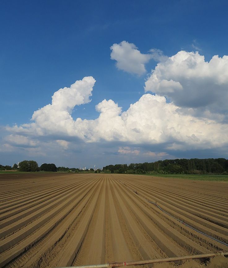
Deutsch: Blauer Himmel mit Wolken über gepflügtem Ackerland nordöstlich von Studernheim (Standort), am Horizont die BASF in Ludwigshafen am Rhein. Bäume im Mittelgrund verdecken Schornsteine, die wesentlich höher sind als die Bäume. Die BASF ist laut GPS-Daten 4 bis 5 Kilometer entfernt (Distanzrecher). Die Erdkrümmung wirkt sich schon geringfügig aus. Dazu addiert sich die optische Wirkung des spitzen Sehwinkels, der bewirkt, dass die Gebäude der BASF hinter den Bäumen wie Miniaturen erscheinen und niedriger als sie sind (File:Blick auf die BASF.jpg). Mit dem bloßen Auge kann man den Effekt der Erdkrümmung nicht von dem Effekt durch die Bäume unterscheiden. Deshalb gibt es die Erdmessung, die Geodäsie, bei der die Fachleute den Anteil der Erdkrümmung berechnen und berücksichtigen. File:Sichtweite 1.png.
English: Blue sky with clouds over ploughed farmland north-east of Studernheim (position), BASF in Ludwigshafen am Rhein on the horizon. Trees in the middle ground hide chimneys that are much higher than the trees. According to GPS data, BASF is 4 to 5 kilometres away (distance calculator). The curvature of the earth already has a slight effect. To this effect is added the optical effect of the acute viewing angle, which causes the BASF buildings to appear like miniatures behind the trees lower than they are (File:Blick auf die BASF.jpg). The naked eye cannot see cannot distinguish the earth's curvature from the effect caused by the trees. That is why there is earth measurement, geodesy, in which experts calculate and take into account the proportion of the earth's curvature. File:Visibility 1.png |
| Date |
|
| Source |
Own work |
| Author |
Sciencia58 |
|date=2021-06-09 17:50:37 |source=Own work |author=Sciencia58 |permission= |other versions= }}
Licensing
[edit]
I, the copyright holder of this work, hereby publish it under the following license:
This file is licensed under the Creative Commons Attribution-Share Alike 4.0 International license.
- You are free:
- to share – to copy, distribute and transmit the work
- to remix – to adapt the work
- Under the following conditions:
- attribution – You must give appropriate credit, provide a link to the license, and indicate if changes were made. You may do so in any reasonable manner, but not in any way that suggests the licensor endorses you or your use.
- share alike – If you remix, transform, or build upon the material, you must distribute your contributions under the same or compatible license as the original.
File history
Click on a date/time to view the file as it appeared at that time.
| Date/Time | Thumbnail | Dimensions | User | Comment | |
|---|---|---|---|---|---|
| current | 07:36, 14 May 2022 | | 736 × 862 (77 KB) | Sciencia58 (talk | contribs) | so |
| 21:25, 9 June 2021 |  | 3,888 × 4,744 (3.24 MB) | Sciencia58 (talk | contribs) | Uploaded own work with UploadWizard |
You cannot overwrite this file.
File usage on Commons
There are no pages that use this file.