File:Blue Ridge Parkway Map, Region 1 Sheet 6 - DPLA - 115e0eab07f357e99e9bcd8aa5f53c57.jpg
Jump to navigation
Jump to search

Size of this preview: 800 × 532 pixels. Other resolutions: 320 × 213 pixels | 640 × 426 pixels | 1,024 × 681 pixels | 1,280 × 851 pixels | 2,560 × 1,702 pixels | 8,259 × 5,491 pixels.
Original file (8,259 × 5,491 pixels, file size: 6.98 MB, MIME type: image/jpeg)
Captions
Captions
Add a one-line explanation of what this file represents
Summary
[edit]| Blue Ridge Parkway Map, Region 1 Sheet 6
( |
||||||||||||||||||||||||
|---|---|---|---|---|---|---|---|---|---|---|---|---|---|---|---|---|---|---|---|---|---|---|---|---|
| Creator | Published by United States Department of the Interior National Park Service (Washington, D.C.) | |||||||||||||||||||||||
| Title |
Blue Ridge Parkway Map, Region 1 Sheet 6 |
|||||||||||||||||||||||
| Description |
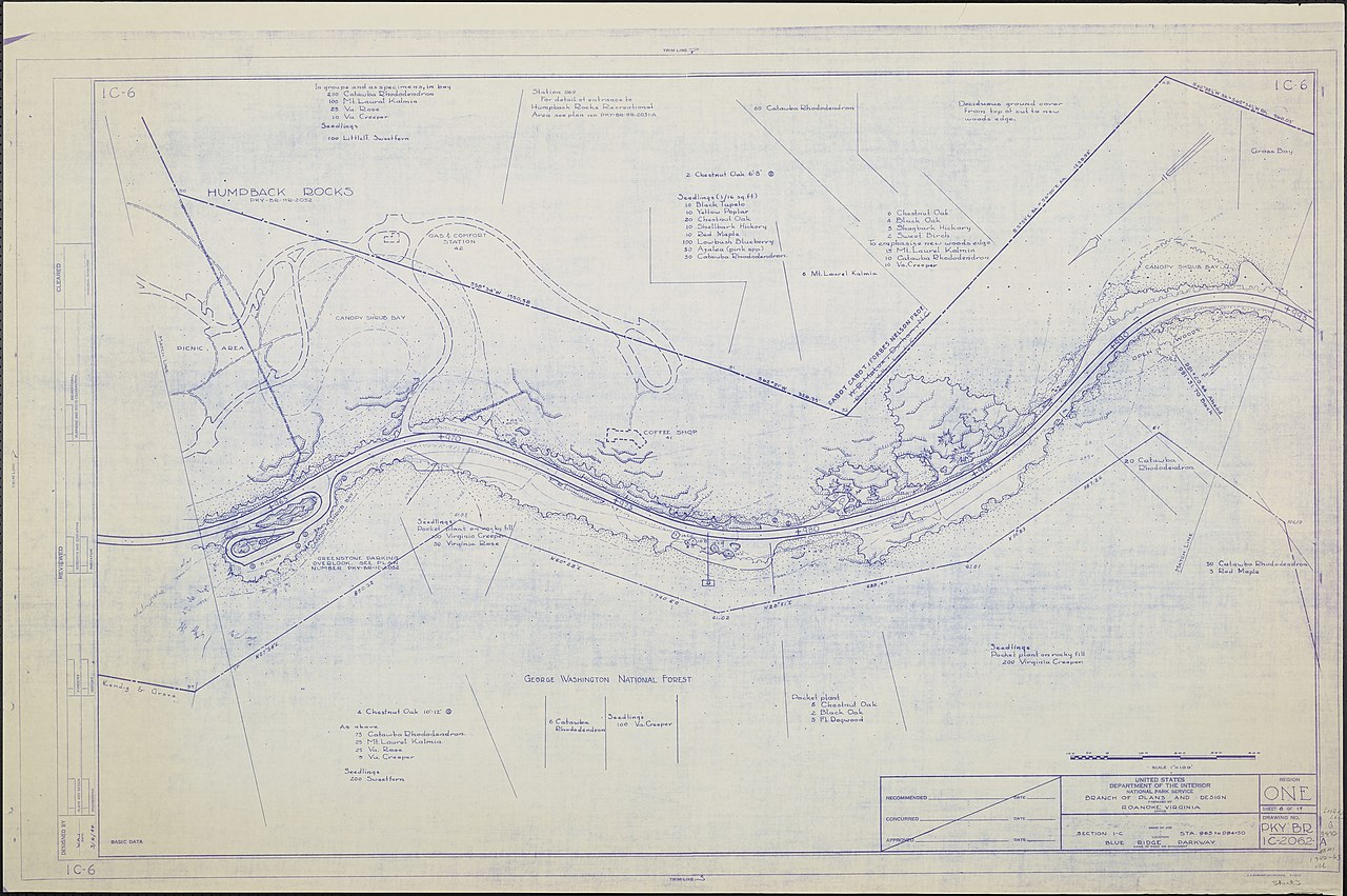
A map of the Blue Ridge Parkway with details about the nearby trees, shrubbery, and seedlings. Includes the Greenstone Parking Overlook. Prepared by the Roanoke, VA office of the Branch of Plans and Design. Drawing 1C-6. Scale 1"=100'. |
|||||||||||||||||||||||
| Date | March 1944 | |||||||||||||||||||||||
| Collection |
|
|||||||||||||||||||||||
| Source/Photographer |
|
|||||||||||||||||||||||
| Permission (Reusing this file) |
|
|||||||||||||||||||||||
| Standardized rights statement |
|
|||||||||||||||||||||||


File history
Click on a date/time to view the file as it appeared at that time.
| Date/Time | Thumbnail | Dimensions | User | Comment | |
|---|---|---|---|---|---|
| current | 23:10, 13 March 2020 | | 8,259 × 5,491 (6.98 MB) | DPLA bot (talk | contribs) | Uploading DPLA ID 115e0eab07f357e99e9bcd8aa5f53c57 |
You cannot overwrite this file.
File usage on Commons
The following page uses this file: