File:Blue Ridge Parkway Map, Region 1 Sheet 1 - DPLA - 4be94766ce7c57adf26bb22615b1b054.jpg
Jump to navigation
Jump to search

Size of this preview: 800 × 532 pixels. Other resolutions: 320 × 213 pixels | 640 × 425 pixels | 1,024 × 680 pixels | 1,280 × 850 pixels | 2,560 × 1,701 pixels | 8,258 × 5,487 pixels.
Original file (8,258 × 5,487 pixels, file size: 4.48 MB, MIME type: image/jpeg)
Captions
Captions
Add a one-line explanation of what this file represents
Summary
[edit]| Blue Ridge Parkway Map, Region 1 Sheet 1
( |
||||||||||||||||||||||||
|---|---|---|---|---|---|---|---|---|---|---|---|---|---|---|---|---|---|---|---|---|---|---|---|---|
| Creator | Published by United States Department of the Interior National Park Service (Washington, D.C.) | |||||||||||||||||||||||
| Title |
Blue Ridge Parkway Map, Region 1 Sheet 1 |
|||||||||||||||||||||||
| Description |
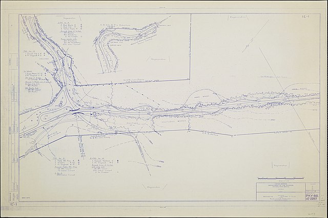
A map of the Blue Ridge Parkway with details about the nearby trees, shrubbery, and seedlings. Drawing No. IE-1. Scale 1"=100'. |
|||||||||||||||||||||||
| Date | March 1951 | |||||||||||||||||||||||
| Collection |
|
|||||||||||||||||||||||
| Source/Photographer |
|
|||||||||||||||||||||||
| Permission (Reusing this file) |
|
|||||||||||||||||||||||
| Standardized rights statement |
|
|||||||||||||||||||||||


File history
Click on a date/time to view the file as it appeared at that time.
| Date/Time | Thumbnail | Dimensions | User | Comment | |
|---|---|---|---|---|---|
| current | 23:10, 13 March 2020 | | 8,258 × 5,487 (4.48 MB) | DPLA bot (talk | contribs) | Uploading DPLA ID 4be94766ce7c57adf26bb22615b1b054 |
You cannot overwrite this file.
File usage on Commons
The following page uses this file: