File:Bliss Beach, Lake Tahoe, CA 8-10 (19945386515).jpg
Original file (2,150 × 2,450 pixels, file size: 2 MB, MIME type: image/jpeg)
Captions
Captions
Summary
[edit].jpg&action=edit§ion=1)
| Description |
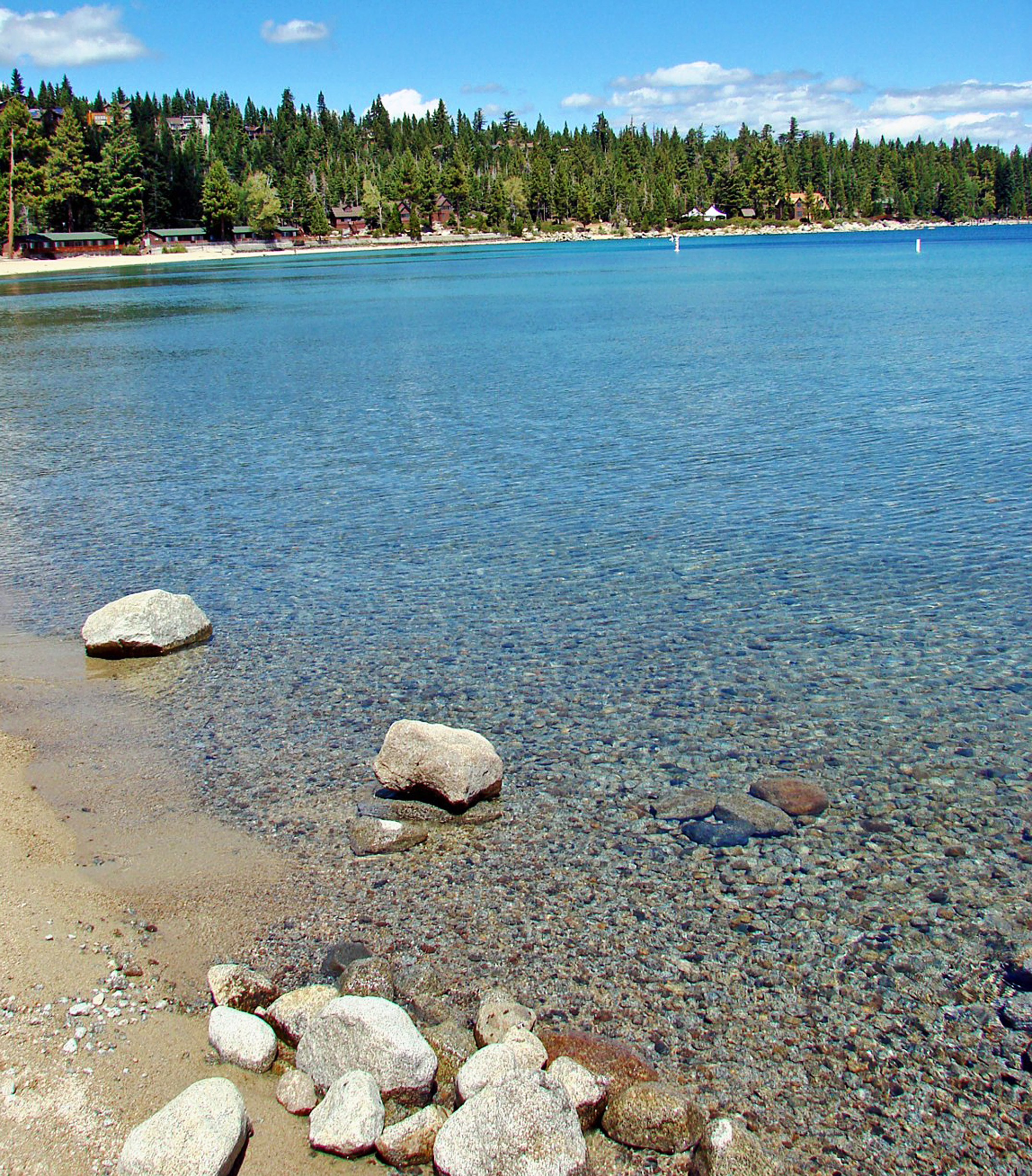
(1 in a multiple picture album) The surface of the Lake is at an elevation of 6,225 feet above historical sea level. The surrounding mountain peaks vary from 9,000 to nearly 11,000 feet. Only 16 other large lakes in the world are higher. The water is 99.994% pure, making it one of the purest large lakes in the world. For comparison, commercially distilled water is 99.998% pure. Tahoe contains roughly 60 parts per million of dissolved matter. As light penetrates the Lake, water molecules absorb various colors. Fine particles and the exceptional clarity allow back scattering of the predominating light color toward the eye of an observer. The lake water appears blue as other colors in the light spectrum are absorbed at deeper depths and the predominant blue light is scattered back toward the observer’s eye. The center of the Lake can appear cobalt blue, as blue light is absorbed further, leaving visible violet light as the predominant light color. In shallow areas, the water can appear emerald or turquoise in color since green is the predominant light color at shallow depths. In addition, under the right conditions, the Lake surface can reflect the adjacent mountains and the color of the sky. Clarity is determined by measuring the water depth at which an 8-inch diameter white disk disappears from view. The Lake owes it extraordinary natural clarity mainly to its exceptional depth and volume, a relatively small watershed.and favorable dermatological conditions. In 2008, clarity averaged 69.6 feet. That means you could see the little white disc when it was 70 feet below the surface. It used to be visible at 120 feet. |
| Date | |
| Source | Bliss Beach, Lake Tahoe, CA 8-10 |
| Author | Don Graham from Redlands, CA, USA - God bless it! |
| Camera location | | View this and other nearby images on: OpenStreetMap |
|---|
.jpg¶ms=039.009580_N_-120.117645_E_globe:Earth_type:camera_source:Flickr_&language=en)
Licensing
[edit].jpg&action=edit§ion=2)
- You are free:
- to share – to copy, distribute and transmit the work
- to remix – to adapt the work
- Under the following conditions:
- attribution – You must give appropriate credit, provide a link to the license, and indicate if changes were made. You may do so in any reasonable manner, but not in any way that suggests the licensor endorses you or your use.
- share alike – If you remix, transform, or build upon the material, you must distribute your contributions under the same or compatible license as the original.
| This image was originally posted to Flickr by inkknife_2000 (5.5 million views) at https://flickr.com/photos/23155134@N06/19945386515. It was reviewed on 7 December 2015 by FlickreviewR and was confirmed to be licensed under the terms of the cc-by-sa-2.0. |
File history
Click on a date/time to view the file as it appeared at that time.
| Date/Time | Thumbnail | Dimensions | User | Comment | |
|---|---|---|---|---|---|
| current | 09:32, 7 December 2015 | | 2,150 × 2,450 (2 MB) | James Allison (talk | contribs) | Transferred from Flickr via Flickr2Commons |
You cannot overwrite this file.
File usage on Commons
There are no pages that use this file.
.jpg&oldid=883777848)