File:Blankenburg-Hebammenbrücke.jpg
Jump to navigation
Jump to search

Size of this preview: 800 × 600 pixels. Other resolutions: 320 × 240 pixels | 640 × 480 pixels | 1,024 × 768 pixels | 1,280 × 960 pixels | 1,600 × 1,200 pixels.
Original file (1,600 × 1,200 pixels, file size: 345 KB, MIME type: image/jpeg)
Captions
Captions
Add a one-line explanation of what this file represents
Summary
[edit]
| Description |
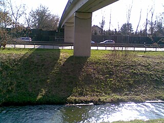
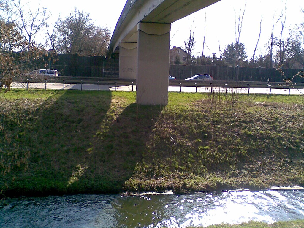
Deutsch: Die Panke durchfließt auf ihrem Wege von der Quelle in Bernau/b. Berlin zur Mündung in die Spree in Berlin-Mitte besiedeltes Gebiet und durchfließt deshalb viele Brücken und Überführungen. Die Hebammensteigbrücke Die Hebammensteigbrücke ist eine zweite mehr als 100 Meter lange Fußgängerbrücke über die BAB 114 und die Panke. Sie stellt eine Ost-West-Verbindung zwischen der Wohnsiedlung in Karow und der Ferdinand-Buisson-Straße her und ist 2 Meter breit. Mit den Rampen ür Fußgänger und Radfahrer ht sie eine Länge von 180 Metern. |
| Date | |
| Source | Own work |
| Author | Boonekamp |
| Camera location | | View this and other nearby images on: OpenStreetMap |
|---|
Licensing
[edit]
| I, the copyright holder of this work, release this work into the public domain. This applies worldwide. In some countries this may not be legally possible; if so: I grant anyone the right to use this work for any purpose, without any conditions, unless such conditions are required by law. |
File history
Click on a date/time to view the file as it appeared at that time.
| Date/Time | Thumbnail | Dimensions | User | Comment | |
|---|---|---|---|---|---|
| current | 19:14, 3 April 2010 | | 1,600 × 1,200 (345 KB) | Boonekamp (talk | contribs) | {{Information |Description={{de|1=Die Panke durchfließt auf ihrem Wege von der Quelle in Bernau/b. Berlin zur Mündung in die Spree in Berlin-Mitte besiedeltes Gebiet und durchfließt deshalb viele Brücken und Überführungen. Die Hebammensteigbrücke D |
You cannot overwrite this file.
File usage on Commons
There are no pages that use this file.
File usage on other wikis
The following other wikis use this file:
- Usage on de.wikipedia.org