File:Blank map of the Free State (2011).svg
Jump to navigation
Jump to search

Size of this PNG preview of this SVG file: 673 × 599 pixels. Other resolutions: 270 × 240 pixels | 539 × 480 pixels | 862 × 768 pixels | 1,150 × 1,024 pixels | 2,300 × 2,048 pixels | 749 × 667 pixels.
Original file (SVG file, nominally 749 × 667 pixels, file size: 461 KB)
Captions
Captions
Add a one-line explanation of what this file represents
Summary
[edit].svg&action=edit§ion=1)
| Description |
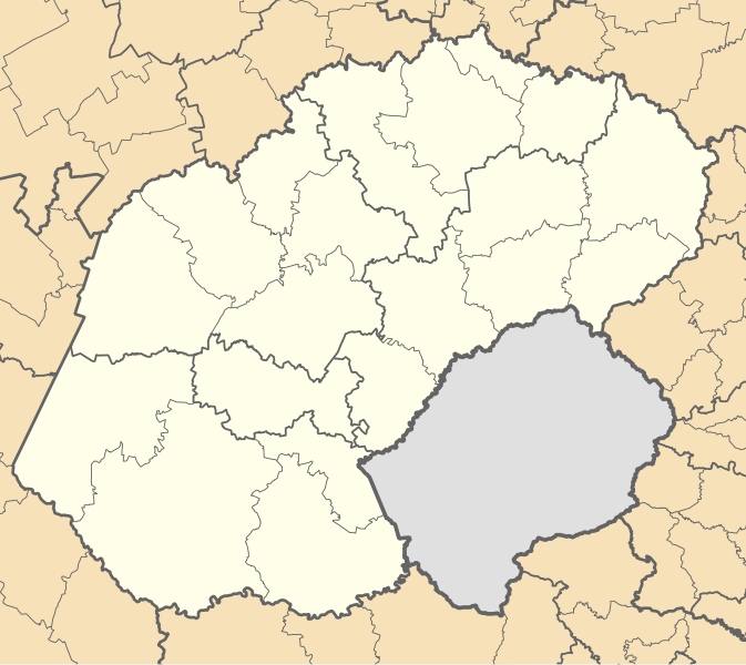
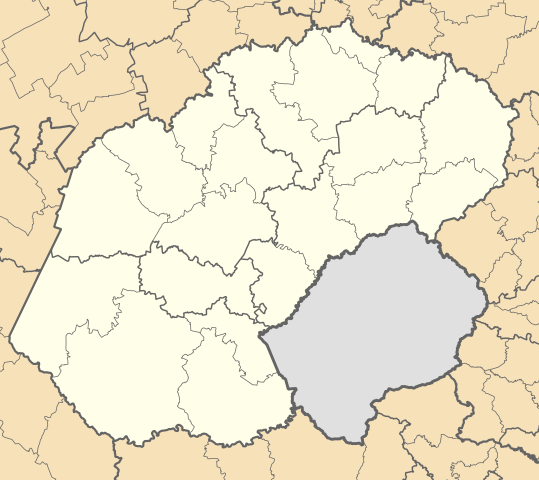
English: Blank map of the Free State province of South Africa, with municipal boundaries as they will be after the municipal elections of 18 May 2011. Equirectangular projection; map shows 24.25° to 30° E and 26.5° to 31° S. |
| Date | |
| Source | Own work |
| Author | Htonl |
Licensing
[edit].svg&action=edit§ion=2)
I, the copyright holder of this work, hereby publish it under the following licenses:

|
Permission is granted to copy, distribute and/or modify this document under the terms of the GNU Free Documentation License, Version 1.2 or any later version published by the Free Software Foundation; with no Invariant Sections, no Front-Cover Texts, and no Back-Cover Texts. A copy of the license is included in the section entitled GNU Free Documentation License. |
This file is licensed under the Creative Commons Attribution-Share Alike Attribution-Share Alike 4.0 International, 3.0 Unported, 2.5 Generic, 2.0 Generic and 1.0 Generic license.
- You are free:
- to share – to copy, distribute and transmit the work
- to remix – to adapt the work
- Under the following conditions:
- attribution – You must give appropriate credit, provide a link to the license, and indicate if changes were made. You may do so in any reasonable manner, but not in any way that suggests the licensor endorses you or your use.
- share alike – If you remix, transform, or build upon the material, you must distribute your contributions under the same or compatible license as the original.
You may select the license of your choice.
File history
Click on a date/time to view the file as it appeared at that time.
| Date/Time | Thumbnail | Dimensions | User | Comment | |
|---|---|---|---|---|---|
| current | 18:21, 2 May 2011 | | 749 × 667 (461 KB) | Htonl (talk | contribs) | == Summary == {{Information |Description ={{en|1=Blank map of the Free State province of South Africa, with municipal boundaries as they will be after the municipal elections of 18 May 2011. Equirectangular |
You cannot overwrite this file.
File usage on Commons
There are no pages that use this file.
File usage on other wikis
The following other wikis use this file:
- Usage on af.wikipedia.org
- Vrystaat
- Fezile Dabi-distriksmunisipaliteit
- Lejweleputswa-distriksmunisipaliteit
- Thabo Mofutsanyana-distriksmunisipaliteit
- Xhariep-distriksmunisipaliteit
- Matjhabeng Plaaslike Munisipaliteit
- Nala Plaaslike Munisipaliteit
- Masilonyana Plaaslike Munisipaliteit
- Tswelopele Plaaslike Munisipaliteit
- Tokologo Plaaslike Munisipaliteit
- Moqhaka Plaaslike Munisipaliteit
- Ngwathe Plaaslike Munisipaliteit
- Metsimaholo Plaaslike Munisipaliteit
- Mafube Plaaslike Munisipaliteit
- Kopanong Plaaslike Munisipaliteit
- Letsemeng Plaaslike Munisipaliteit
- Mohokare Plaaslike Munisipaliteit
- Mangaung Metropolitaanse Munisipaliteit
- Naledi Plaaslike Munisipaliteit, Vrystaat
- Setsoto Plaaslike Munisipaliteit
- Dihlabeng Plaaslike Munisipaliteit
- Phumelela Plaaslike Munisipaliteit
- Nketoana Plaaslike Munisipaliteit
- Sjabloon:Vrystaatse Munisipaliteite
- Mantsopa Plaaslike Munisipaliteit
- Maluti-a-Phofung Plaaslike Munisipaliteit
- Usage on es.wikipedia.org
- Usage on fa.wikipedia.org
.svg&oldid=825335873)