File:BirdsHeadPeninsula Topo nl.jpg
Jump to navigation
Jump to search

Size of this preview: 800 × 551 pixels. Other resolutions: 320 × 220 pixels | 640 × 440 pixels | 837 × 576 pixels.
Original file (837 × 576 pixels, file size: 77 KB, MIME type: image/jpeg)
Captions
Captions
Add a one-line explanation of what this file represents
Summary
[edit]
| Description |
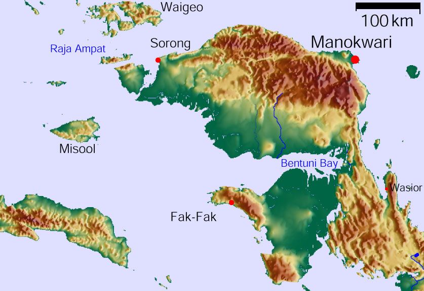
English: Vogelkop Peninsula, West Papua (Indonesia) indicated in Dutch Arfak- and Tamraumountains
Nederlands: Schiereiland Vogelkop met daarop aangegeven Wandammen, Tamrau- en Arfakgebergte |
| Date | January 2006/modified version: April 18, 2012 |
| Source | GMT, GLOBE, own work |
| Author | Stefan Faymer /Modified version: HW de Nie |
| Permission (Reusing this file) |
The map has been created with the Generic Mapping Tools: http://gmt.soest.hawaii.edu/ using one or more of these public domain datasets |
| Other versions | http://upload.wikimedia.org/wikipedia/commons/8/89/BirdsHeadPeninsula_Topo.jpg |
The public domain datasets for the relief: ETOPO2 (topography/bathymetry): http://www.ngdc.noaa.gov/mgg/global/global.html GLOBE (topography): http://www.ngdc.noaa.gov/mgg/topo/gltiles.html SRTM (topography): http://www2.jpl.nasa.gov/srtm/
Licensing
[edit]
| This file is in the public domain in the United States because it was solely created by NASA. NASA copyright policy states that "NASA material is not protected by copyright unless noted". (See Template:PD-USGov, NASA copyright policy page or JPL Image Use Policy.) | ||
 |
Warnings:
|
File history
Click on a date/time to view the file as it appeared at that time.
| Date/Time | Thumbnail | Dimensions | User | Comment | |
|---|---|---|---|---|---|
| current | 11:54, 18 April 2012 | | 837 × 576 (77 KB) | Hwdenie (talk | contribs) | {{Information |Description ={{en|1=Vogelkop Peninsula, West Papua (Indonesia) indicated in Dutch Arfak- and Tamraumountains}} {{nl|1=Schiereiland Vogelkop met daarop aangegeven Wandammen, Tamrau- en Arfakgebergte}} |Source =GMT, GLOBE, own w... |
You cannot overwrite this file.
File usage on Commons
There are no pages that use this file.
File usage on other wikis
The following other wikis use this file:
- Usage on nl.wikipedia.org