File:Bircher Common - geograph.org.uk - 1461576.jpg
Jump to navigation
Jump to search
No higher resolution available.
Bircher_Common_-_geograph.org.uk_-_1461576.jpg (640 × 480 pixels, file size: 74 KB, MIME type: image/jpeg)
Captions
Captions
Add a one-line explanation of what this file represents
Summary
[edit]
| Description |
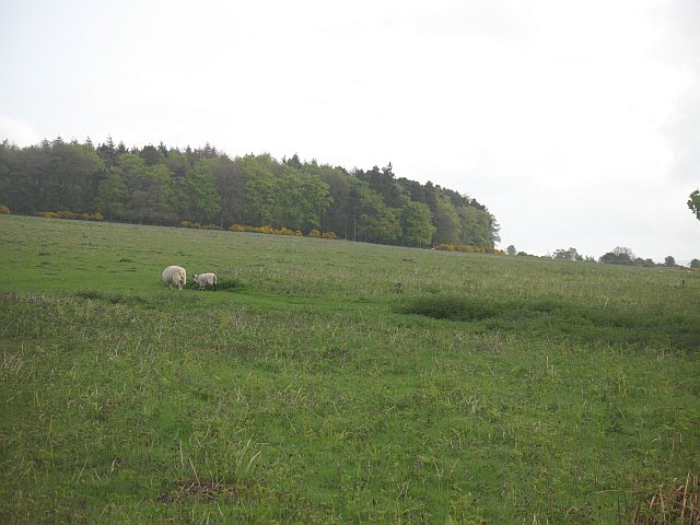
English: Bircher Common The common is slowly deteriorating as a grassland, with bracken taking up more land. View across to the round Oaker Coppice. The National Trust are somewhat obstructive in their management of the common. The able bodied can still walk in, there is limited parking on the Shobdon road, but all the car parks, and even in one case a turning place have been blocked off. |
| Date | |
| Source | From geograph.org.uk |
| Author | Richard Webb |
| Attribution (required by the license) | Richard Webb / Bircher Common / |
| Camera location | | View this and other nearby images on: OpenStreetMap |
|---|
_heading:45.00&language=en)
| Object location | | View this and other nearby images on: OpenStreetMap |
|---|
_heading:45.00&language=en)
Licensing
[edit]

|
This image was taken from the Geograph project collection. See this photograph's page on the Geograph website for the photographer's contact details. The copyright on this image is owned by Richard Webb and is licensed for reuse under the Creative Commons Attribution-ShareAlike 2.0 license.
|
This file is licensed under the Creative Commons Attribution-Share Alike 2.0 Generic license.
Attribution: Richard Webb
- You are free:
- to share – to copy, distribute and transmit the work
- to remix – to adapt the work
- Under the following conditions:
- attribution – You must give appropriate credit, provide a link to the license, and indicate if changes were made. You may do so in any reasonable manner, but not in any way that suggests the licensor endorses you or your use.
- share alike – If you remix, transform, or build upon the material, you must distribute your contributions under the same or compatible license as the original.
- Remove redundant categories and try to put this image in the most specific category/categories
- Remove this template
- The location categories are based on information from this geonames tool and this OpenStreetMap tool combined with a database. You can also have a look at this tool from mysociety.
- The topic category from Geograph was Rough grazing (find similar images grazing at Geograph)
File history
Click on a date/time to view the file as it appeared at that time.
| Date/Time | Thumbnail | Dimensions | User | Comment | |
|---|---|---|---|---|---|
| current | 07:54, 2 March 2011 | | 640 × 480 (74 KB) | GeographBot (talk | contribs) | == {{int:filedesc}} == {{Information |description={{en|1=Bircher Common The common is slowly deteriorating as a grassland, with bracken taking up more land. View across to the round Oaker Coppice. The National Trust are somewhat obstructive in their manag |
You cannot overwrite this file.
File usage on Commons
There are no pages that use this file.