File:Big Muskie - Side View.jpg
Jump to navigation
Jump to search
Size of this preview: 800 × 540 pixels. Other resolutions: 320 × 216 pixels | 640 × 432 pixels | 1,024 × 691 pixels | 1,280 × 864 pixels | 1,755 × 1,185 pixels.
Original file (1,755 × 1,185 pixels, file size: 1.47 MB, MIME type: image/jpeg)
Captions
Captions
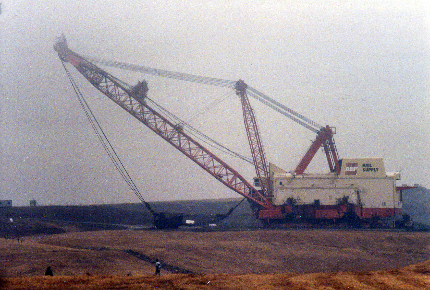
Big Muskie prior to demolition in Ohio, February 1999.
Summary
[edit]
| Description |
English: Side view of Big Muskie (4250-W) prior to its demolition. |
| Date | Taken on 27 February 1999 |
| Source | Own work |
| Author | Brian M. Powell (user Bitmapped on en.wikipedia) |
| Camera location | | View this and other nearby images on: OpenStreetMap |
|---|
Licensing
[edit]
This image is licensed under the below Creative Commons license assuming that proper attribution (Brian M. Powell) is provided. If you use this image for a non-Wikimedia or non-Wikipedia project, please leave a note at Brian's Wikipedia Talk page.
This file is licensed under the Creative Commons Attribution-Share Alike 3.0 Unported license.
Attribution: Brian M. Powell
- You are free:
- to share – to copy, distribute and transmit the work
- to remix – to adapt the work
- Under the following conditions:
- attribution – You must give appropriate credit, provide a link to the license, and indicate if changes were made. You may do so in any reasonable manner, but not in any way that suggests the licensor endorses you or your use.
- share alike – If you remix, transform, or build upon the material, you must distribute your contributions under the same or compatible license as the original.
File history
Click on a date/time to view the file as it appeared at that time.
| Date/Time | Thumbnail | Dimensions | User | Comment | |
|---|---|---|---|---|---|
| current | 19:15, 19 February 2009 | | 1,755 × 1,185 (1.47 MB) | Bitmapped (talk | contribs) | == Summary == {{Information |Description= {{en|1=Side view of w:Big Muskie prior to its demolition.}} |Source= Own work by author/uploader |Author= Brian M. Powell (user bmpowell on [http://en.wikipedia.org en.wikip |
You cannot overwrite this file.
File usage on Commons
The following 3 pages use this file:
File usage on other wikis
The following other wikis use this file:
- Usage on de.wikipedia.org
- Usage on en.wikipedia.org
- Usage on fr.wikipedia.org
- Usage on hy.wikipedia.org
- Usage on id.wikipedia.org
- Usage on it.wikipedia.org
- Usage on ja.wikipedia.org
- Usage on lt.wikipedia.org
- Usage on nl.wikipedia.org
- Usage on pl.wikipedia.org
- Usage on ru.wikipedia.org
- Usage on uk.wikipedia.org