File:Big Inch pipeline running through wooded land.jpg
Jump to navigation
Jump to search
No higher resolution available.
Big_Inch_pipeline_running_through_wooded_land.jpg (591 × 431 pixels, file size: 128 KB, MIME type: image/jpeg)
Captions
Captions
Add a one-line explanation of what this file represents
Summary
[edit]| Description |
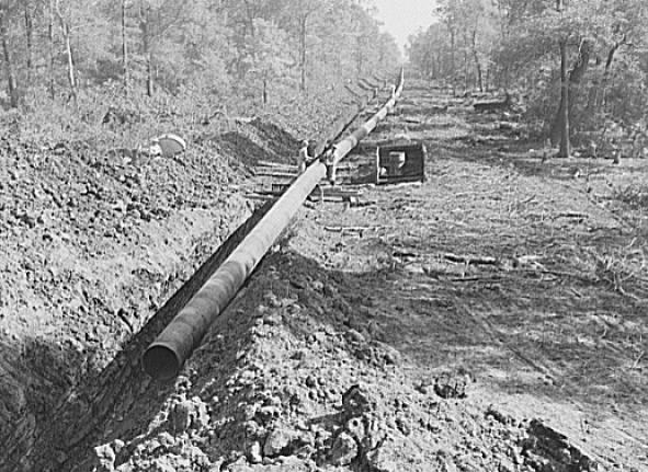
English: Arkansas-Texas state line to Gurdon, Arkansas. War emergency pipeline from Longview, Texas to Norris City, Illinois. Right-of-way of war emergency pipeline running through wooded land
Rights advisory: No known restrictions. For information, see U.S. Farm Security Administration/Office of War Information Black & White Photographs(https://www.loc.gov/rr/print/res/071_fsab.html) |
|||||||||||||||||||||||
| Date | ||||||||||||||||||||||||
| Source |
|
|||||||||||||||||||||||
| Author |
|
|||||||||||||||||||||||


Licensing
[edit]
| This image is a work of an employee of the United States Farm Security Administration or Office of War Information domestic photographic units, taken as part of that person's official duties. As a work of the U.S. federal government, the image is in the public domain in the United States. See Copyright. |
File history
Click on a date/time to view the file as it appeared at that time.
| Date/Time | Thumbnail | Dimensions | User | Comment | |
|---|---|---|---|---|---|
| current | 17:32, 4 April 2014 | | 591 × 431 (128 KB) | Hchc2009 (talk | contribs) | User created page with UploadWizard |
You cannot overwrite this file.
File usage on Commons
There are no pages that use this file.
File usage on other wikis
The following other wikis use this file:
- Usage on en.wikipedia.org