File:BiênGiớiViệtTrung1896.jpg
Jump to navigation
Jump to search

Size of this preview: 800 × 568 pixels. Other resolutions: 320 × 227 pixels | 640 × 455 pixels | 1,024 × 728 pixels | 1,280 × 909 pixels | 2,560 × 1,819 pixels | 7,600 × 5,400 pixels.
Original file (7,600 × 5,400 pixels, file size: 12.64 MB, MIME type: image/jpeg)
Captions
Captions
Add a one-line explanation of what this file represents
Summary
[edit]| Description |
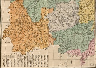
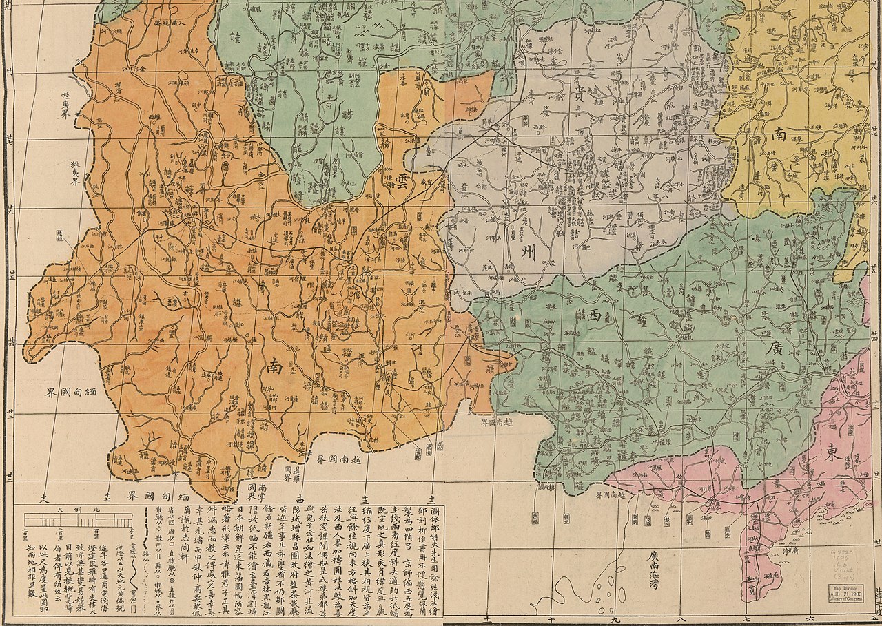
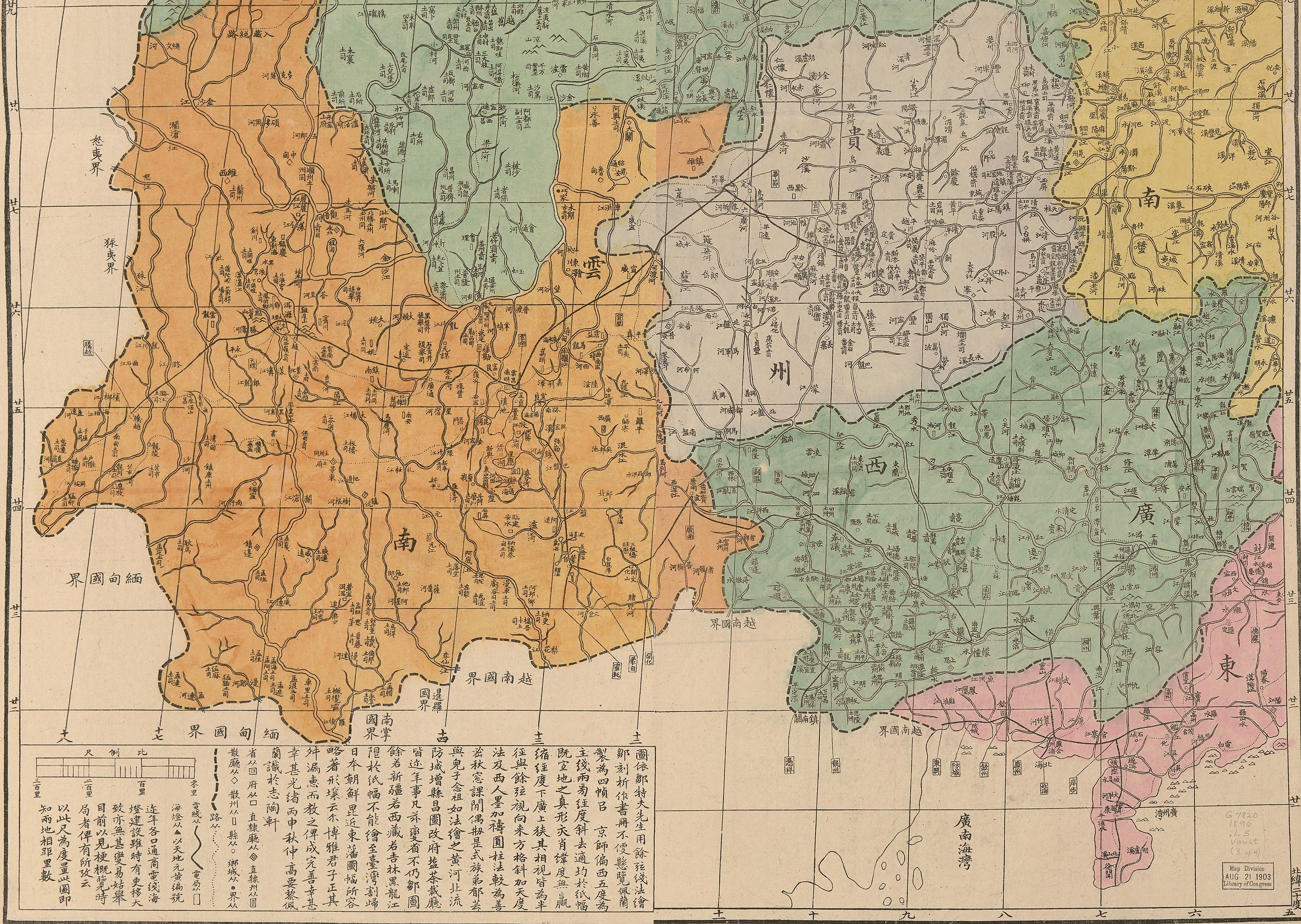
English: A detail of an 1896 map of China, showing Yunnan, Guangxi, and Guizhou.
Tiếng Việt: Bản đồ vùng lãnh thổ Đại Thanh tiếp giáp biên giới với Việt Nam năm 1896. |
| Date | |
| Source | LOC |
| Author | Li Peilan |
| Other versions |
|
_LOC_gm71005083.jpg)
Licensing
[edit]
This work is in the public domain in the United States because it was published (or registered with the U.S. Copyright Office) before January 1, 1929.
Public domain works must be out of copyright in both the United States and in the source country of the work in order to be hosted on the Commons. If the work is not a U.S. work, the file must have an additional copyright tag indicating the copyright status in the source country.
Note: This tag should not be used for sound recordings. |
File history
Click on a date/time to view the file as it appeared at that time.
| Date/Time | Thumbnail | Dimensions | User | Comment | |
|---|---|---|---|---|---|
| current | 04:02, 5 December 2022 | | 7,600 × 5,400 (12.64 MB) | Doãn Hiệu (talk | contribs) | Uploaded a work by Li, Peilan from https://commons.wikimedia.org/wiki/File:(Huang_chao_zhi_sheng_yu_di_quan_tu)_LOC_gm71005083.jpg https://www.loc.gov/item/gm71005083/ with UploadWizard |
You cannot overwrite this file.
File usage on Commons
The following page uses this file:
File usage on other wikis
The following other wikis use this file:
- Usage on vi.wikipedia.org
- Usage on zh.wikipedia.org