File:Bhutan-map.gif
Jump to navigation
Jump to search
No higher resolution available.
Bhutan-map.gif (600 × 342 pixels, file size: 29 KB, MIME type: image/gif)
Captions
Captions
Add a one-line explanation of what this file represents
Summary
[edit]
| Description |
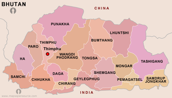
English: Map of Bhutan showing most districts. Map is missing Gasa District, largest of all districts of Bhutan |
| Date | |
| Source | http://www.mapsopensource.com/images/bhutan-map.gif |
| Author | MapsOpenSource |
Licensing
[edit]
This file is licensed under the Creative Commons Attribution 3.0 Unported license.
- You are free:
- to share – to copy, distribute and transmit the work
- to remix – to adapt the work
- Under the following conditions:
- attribution – You must give appropriate credit, provide a link to the license, and indicate if changes were made. You may do so in any reasonable manner, but not in any way that suggests the licensor endorses you or your use.
File history
Click on a date/time to view the file as it appeared at that time.
| Date/Time | Thumbnail | Dimensions | User | Comment | |
|---|---|---|---|---|---|
| current | 17:32, 27 October 2015 | | 600 × 342 (29 KB) | Bigisland55 (talk | contribs) | User created page with UploadWizard |
You cannot overwrite this file.
File usage on Commons
There are no pages that use this file.
File usage on other wikis
The following other wikis use this file:
- Usage on en.wikipedia.org
- Usage on te.wikipedia.org