File:Beyrouth (FL167448787 2370088).jpg
Jump to navigation
Jump to search

Size of this preview: 762 × 599 pixels. Other resolutions: 305 × 240 pixels | 610 × 480 pixels | 976 × 768 pixels | 1,280 × 1,007 pixels | 2,560 × 2,014 pixels | 18,595 × 14,629 pixels.
Original file (18,595 × 14,629 pixels, file size: 305.97 MB, MIME type: image/jpeg)
Captions
Captions
Add a one-line explanation of what this file represents
Summary
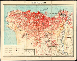
[edit]| Beyrouth
( |
||||||||||||||||||||||||
|---|---|---|---|---|---|---|---|---|---|---|---|---|---|---|---|---|---|---|---|---|---|---|---|---|
| Title |
Beyrouth |
|||||||||||||||||||||||
| Publisher |
Bureau Topographique des Troupes francaises du Levant |
|||||||||||||||||||||||
| Description |
Beyrouth. Dresse. heliograve et publie au Bureau Topographique des Troupes francaises du Levant. |
|||||||||||||||||||||||
| Language | French | |||||||||||||||||||||||
| Publication date | 1936 | |||||||||||||||||||||||
| Collection |
|
|||||||||||||||||||||||
| Current location |
|
|||||||||||||||||||||||
| Place of publication | unknown | |||||||||||||||||||||||
| search Merhav catalog | unknown | |||||||||||||||||||||||
| Notes | Inset scheme : Quartiers de Beyrouth | |||||||||||||||||||||||
| scale | 1:10,000 cm | |||||||||||||||||||||||
| IE PID | IE167448785 | |||||||||||||||||||||||
| Rosetta filename | FL167448787 | |||||||||||||||||||||||
| NNL item ID (P3959) | 990023700880205171 | |||||||||||||||||||||||
| search Merhav catalog | French | |||||||||||||||||||||||
| search Merhav catalog | Bureau Topographique des Troupes francaises du Levant | |||||||||||||||||||||||
| Source/Photographer |
|
|||||||||||||||||||||||
| Other versions | ||||||||||||||||||||||||
| Jpg / Tif version |
|
|||||||||||||||||||||||

.jpg)

.jpg&action=edit§ion=1)
Licensing
[edit].jpg&action=edit§ion=2)
This work created by the United Kingdom Government is in the public domain.
This is because it is one of the following:
HMSO has declared that the expiry of Crown Copyrights applies worldwide (ref: HMSO Email Reply)
|
 |
File history
Click on a date/time to view the file as it appeared at that time.
| Date/Time | Thumbnail | Dimensions | User | Comment | |
|---|---|---|---|---|---|
| current | 03:38, 2 August 2023 | | 18,595 × 14,629 (305.97 MB) | Geagea (talk | contribs) | pattypan 22.03 |
You cannot overwrite this file.
File usage on Commons
The following 2 pages use this file:
.jpg&oldid=822806514)