File:Bernard Lamy, Nouvelle carte de la Terre Sainte Pour servir a l'intelligence de l'Ancien & du Nouveau Testament (FL37098860 2368695).jpg
Jump to navigation
Jump to search

Size of this preview: 780 × 600 pixels. Other resolutions: 312 × 240 pixels | 624 × 480 pixels | 999 × 768 pixels | 1,280 × 984 pixels | 2,560 × 1,969 pixels | 5,653 × 4,347 pixels.
Original file (5,653 × 4,347 pixels, file size: 28.24 MB, MIME type: image/jpeg)
Captions
Captions
Add a one-line explanation of what this file represents
Summary
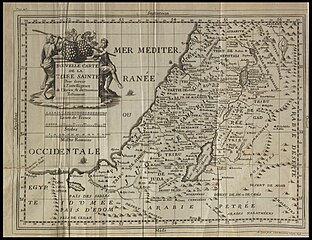
[edit]| Bernard Lamy: Nouvelle carte de la Terre Sainte Pour servir a l'intelligence de l'Ancien & du Nouveau Testament
( |
||||||||||||||||||||||||
|---|---|---|---|---|---|---|---|---|---|---|---|---|---|---|---|---|---|---|---|---|---|---|---|---|
| Artist |
| |||||||||||||||||||||||
| Contributors | Ogier, Mathieu | |||||||||||||||||||||||
| Title |
Nouvelle carte de la Terre Sainte Pour servir a l'intelligence de l'Ancien & du Nouveau Testament |
|||||||||||||||||||||||
| Description |
Nouvelle carte de la Terre Sainte Pour servir a l'intelligence de l'Ancien & du Nouveau Testament. M.Ogier fecit. |
|||||||||||||||||||||||
| Language | French | |||||||||||||||||||||||
| Publication date | 1698 | |||||||||||||||||||||||
| Dimensions | height: 273 mm (10.74 in); width: 362 mm (14.25 in) | |||||||||||||||||||||||
| Collection |
|
|||||||||||||||||||||||
| Current location |
|
|||||||||||||||||||||||
| Place of publication | Lyon | |||||||||||||||||||||||
| search Merhav catalog | Lyon | |||||||||||||||||||||||
| Notes | Copperplate; From: Lamy, Bernard, Introduction a l'Ecriture Sainte, Lyon, 1699, p.47.; Translated from the Latin original first published in 1687. This French edition is enlarged and revised.; The map of the Holy Land is newly drawn and engraved for this edition after Mathieu Ogier, a French priest and cartographer of the 16th century. | |||||||||||||||||||||||
| IE PID | IE37098858 | |||||||||||||||||||||||
| Rosetta filename | FL37098860 | |||||||||||||||||||||||
| NNL item ID (P3959) | 990023686950205171 | |||||||||||||||||||||||
| search Merhav catalog | French, Bernard Lamy | |||||||||||||||||||||||
| search Merhav catalog | Twelve tribes of IsraelMaps | |||||||||||||||||||||||
| Source/Photographer |
|
|||||||||||||||||||||||
| Other versions | ||||||||||||||||||||||||
| Jpg / Tif version |
|
|||||||||||||||||||||||


.jpg)

.jpg&action=edit§ion=1)
Licensing
[edit].jpg&action=edit§ion=2)
The copyright situation of this work is theoretically uncertain, because in the country of origin copyright lasts 70 years after the death of the author, and the date of the author's death is unknown. However, the date of creation of the work was over 120 years ago, and it is thus a reasonable assumption that the copyright has expired (see here for the community discussion). Do not use this template if the date of death of the author is known.
| |
| This file has been identified as being free of known restrictions under copyright law, including all related and neighboring rights. | |
File history
Click on a date/time to view the file as it appeared at that time.
| Date/Time | Thumbnail | Dimensions | User | Comment | |
|---|---|---|---|---|---|
| current | 17:23, 28 July 2023 | | 5,653 × 4,347 (28.24 MB) | Geagea (talk | contribs) | pattypan 22.03 |
You cannot overwrite this file.
File usage on Commons
The following page uses this file:
.jpg&oldid=822038290)