File:Bergues Abbaye R04.jpg
From Wikimedia Commons, the free media repository
Jump to navigation
Jump to search
Size of this preview: 431 × 600 pixels. Other resolutions: 172 × 240 pixels | 345 × 480 pixels | 552 × 768 pixels | 736 × 1,024 pixels | 1,471 × 2,048 pixels | 3,184 × 4,432 pixels.
Original file (3,184 × 4,432 pixels, file size: 8.79 MB, MIME type: image/jpeg)
File information
Structured data
Captions
Summary
[edit]DescriptionBergues Abbaye R04.jpg |
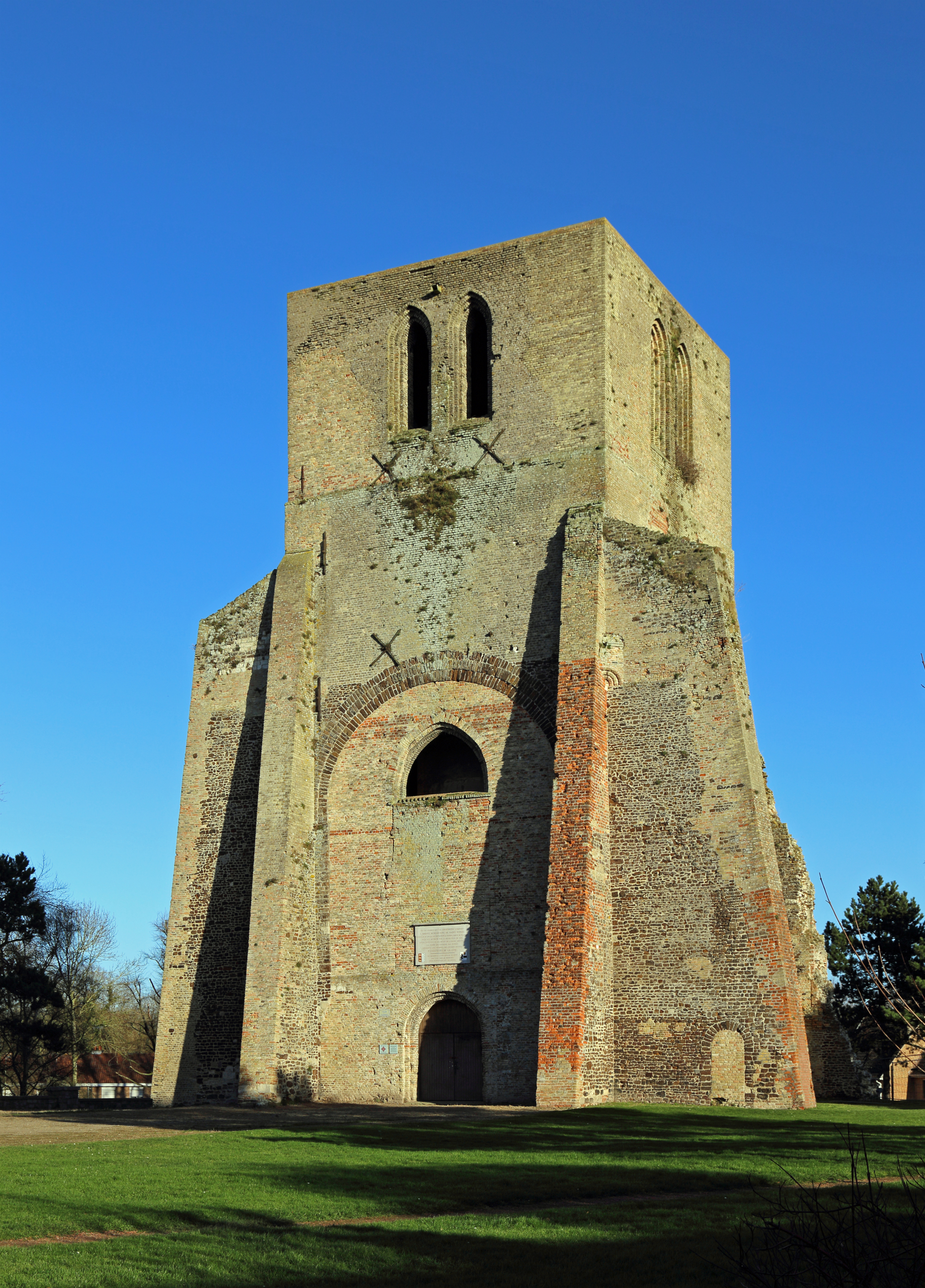
Nederlands: Sint-Winoksbergen (département du Nord, Frankrijk): vieringtoren van de voormalige abdijkerk, ook wel Tour Carrée genaamd English: Bergues (département du Nord, France): tower of the former abbey church, also called Tour Carrée Français : Bergues (département du Nord, France) : la tour de l'ancienne abbatiale, dite 'Tour Carrée'
|
||
Date | |||
Source | Own work | ||
Author | Marc Ryckaert (MJJR) |
Camera location | 50° 58′ 03.91″ N, 2° 26′ 18.95″ E | View this and other nearby images on: OpenStreetMap | 50.967753; 2.438598 |
---|
Licensing
[edit]I, the copyright holder of this work, hereby publish it under the following license:
This file is licensed under the Creative Commons Attribution 3.0 Unported license.
- You are free:
- to share – to copy, distribute and transmit the work
- to remix – to adapt the work
- Under the following conditions:
- attribution – You must give appropriate credit, provide a link to the license, and indicate if changes were made. You may do so in any reasonable manner, but not in any way that suggests the licensor endorses you or your use.
File history
Click on a date/time to view the file as it appeared at that time.
Date/Time | Thumbnail | Dimensions | User | Comment | |
---|---|---|---|---|---|
current | 15:43, 5 January 2015 | 3,184 × 4,432 (8.79 MB) | MJJR (talk | contribs) | User created page with UploadWizard |
You cannot overwrite this file.
File usage on Commons
There are no pages that use this file.
Metadata
This file contains additional information such as Exif metadata which may have been added by the digital camera, scanner, or software program used to create or digitize it. If the file has been modified from its original state, some details such as the timestamp may not fully reflect those of the original file. The timestamp is only as accurate as the clock in the camera, and it may be completely wrong.
Camera manufacturer | Canon |
---|---|
Camera model | Canon EOS 6D |
Exposure time | 1/200 sec (0.005) |
F-number | f/10 |
ISO speed rating | 100 |
Date and time of data generation | 15:45, 2 January 2015 |
Lens focal length | 40 mm |
Latitude | 50° 58′ 3.91″ N |
Longitude | 2° 26′ 18.95″ E |
Altitude | 9.2 meters above sea level |
Orientation | Normal |
Horizontal resolution | 350 dpi |
Vertical resolution | 350 dpi |
Software used | Adobe Photoshop Elements 6.0 Macintosh |
File change date and time | 16:25, 5 January 2015 |
Y and C positioning | Centered |
Exif version | 2.3 |
Date and time of digitizing | 15:45, 2 January 2015 |
Meaning of each component |
|
APEX shutter speed | 7.625 |
APEX aperture | 6.625 |
APEX exposure bias | 0 |
Flash | Flash did not fire, compulsory flash suppression |
Supported Flashpix version | 1 |
Color space | sRGB |
Focal plane X resolution | 3,810.5849582173 |
Focal plane Y resolution | 3,815.89958159 |
Focal plane resolution unit | inches |
Custom image processing | Normal process |
Exposure mode | Auto exposure |
White balance | Auto white balance |
Scene capture type | Standard |
GPS time (atomic clock) | 13:40:55.003 |
Satellites used for measurement | 12 |
Receiver status | Measurement in progress |
Geodetic survey data used | WGS-84 |
GPS date | 2 January 2015 |
GPS tag version | 0.0.3.2 |
Supported Flashpix version | 1 |
Image width | 3,184 px |
Image height | 4,432 px |
Rating (out of 5) | 0 |
Date metadata was last modified | 17:25, 5 January 2015 |
Structured data
Items portrayed in this file
depicts
2 January 2015
50°58'3.911999999"N, 2°26'18.953999999"E
image/jpeg
971cdf9c2979569ce2b45596d70c3bb3b7145c95
9,213,328 byte
4,432 pixel
3,184 pixel
0.005 second
10
100
40 millimetre
Hidden categories:
- Base Mérimée
- Monuments historiques inscrits
- Mérimée with PA parameter
- Cultural heritage monuments in France with known IDs
- Cultural heritage monuments in France missing SDC depicts
- Cultural heritage monuments in France missing SDC location of creation
- Files with coordinates missing SDC location of creation (50° N, 2° E)
- CC-BY-3.0
- Self-published work
- Taken with Canon EOS 6D
- Images by MJJR
- France photographs taken on 2015-01-02