File:Bengjianzi 01.jpg
From Wikimedia Commons, the free media repository
Jump to navigation
Jump to search
Size of this preview: 800 × 552 pixels. Other resolutions: 320 × 221 pixels | 640 × 442 pixels | 1,024 × 707 pixels | 1,280 × 884 pixels | 2,560 × 1,767 pixels | 3,100 × 2,140 pixels.
Original file (3,100 × 2,140 pixels, file size: 3.3 MB, MIME type: image/jpeg)
File information
Structured data
Captions
Summary
[edit]DescriptionBengjianzi 01.jpg |
中文(中国大陆):长阳崩尖子国家级自然保护区界碑。
English: 
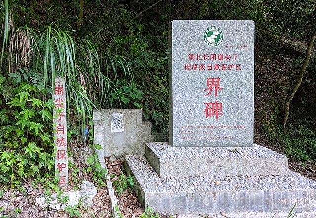
Boundary marker of Changyang Bengjianzi National Nature Reserve. |
Date | |
Source | Own work |
Author | Sun Jiao (Interaccoonale) |
Camera location | 30° 20′ 56.13″ N, 110° 47′ 36.26″ E | View this and other nearby images on: OpenStreetMap | 30.348925; 110.793406 |
---|
Licensing
[edit]I, the copyright holder of this work, hereby publish it under the following license:
This file is licensed under the Creative Commons Attribution 4.0 International license.
- You are free:
- to share – to copy, distribute and transmit the work
- to remix – to adapt the work
- Under the following conditions:
- attribution – You must give appropriate credit, provide a link to the license, and indicate if changes were made. You may do so in any reasonable manner, but not in any way that suggests the licensor endorses you or your use.
File history
Click on a date/time to view the file as it appeared at that time.
Date/Time | Thumbnail | Dimensions | User | Comment | |
---|---|---|---|---|---|
current | 08:27, 22 July 2022 | 3,100 × 2,140 (3.3 MB) | Interaccoonale (talk | contribs) | Uploaded own work with UploadWizard |
You cannot overwrite this file.
File usage on Commons
There are no pages that use this file.
File usage on other wikis
The following other wikis use this file:
- Usage on www.wikidata.org
- Usage on zh.wikipedia.org
Metadata
This file contains additional information such as Exif metadata which may have been added by the digital camera, scanner, or software program used to create or digitize it. If the file has been modified from its original state, some details such as the timestamp may not fully reflect those of the original file. The timestamp is only as accurate as the clock in the camera, and it may be completely wrong.
Camera manufacturer | OnePlus |
---|---|
Camera model | KB2000 |
Exposure time | 10,899/1,000,000 sec (0.010899) |
F-number | f/1.75 |
ISO speed rating | 220 |
Date and time of data generation | 15:14, 10 July 2022 |
Lens focal length | 4.745 mm |
Latitude | 30° 20′ 56.13″ N |
Longitude | 110° 47′ 36.26″ E |
Altitude | 209.87 meters above sea level |
Orientation | Normal |
Horizontal resolution | 300 dpi |
Vertical resolution | 300 dpi |
Software used | GIMP 2.10.30 |
File change date and time | 16:10, 22 July 2022 |
Y and C positioning | Centered |
Exposure Program | Normal program |
Exif version | 2.31 |
Date and time of digitizing | 15:14, 10 July 2022 |
Meaning of each component |
|
APEX shutter speed | 6.52 |
APEX aperture | 1.61 |
APEX brightness | 2 |
APEX exposure bias | 0 |
Maximum land aperture | 1.61 APEX (f/1.75) |
Subject distance | 1.886 meters |
Metering mode | Center weighted average |
Flash | Flash did not fire, compulsory flash suppression |
DateTime subseconds | 714096 |
DateTimeOriginal subseconds | 714096 |
DateTimeDigitized subseconds | 714096 |
Supported Flashpix version | 1 |
Sensing method | One-chip color area sensor |
Scene type | A directly photographed image |
Custom image processing | Custom process |
Exposure mode | Auto exposure |
White balance | Auto white balance |
Digital zoom ratio | 0 |
Focal length in 35 mm film | 26 mm |
Scene capture type | Standard |
Contrast | Normal |
Saturation | Normal |
Sharpness | Normal |
Subject distance range | Close view |
GPS time (atomic clock) | 07:14 |
Measurement precision | Poor (7.033) |
GPS date | 10 July 2022 |
GPS tag version | 0.0.2.2 |
Unique ID of original document | xmp.did:48dcedd4-99cb-4cd9-93b1-0978e4dd33e2 |