File:Bengal Bihar 1782.jpg
Jump to navigation
Jump to search

Size of this preview: 800 × 598 pixels. Other resolutions: 320 × 239 pixels | 640 × 479 pixels | 1,024 × 766 pixels | 1,280 × 957 pixels | 2,560 × 1,914 pixels | 12,752 × 9,536 pixels.
Original file (12,752 × 9,536 pixels, file size: 21.86 MB, MIME type: image/jpeg)
Captions
Captions
Add a one-line explanation of what this file represents
| Warning | The original file is very high-resolution. It might not load properly or could cause your browser to freeze when opened at full size. |
|---|
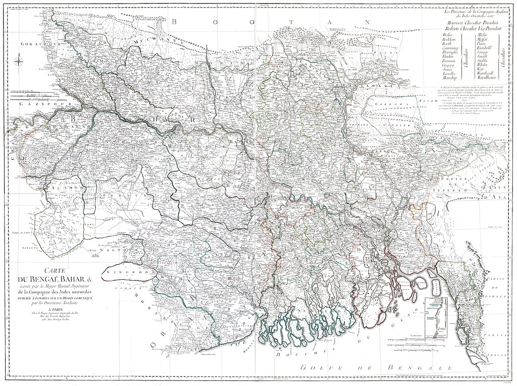
| Description |
Carte du Bengale, Bahar etc / levé par le Major Rennell ingénieur de la compagnie des Indes orientales |
|||||||||
| Date | ||||||||||
| Source | Bibliothèque nationale de France, département Cartes et plans, GE C-10869 (1-4) | |||||||||
| Creator |
Rennell, James (1742-1830). Cartographe ; Le Rouge, Georges-Louis (1712-179.). Graveur ; Chez Le Rouge (Paris) |
|||||||||
| Permission (Reusing this file) |
|
|||||||||
| Geotemporal data | ||||||||||
| Bounding box |
|
|||||||||
| Georeferencing | ||||||||||
File history
Click on a date/time to view the file as it appeared at that time.
| Date/Time | Thumbnail | Dimensions | User | Comment | |
|---|---|---|---|---|---|
| current | 06:33, 3 July 2020 | | 12,752 × 9,536 (21.86 MB) | Shyamal (talk | contribs) | c:User:Rillke/bigChunkedUpload.js: {{map | description =Carte du Bengale, Bahar etc / levé par le Major Rennell ingénieur de la compagnie des Indes orientales |author= Rennell, James (1742-1830). Cartographe ; Le Rouge, Georges-Louis (1712-179.). Graveur ; Chez Le Rouge (Paris) | date = 1782 | source = [http://catalogue.bnf.fr/ark:/12148/cb405939263 Bibliothèque nationale de France, département Cartes et plans, GE C-10869 (1-4) ] | permission = {{pd-old-70}} }} |
You cannot overwrite this file.
File usage on Commons
There are no pages that use this file.