File:BengalMapInglis.jpg
Jump to navigation
Jump to search

Size of this preview: 800 × 469 pixels. Other resolutions: 320 × 188 pixels | 640 × 376 pixels | 1,024 × 601 pixels | 1,280 × 751 pixels | 2,560 × 1,502 pixels | 4,976 × 2,920 pixels.
Original file (4,976 × 2,920 pixels, file size: 15.89 MB, MIME type: image/jpeg)
Captions
Captions
Add a one-line explanation of what this file represents
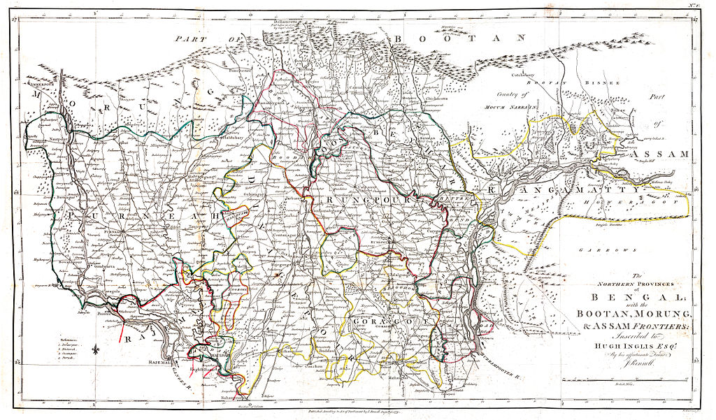
| Description | The Northern provinces of Bengal; with the Bootan, Morung, and Assam frontiers: inscribed to Hugh Inglis Esq by his affectionate friend J. Rennell | ||||
| Date | |||||
| Source |
[http://beinecke.library.yale.edu/dl_crosscollex/brbldl_getrec.asp?fld=img&id=1012288 Rennell, James, 1742-1830 A Bengal atlas, containing maps of the theatre of war and commerce on that side of Hindoostan, compiled from the original surveys; and published by order of the honourable the Court of Directors for the Affairs of the East India Co [London] 1780 |
||||
| Author | J. Rennell | ||||
| Permission (Reusing this file) |
|
||||
File history
Click on a date/time to view the file as it appeared at that time.
| Date/Time | Thumbnail | Dimensions | User | Comment | |
|---|---|---|---|---|---|
| current | 10:03, 2 September 2012 | | 4,976 × 2,920 (15.89 MB) | Shyamal (talk | contribs) | {{Information |Description=The Northern provinces of Bengal; with the Bootan, Morung, and Assam frontiers: inscribed to Hugh Inglis Esq by his affectionate friend J. Rennell |Source=[http://beinecke.library.yale.edu/dl_crosscollex/brbldl_getrec.asp?fld... |
You cannot overwrite this file.
File usage on Commons
There are no pages that use this file.