File:Benelux location map.svg

Original file (SVG file, nominally 960 × 1,304 pixels, file size: 175 KB)
Captions
Captions
Summary
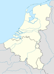
[edit]| Description |
Deutsch: Positionskarte der Benelux-Staaten
Quadratische Plattkarte, N-S-Streckung 160 %. Geographische Begrenzung der Karte:
English: Location map of the Benelux countries
Equirectangular projection, N/S stretching 160 %. Geographic limits of the map:
|
|
| Date | ||
| Source |
Own work, using
|
|
| Author | NordNordWest | |
| Permission (Reusing this file) |
This file is licensed under the Creative Commons Attribution-Share Alike 3.0 Germany license.
 This file is licensed under the Creative Commons Attribution-Share Alike 3.0 Unported license.
|


|
This map has been made or improved in the German Kartenwerkstatt (Map Lab). You can propose maps to improve as well.
|
File history
Click on a date/time to view the file as it appeared at that time.
| Date/Time | Thumbnail | Dimensions | User | Comment | |
|---|---|---|---|---|---|
| current | 18:34, 17 February 2011 | | 960 × 1,304 (175 KB) | NordNordWest (talk | contribs) | == {{int:filedesc}} == {{Information |Description= {{de|Positionskarte der Benelux-Staaten}} Quadratische Plattkarte, N-S-Streckung 160 %. Geographische Begrenzung der Karte: * N: 53.7° N * S: 49.2° N * W: 2.2° O * O: 7.5° O {{en|Locat |
You cannot overwrite this file.
File usage on Commons
The following 2 pages use this file:
File usage on other wikis
The following other wikis use this file:
- Usage on ar.wikipedia.org
- Usage on ba.wikipedia.org
- Usage on bn.wikipedia.org
- Usage on bs.wikipedia.org
- Usage on ceb.wikipedia.org
- Usage on ckb.wikipedia.org
- Usage on da.wikipedia.org
- Usage on de.wikipedia.org
- Intercity-Express
- Liste der Nationalparks im Königreich der Niederlande
- Benutzer:Spischot/Sketchpad 3
- Werder Bremen/Namen und Zahlen
- Wikipedia:Kartenwerkstatt/Positionskarten/Europa
- Freie-Partie-Europameisterschaft
- Coupe d’Europe
- Superprestige Cyclocross 2010/11
- Vorlage:Positionskarte Benelux
- Wikipedia:Kartenwerkstatt/Archiv/2011-02
- National League (Belgien)
- Benutzer:Rafael Zink/Vorlagen/Karten
- Crystal Kelly Cup
- Dreiband-Europameisterschaft der Junioren
- Liste benannter IC/ICE-Fahrzeuge
- Benutzer:Gps-for-five/Spielwiese/Vorlage:Suche Poskarte
- Benutzer:Gps-for-five/Spielwiese/Vorlage:Suche Poskarte/Doku
- Vorlage:Suche Positionskarte
- Vorlage:Suche Positionskarte/Doku
- Benutzer:HugoVert/Werders Europapokalgegner
- Grenzpark Kalmthoutse Heide
- Drei-Nationen-Turnier (Frauenfußball, 2021)
- Zweikampf-Europameisterschaft der Junioren
- Benutzer:Wizzo818/Eintracht Frankfurt/Europapokalstatistik
- Usage on en.wikipedia.org
- Benelux
- Trappist beer
- 't Haantje, Drenthe
- Putte, Netherlands
- 't Woudt
- North Sea Cup
- 2008–09 Euro Hockey League
- Belgium–Netherlands 2018 FIFA World Cup bid
- 2009–10 Euro Hockey League
- Mount Saint Peter
- Module:Location map/data/Benelux/doc
- 2010–11 Euro Hockey League
- 2012–13 BeNe League
- 2011–12 Euro Hockey League
- Nederlandse Rugby League Bond Championship
View more global usage of this file.