File:Ben Nevis , Munro No 1 - geograph.org.uk - 69846.jpg
Jump to navigation
Jump to search
No higher resolution available.
Ben_Nevis_,_Munro_No_1_-_geograph.org.uk_-_69846.jpg (640 × 480 pixels, file size: 209 KB, MIME type: image/jpeg)
Captions
Captions
Add a one-line explanation of what this file represents
Summary
[edit]
| Description |
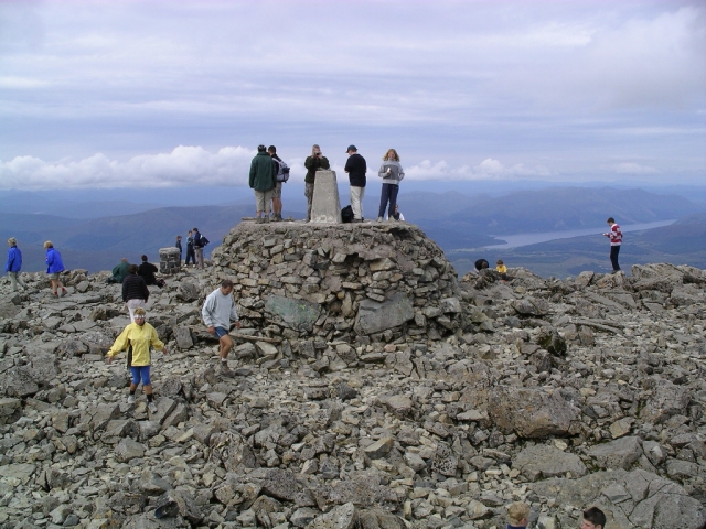
English: Ben Nevis : Munro No 1. The highest in the land at 1344m / 4409 ft above sea level. This shows the "cairn" with the trig point on the top on 12th August 2003. A "summer" picture, and one of the few days that you can see off the top. The view beyond the trig point is to the south east. |
| Date | |
| Source | From geograph.org.uk |
| Author | Graham Ellis |
| Attribution (required by the license) | Graham Ellis / Ben Nevis : Munro No 1 / |
| Object location | | View this and other nearby images on: OpenStreetMap |
|---|
_&language=en)
Licensing
[edit]

|
This image was taken from the Geograph project collection. See this photograph's page on the Geograph website for the photographer's contact details. The copyright on this image is owned by Graham Ellis and is licensed for reuse under the Creative Commons Attribution-ShareAlike 2.0 license.
|
This file is licensed under the Creative Commons Attribution-Share Alike 2.0 Generic license.
Attribution: Graham Ellis
- You are free:
- to share – to copy, distribute and transmit the work
- to remix – to adapt the work
- Under the following conditions:
- attribution – You must give appropriate credit, provide a link to the license, and indicate if changes were made. You may do so in any reasonable manner, but not in any way that suggests the licensor endorses you or your use.
- share alike – If you remix, transform, or build upon the material, you must distribute your contributions under the same or compatible license as the original.
File history
Click on a date/time to view the file as it appeared at that time.
| Date/Time | Thumbnail | Dimensions | User | Comment | |
|---|---|---|---|---|---|
| current | 13:16, 30 January 2010 | | 640 × 480 (209 KB) | GeographBot (talk | contribs) | == {{int:filedesc}} == {{Information |description={{en|1=Ben Nevis : Munro No 1. The highest in the land at 1344m / 4409 ft above sea level. This shows the "cairn" with the trig point on the top on 12th August 2003. A "summer" picture, and one of the few |
You cannot overwrite this file.
File usage on Commons
There are no pages that use this file.