File:Belgian Railway Line 45A.png
Jump to navigation
Jump to search
Size of this preview: 795 × 599 pixels. Other resolutions: 319 × 240 pixels | 637 × 480 pixels | 1,019 × 768 pixels | 1,280 × 965 pixels | 1,783 × 1,344 pixels.
Original file (1,783 × 1,344 pixels, file size: 1.9 MB, MIME type: image/png)
Captions
Captions
Add a one-line explanation of what this file represents
Summary
[edit]
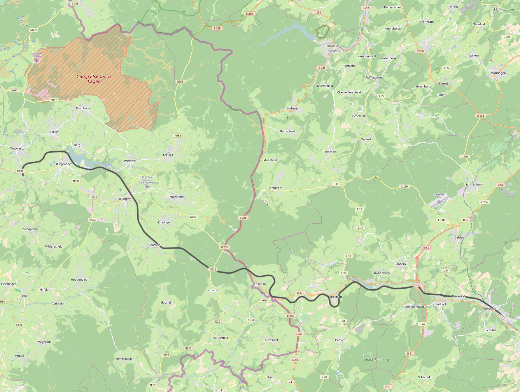
| Description | Belgian Railway Line 45A, Jünkerath - Weywertz |
| Date | |
| Source | Own work |
| Author | OpenStreetMap contributors |
Licensing
[edit]
I, the copyright holder of this work, hereby publish it under the following licenses:

|
Permission is granted to copy, distribute and/or modify this document under the terms of the GNU Free Documentation License, Version 1.2 or any later version published by the Free Software Foundation; with no Invariant Sections, no Front-Cover Texts, and no Back-Cover Texts. A copy of the license is included in the section entitled GNU Free Documentation License. |
This file is licensed under the Creative Commons Attribution-Share Alike 3.0 Unported, 2.5 Generic, 2.0 Generic and 1.0 Generic license.
- You are free:
- to share – to copy, distribute and transmit the work
- to remix – to adapt the work
- Under the following conditions:
- attribution – You must give appropriate credit, provide a link to the license, and indicate if changes were made. You may do so in any reasonable manner, but not in any way that suggests the licensor endorses you or your use.
- share alike – If you remix, transform, or build upon the material, you must distribute your contributions under the same or compatible license as the original.
You may select the license of your choice.
File history
Click on a date/time to view the file as it appeared at that time.
| Date/Time | Thumbnail | Dimensions | User | Comment | |
|---|---|---|---|---|---|
| current | 22:06, 4 May 2016 | | 1,783 × 1,344 (1.9 MB) | Vunz (talk | contribs) | improved |
| 15:27, 2 September 2010 |  | 1,048 × 792 (503 KB) | Vunz (talk | contribs) | ||
| 22:23, 9 December 2009 |  | 1,048 × 792 (501 KB) | Vunz (talk | contribs) | ||
| 21:18, 20 January 2009 |  | 520 × 390 (99 KB) | Vunz (talk | contribs) | {{Information |Description={{nl|1=spoormap}} |Source=eigen werk (own work) |Author=Wiebevl |Date=20/01/2009 |Permission= |other_versions= }} <!--{{ImageUpload|full}}--> Category:Rail transport maps of Belgium [[Category:Public domain |
You cannot overwrite this file.
File usage on Commons
The following 12 pages use this file:
- User:Chumwa/OgreBot/Potential transport maps/2016 May 1-10
- User:Chumwa/OgreBot/Public transport information/2016 May 1-10
- User:Chumwa/OgreBot/Transport Maps/2016 May 1-10
- User:Chumwa/OgreBot/Travel and communication maps/2016 May 1-10
- User:Nordlicht8/Rail Germany/2016 May 1-10
- File:Spoorlijn45A.png (file redirect)
- Category:Vennquerbahn
File usage on other wikis
The following other wikis use this file:
- Usage on de.wikipedia.org
- Usage on fr.wikipedia.org
- Usage on nl.wikipedia.org
- Usage on www.wikidata.org