File:Beleg van Breda 1624 contra en circumvallatielinies.jpg
Jump to navigation
Jump to search

Size of this preview: 800 × 528 pixels. Other resolutions: 320 × 211 pixels | 640 × 423 pixels | 1,024 × 676 pixels | 1,249 × 825 pixels.
Original file (1,249 × 825 pixels, file size: 206 KB, MIME type: image/jpeg)
Captions
Captions
Add a one-line explanation of what this file represents
Summary
[edit]
| Description |
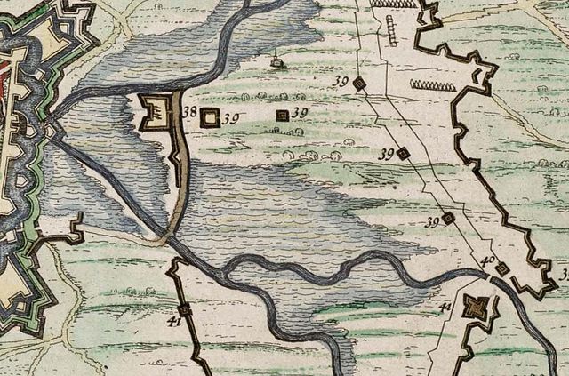
English: Detail of the map of the Siege of Breda (1624) by Ambrogio Spinola. (Map J.Blaeu, 1649) (file:Siege of Breda 1624 - Obsidio Bredaem per Ambriosium Spinolam (anno 1624).jpg)
Nederlands: Uiterst rechts als een dikke lijn de definitieve circumvallatielinie. Daarnaast als een lichte lijn de voorlopige circumvallatielinie. Links daarvan de voorlopige contravallatielinie. Verder naar links als een dikke lijn de definitieve contravallatielinie. Uiterst links de verdedigingswerken van Breda en de stad zelf. |
| Date | |
| Source | Atlas van Loon |
| Author | J.Blaeu |
.jpg)
Licensing
[edit]
|
This work is in the public domain in its country of origin and other countries and areas where the copyright term is the author's life plus 100 years or fewer. | |
| This file has been identified as being free of known restrictions under copyright law, including all related and neighboring rights. | |
File history
Click on a date/time to view the file as it appeared at that time.
| Date/Time | Thumbnail | Dimensions | User | Comment | |
|---|---|---|---|---|---|
| current | 10:40, 11 October 2009 | | 1,249 × 825 (206 KB) | Druifkes (talk | contribs) | {{Information |Description={{en|1=Detail of the map of the Siege of Breda (1624) by Ambrogio Spinola. (Map J.Blaeu, 1649) (file:Siege of Breda 1624 - Obsidio Bredaem per Ambriosium Spinolam (anno 1624).jpg)}} {{nl|1=Uiterst rechts als een dikke lijn |
You cannot overwrite this file.
File usage on Commons
There are no pages that use this file.
File usage on other wikis
The following other wikis use this file:
- Usage on nl.wikipedia.org