File:BeitSira2140.JPG
Jump to navigation
Jump to search
Size of this preview: 800 × 533 pixels. Other resolutions: 320 × 213 pixels | 640 × 427 pixels | 1,024 × 683 pixels | 1,280 × 853 pixels | 2,560 × 1,707 pixels | 4,608 × 3,072 pixels.
Original file (4,608 × 3,072 pixels, file size: 3.3 MB, MIME type: image/jpeg)
Captions
Captions
Add a one-line explanation of what this file represents
Summary
[edit]
| Description |
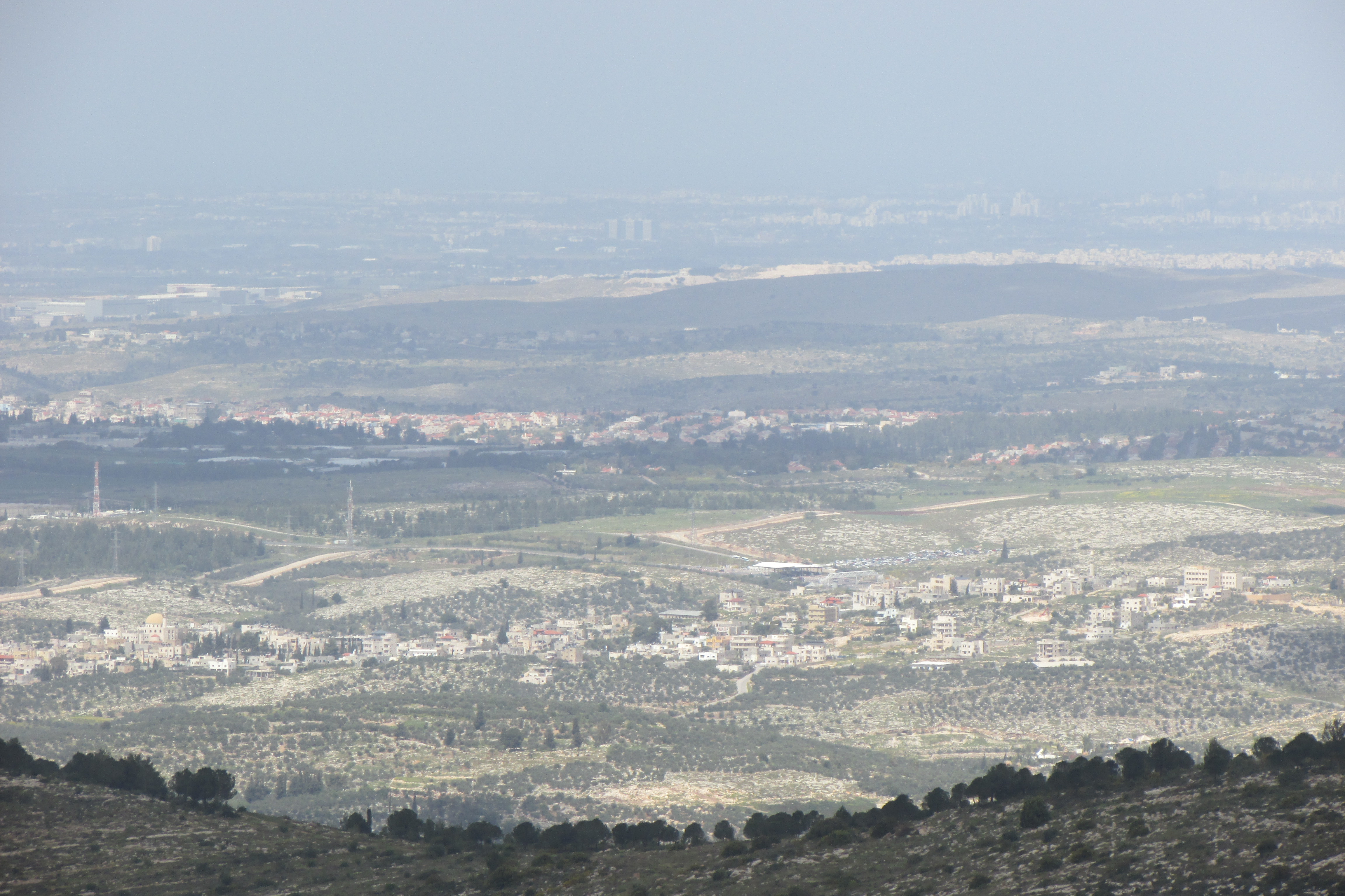
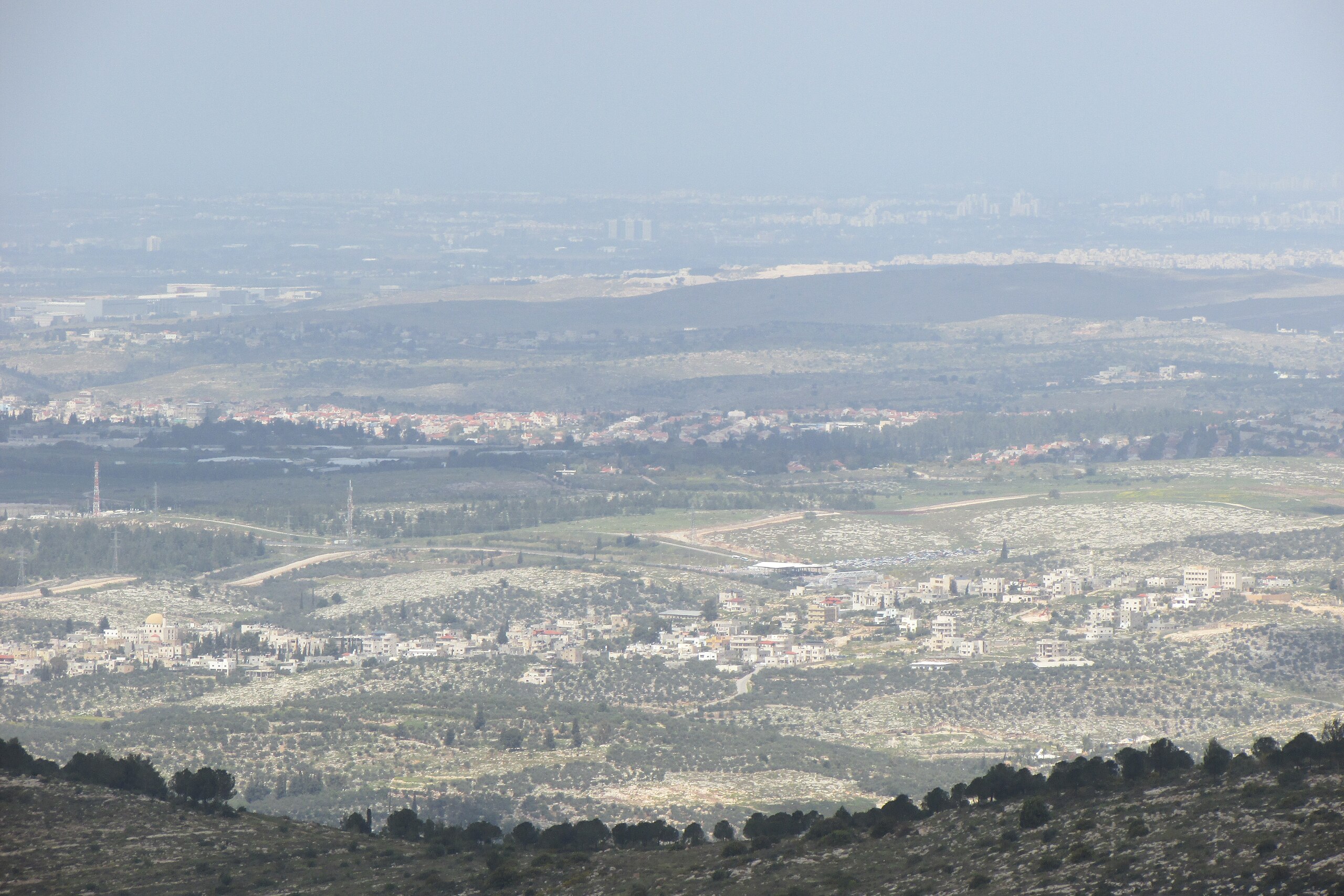
English: Beit Sira from south east. Behind is Beit Sira is route 443. Note the shack on the road which is the check post of the Israeli West Bank barrier. The red roofed houses in the middle of the picture from the middle to the left is Hashmonaim. On the right is the edge of Kfar Haoranim. Behind Kfar Haoranim is Nilin and behind Hashmonaim is Budrus. Behind Shoham on the left is teh Shoham industrial zone. The closest white houses in the farther area is Elad. Behind Elad are houses of Ho Hasharon. |
| Date | |
| Source | Own work |
| Author | עדירל |
Licensing
[edit]
I, the copyright holder of this work, hereby publish it under the following license:
This file is licensed under the Creative Commons Attribution-Share Alike 4.0 International license.
- You are free:
- to share – to copy, distribute and transmit the work
- to remix – to adapt the work
- Under the following conditions:
- attribution – You must give appropriate credit, provide a link to the license, and indicate if changes were made. You may do so in any reasonable manner, but not in any way that suggests the licensor endorses you or your use.
- share alike – If you remix, transform, or build upon the material, you must distribute your contributions under the same or compatible license as the original.
File history
Click on a date/time to view the file as it appeared at that time.
| Date/Time | Thumbnail | Dimensions | User | Comment | |
|---|---|---|---|---|---|
| current | 15:09, 22 March 2016 | | 4,608 × 3,072 (3.3 MB) | עדירל (talk | contribs) | User created page with UploadWizard |
You cannot overwrite this file.
File usage on Commons
The following page uses this file: