File:Beeldengroep Verzoening 01.jpg
Jump to navigation
Jump to search
Size of this preview: 799 × 599 pixels. Other resolutions: 320 × 240 pixels | 640 × 480 pixels | 1,024 × 768 pixels | 1,280 × 960 pixels | 2,560 × 1,920 pixels | 4,565 × 3,424 pixels.
Original file (4,565 × 3,424 pixels, file size: 2.56 MB, MIME type: image/jpeg)
Captions
Captions
Add a one-line explanation of what this file represents
Summary
[edit]
| Description |
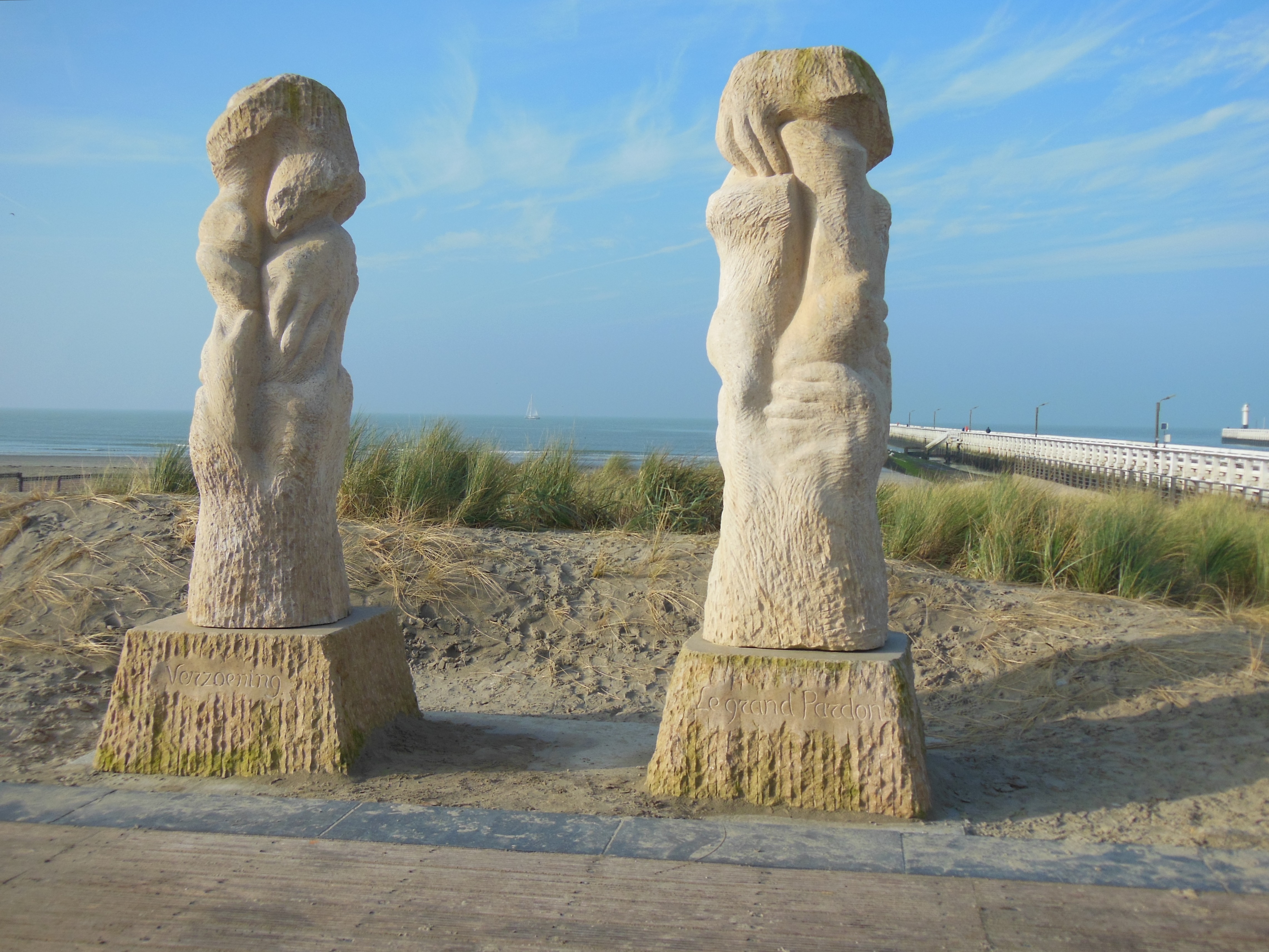
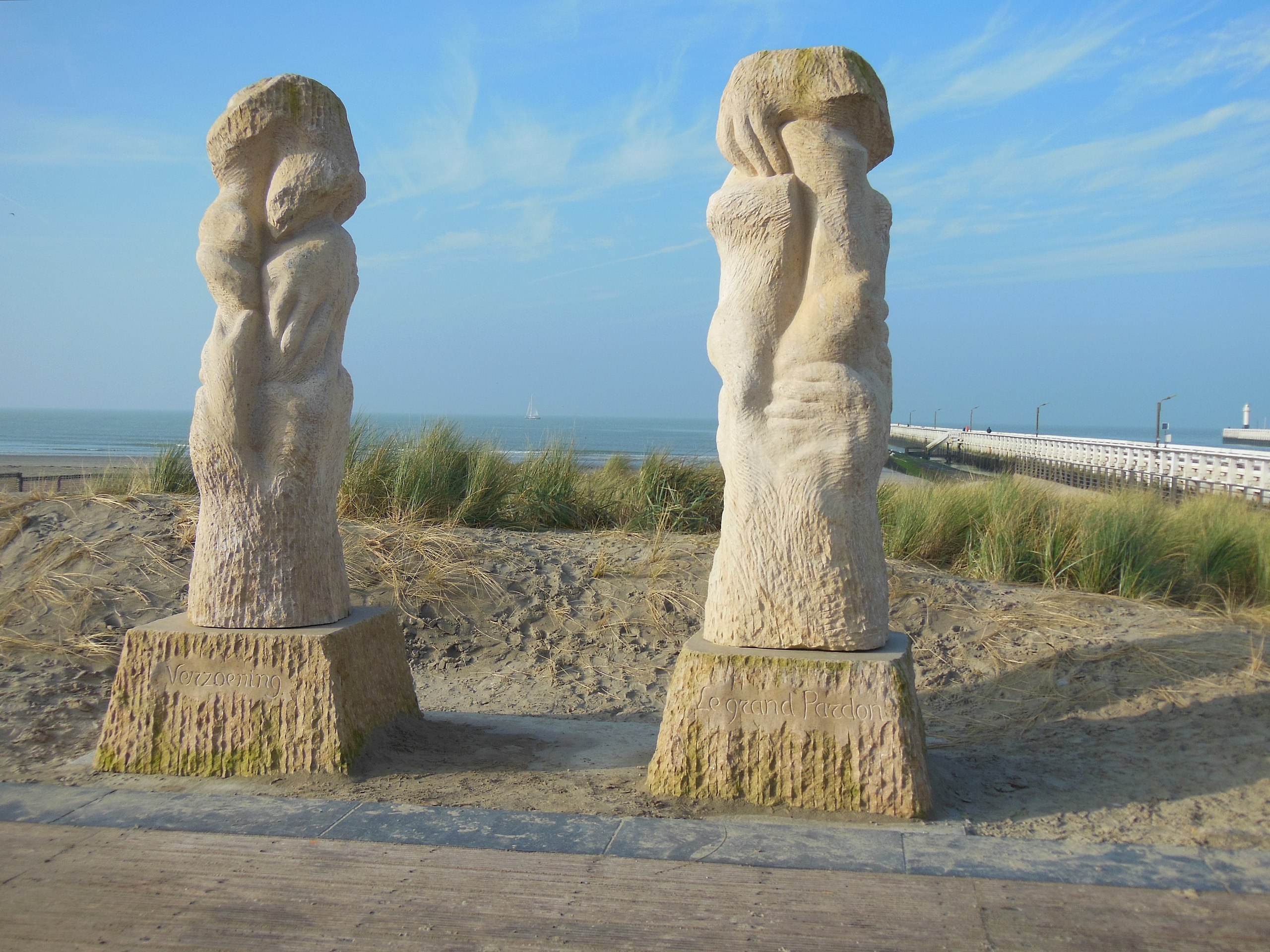
Nederlands: Beeldengroep "Verzoening" met menselijke vormen als metafoor voor agressie, verzoening, beschutting en gastvrijheid
English: A pair of figures, called "Reconciliation", with human forms as a metaphor for aggression, reconciliation, shelter and hospitality |
| Date | |
| Source | Own work |
| Author | Frans90245 |
| Camera location | | View this and other nearby images on: OpenStreetMap |
|---|
De beelden werden gemaakt door Willem Vermandere. Ze werden, ter herdenking aan de Eerste Wereldoorlog, op 8 oktober 2014 op het geografische beginpunt van het Westelijk Front geplaatst.
The images were created by Willem Vermandere. On 8 October 2014 they were placed at the geographical starting point of the Western Front in commemoration of the first world war.
Licensing
[edit]
I, the copyright holder of this work, hereby publish it under the following license:
This file is licensed under the Creative Commons Attribution-Share Alike 4.0 International license.
- You are free:
- to share – to copy, distribute and transmit the work
- to remix – to adapt the work
- Under the following conditions:
- attribution – You must give appropriate credit, provide a link to the license, and indicate if changes were made. You may do so in any reasonable manner, but not in any way that suggests the licensor endorses you or your use.
- share alike – If you remix, transform, or build upon the material, you must distribute your contributions under the same or compatible license as the original.
File history
Click on a date/time to view the file as it appeared at that time.
| Date/Time | Thumbnail | Dimensions | User | Comment | |
|---|---|---|---|---|---|
| current | 13:55, 29 December 2016 | | 4,565 × 3,424 (2.56 MB) | Frans90245 (talk | contribs) | User created page with UploadWizard |
You cannot overwrite this file.
File usage on Commons
There are no pages that use this file.
File usage on other wikis
The following other wikis use this file:
- Usage on en.wikipedia.org