File:Beacon Hill Gloucester locator map.png
Jump to navigation
Jump to search
No higher resolution available.
Beacon_Hill_Gloucester_locator_map.png (356 × 296 pixels, file size: 6 KB, MIME type: image/png)
Captions
Captions
Add a one-line explanation of what this file represents
- Author: en:User:Earl Andrew
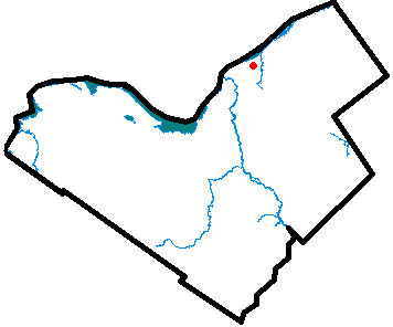
- Description: Locator map of Beacon Hill, a neighbourhood of Gloucester, Ontario, part of Ottawa, Ontario.
- Source: Uploaded as en:Image:Beaconhillgloucester.PNG on January 31 2005
Note: This tag is deprecated, please replace this template with {{PD-user-w}}
| |
This work has been released into the public domain by its author, Earl Andrew, at the English Wikipedia project. This applies worldwide. In case this is not legally possible: |
File history
Click on a date/time to view the file as it appeared at that time.
| Date/Time | Thumbnail | Dimensions | User | Comment | |
|---|---|---|---|---|---|
| current | 22:50, 5 April 2006 | 356 × 296 (6 KB) | Jkelly (talk | contribs) | *Author: en:User:Earl Andrew *Description: Locator map of Beacon Hill, a neighbourhood of Gloucester, Ontario, part of Ottawa, Ontario. *Source: Uploaded as en:Image:Beaconhillgloucester.PNG on January 31 2005 {{PD-user-wikimedia|E |
You cannot overwrite this file.
File usage on Commons
There are no pages that use this file.
File usage on other wikis
The following other wikis use this file:
- Usage on en.wikipedia.org
- Usage on www.wikidata.org
- Usage on zh.wikipedia.org