File:Beach near Hengistbury Head - geograph.org.uk - 1047999.jpg
Jump to navigation
Jump to search
No higher resolution available.
Beach_near_Hengistbury_Head_-_geograph.org.uk_-_1047999.jpg (640 × 428 pixels, file size: 70 KB, MIME type: image/jpeg)
Captions
Captions
Add a one-line explanation of what this file represents
Summary
[edit]
| Description |
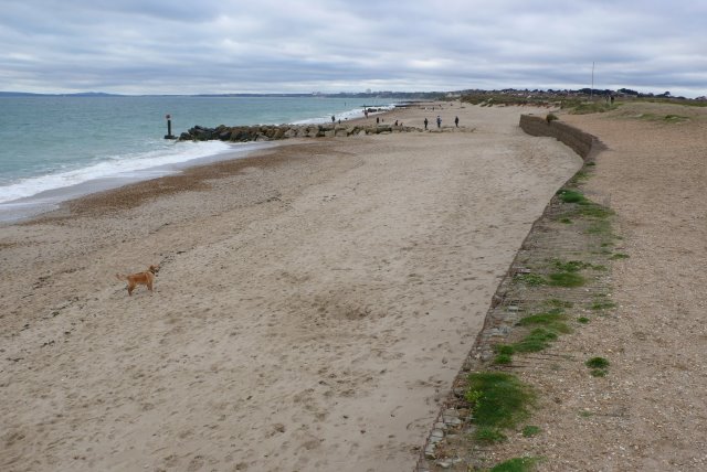
English: Beach near Hengistbury Head Looking west along the beach from the southern end of the double dykes that were the defences of the prehistoric port area. In the foreground can be seen the gabions which have successfully reduced the erosion. Where there are no gabions the coast has receded much more. |
| Date | |
| Source | From geograph.org.uk |
| Author | Nigel Mykura |
| Attribution (required by the license) | Nigel Mykura / Beach near Hengistbury Head / |
| Camera location | | View this and other nearby images on: OpenStreetMap |
|---|
_heading:270.00&language=en)
| Object location | | View this and other nearby images on: OpenStreetMap |
|---|
_heading:270.00&language=en)
Licensing
[edit]

|
This image was taken from the Geograph project collection. See this photograph's page on the Geograph website for the photographer's contact details. The copyright on this image is owned by Nigel Mykura and is licensed for reuse under the Creative Commons Attribution-ShareAlike 2.0 license.
|
This file is licensed under the Creative Commons Attribution-Share Alike 2.0 Generic license.
Attribution: Nigel Mykura
- You are free:
- to share – to copy, distribute and transmit the work
- to remix – to adapt the work
- Under the following conditions:
- attribution – You must give appropriate credit, provide a link to the license, and indicate if changes were made. You may do so in any reasonable manner, but not in any way that suggests the licensor endorses you or your use.
- share alike – If you remix, transform, or build upon the material, you must distribute your contributions under the same or compatible license as the original.
File history
Click on a date/time to view the file as it appeared at that time.
| Date/Time | Thumbnail | Dimensions | User | Comment | |
|---|---|---|---|---|---|
| current | 20:41, 23 February 2011 | | 640 × 428 (70 KB) | GeographBot (talk | contribs) | == {{int:filedesc}} == {{Information |description={{en|1=Beach near Hengistbury Head Looking west along the beach from the southern end of the double dykes that were the defences of the prehistoric port area. In the foreground can be seen the gabions whic |
You cannot overwrite this file.
File usage on Commons
There are no pages that use this file.