File:Battery no. 10 (near the new fair grounds) - total 14 85-100 acres. LOC lva0000118.jpg
Jump to navigation
Jump to search
Size of this preview: 745 × 600 pixels. Other resolutions: 298 × 240 pixels | 597 × 480 pixels | 954 × 768 pixels | 1,272 × 1,024 pixels | 2,545 × 2,048 pixels | 4,883 × 3,930 pixels.
Original file (4,883 × 3,930 pixels, file size: 893 KB, MIME type: image/jpeg)
Captions
Captions
Add a one-line explanation of what this file represents
Summary
[edit]| Description |
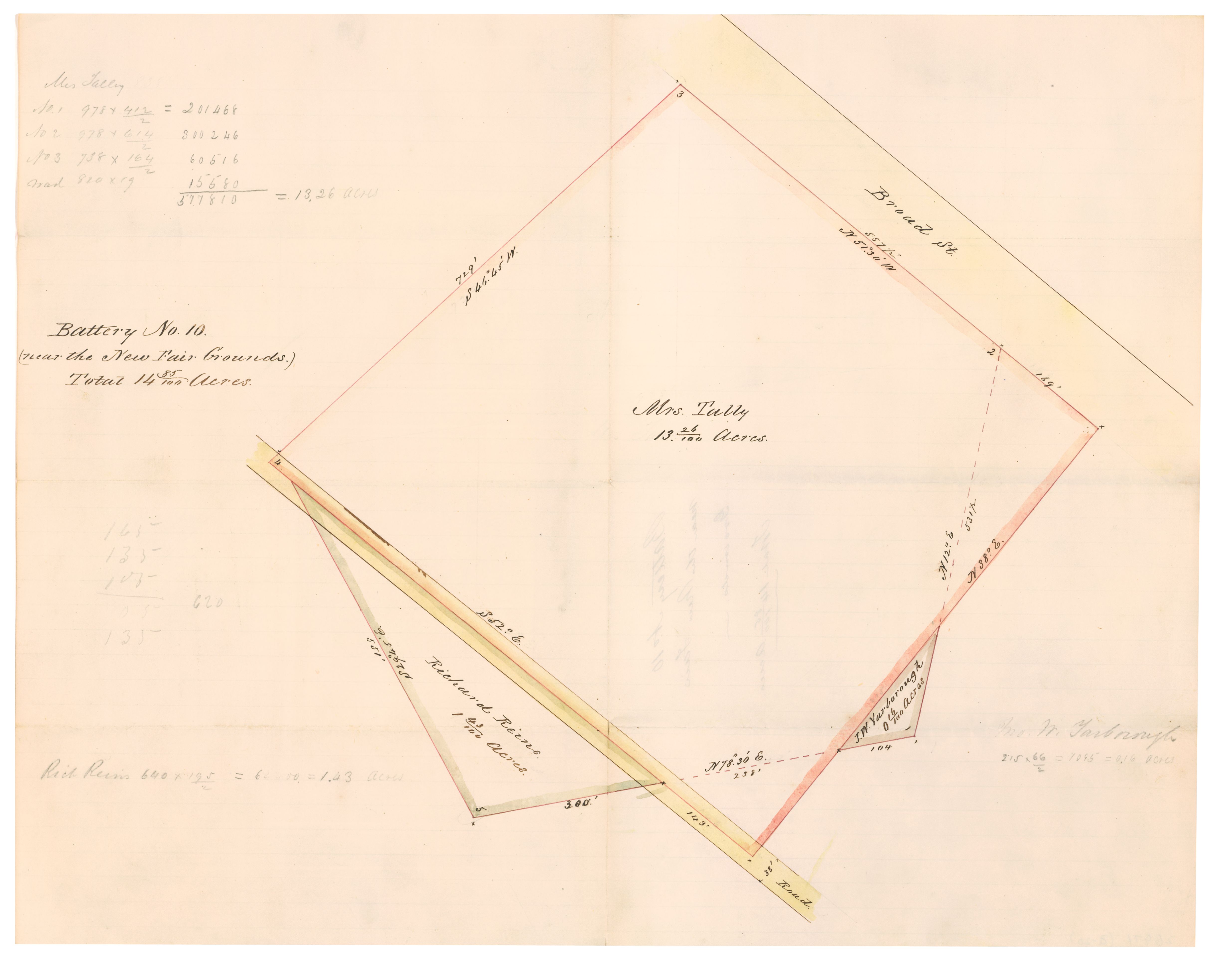
English: Gives measurements and latitude and longitude of perimeters. Map annoted with names of land owners: Mrs. Tally, Richard Reins and J.W. Yarborough. One of a series of ten maps showing the plats of land appropriated for Batteries 1-10 around Richmond. Original maps are included in Personal Papers Collection, accession 26971, B.M. Jones Papers. This item is in the Map Collection of the Library of Virginia; please contact the Library's Archives Research Services department for more information. Available also through the Library of Congress web site as raster image. c. 1, March 2003, source unknown; c. 2, March 2003, color ink jet print, LVA, Map Cataloging Team. Civil War Map Proj. no.: lva00118. Copy 1 map accession no. 26791 (1968); Copy 2, map accession no. 5208j (on sheet approx. 34 x 42 cm.) Digital image available: 15.75 x 12.25 in. Original plats are restricted. Please use copies available in the Map Room (755.43 S8 1861). |
||
| Title | Battery no. 10 (near the new fair grounds) : total 14 85/100 acres. | ||
| Shelf ID | https://www.loc.gov/item/lva0000118/ | ||
| Date | |||
| Source | https://www.loc.gov/item/lva0000118/ | ||
| Author | Jones, M. | ||
| Permission (Reusing this file) |
|
||
| Other versions |
|
||
| Location | United States · Richmond Region · Virginia | ||
| Part of | Military Battles And Campaigns · American Memory · Civil War Maps · Geography And Map Division | ||
| Subject | Maps, Manuscript · Richmond Region · Virginia · Civil War · United States · Richmond Region (Va.) · History |


_-_total_14_85-100_acres._LOC_lva0000118.jpg&action=edit§ion=1)
Licensing
[edit]_-_total_14_85-100_acres._LOC_lva0000118.jpg&action=edit§ion=2)
|
This is a faithful photographic reproduction of a two-dimensional, public domain work of art. The work of art itself is in the public domain for the following reason:
The official position taken by the Wikimedia Foundation is that "faithful reproductions of two-dimensional public domain works of art are public domain".
This photographic reproduction is therefore also considered to be in the public domain in the United States. In other jurisdictions, re-use of this content may be restricted; see Reuse of PD-Art photographs for details. | ||||
File history
Click on a date/time to view the file as it appeared at that time.
| Date/Time | Thumbnail | Dimensions | User | Comment | |
|---|---|---|---|---|---|
| current | 08:35, 31 May 2018 | | 4,883 × 3,930 (893 KB) | Fæ (talk | contribs) | LOC Maps https://www.loc.gov/item/lva0000118/ #702 |
You cannot overwrite this file.
File usage on Commons
The following page uses this file:
_-_total_14_85-100_acres._LOC_lva0000118.jpg&oldid=818620702)