File:Bartniczka (gmina) location map.png
Jump to navigation
Jump to search

Size of this preview: 727 × 599 pixels. Other resolutions: 291 × 240 pixels | 582 × 480 pixels | 872 × 719 pixels.
Original file (872 × 719 pixels, file size: 81 KB, MIME type: image/png)
Captions
Captions
Add a one-line explanation of what this file represents
| Description |
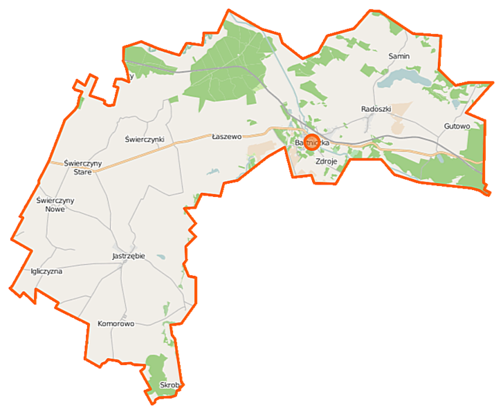
Polski: Mapa gminy Bartniczka, Polska
English: Map of Gmina Bartniczka, Poland |
|||||||||
| Date | ||||||||||
| Source | You may find a page on the OpenStreetMap wiki page for Bartniczka (gmina) | |||||||||
| Creator |
OpenStreetMap contributors OpenStreetMap contributors |
|||||||||
| Permission (Reusing this file) |
OpenStreetMap data is available under the Open Database License (details). Map tiles are licensed under the Creative Commons Attribution-ShareAlike 2.0 license (CC-BY-SA 2.0).
This file is licensed under the Creative Commons Attribution-Share Alike 2.0 Generic license.
|
|||||||||
| Geotemporal data | ||||||||||
| Bounding box |
|
|||||||||
| Georeferencing | If inappropriate please set warp_status = skip to hide. | |||||||||
File history
Click on a date/time to view the file as it appeared at that time.
| Date/Time | Thumbnail | Dimensions | User | Comment | |
|---|---|---|---|---|---|
| current | 07:52, 22 October 2014 | | 872 × 719 (81 KB) | VanWiel (talk | contribs) | {{OpenStreetMap | name = Bartniczka (gmina) | location = Bartniczka (gmina) | description = {{pl|Mapa gminy Bartniczka, Polska}} {{en|Map of Gmina Bartniczka, Poland}} | top = 53.2882 | left = 19.... |
You cannot overwrite this file.
File usage on Commons
There are no pages that use this file.
File usage on other wikis
The following other wikis use this file:
- Usage on be.wikipedia.org
- Usage on pl.wikipedia.org
- Bartniczka (gmina)
- Bartniczka
- Grążawy
- Igliczyzna
- Koziary (województwo kujawsko-pomorskie)
- Nowe Świerczyny
- Stare Świerczyny
- Świerczynki (powiat brodnicki)
- Radoszki (województwo kujawsko-pomorskie)
- Samin (wieś w województwie kujawsko-pomorskim)
- Gutowo (powiat brodnicki)
- Jastrzębie (powiat brodnicki)
- Komorowo (powiat brodnicki)
- Łaszewo (powiat brodnicki)
- Zdroje (powiat brodnicki)
- Jezioro Samińskie
- Długi Most (gmina Bartniczka)
- Gołkówko
- Iły (Radoszki)
- Nowa Igliczyzna
- Sokołowo (powiat brodnicki)
- Skrobacja
- Wilamowo (województwo kujawsko-pomorskie)
- Belfort (Stare Świerczyny)
- Gutowo Pomorskie
- Radoszki (stacja kolejowa)
- Parafia Nawiedzenia Najświętszej Maryi Panny i bł. Księdza Stefana Wincentego Frelichowskiego w Jastrzębiu
- Bajorko (jezioro na Pojezierzu Dobrzyńskim)
- Parafia św. Marcina w Grążawach
- Samin (osada w województwie kujawsko-pomorskim)
- Moduł:Mapa/dane/Bartniczka (gmina)
- Parafia św. Wawrzyńca i Mikołaja w Radoszkach
- Kościół Nawiedzenia Najświętszej Maryi Panny i bł. ks. Stefana Wincentego Frelichowskiego w Jastrzębiu
- Kościół św. Marcina w Grążawach
- Kościół Świętych Wawrzyńca i Mikołaja w Radoszkach
- Usage on pl.wikibooks.org
_location_map.png&oldid=817511346)