File:Barry power station.jpg
Jump to navigation
Jump to search
No higher resolution available.
Barry_power_station.jpg (640 × 282 pixels, file size: 143 KB, MIME type: image/jpeg)
Captions
Captions
Add a one-line explanation of what this file represents
Summary
[edit]
| Description |
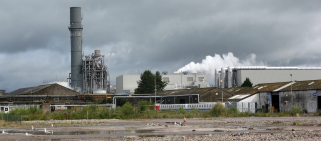
English: Industrial Development at Sully, Barry Power Station viewed from Hayes Road |
| Date | |
| Source | From geograph.org.uk |
| Author | Michael Parry |
| Permission (Reusing this file) |
Creative Commons Attribution Share-alike license 2.0 |
| Attribution (required by the license) | Michael Parry / Industrial Development at Barry / |
| Camera location | | View this and other nearby images on: OpenStreetMap |
|---|
Licensing
[edit]

|
This image was taken from the Geograph project collection. See this photograph's page on the Geograph website for the photographer's contact details. The copyright on this image is owned by Michael Parry and is licensed for reuse under the Creative Commons Attribution-ShareAlike 2.0 license.
|
This file is licensed under the Creative Commons Attribution-Share Alike 2.0 Generic license.
Attribution: Michael Parry
- You are free:
- to share – to copy, distribute and transmit the work
- to remix – to adapt the work
- Under the following conditions:
- attribution – You must give appropriate credit, provide a link to the license, and indicate if changes were made. You may do so in any reasonable manner, but not in any way that suggests the licensor endorses you or your use.
- share alike – If you remix, transform, or build upon the material, you must distribute your contributions under the same or compatible license as the original.
File history
Click on a date/time to view the file as it appeared at that time.
| Date/Time | Thumbnail | Dimensions | User | Comment | |
|---|---|---|---|---|---|
| current | 10:37, 6 April 2009 | | 640 × 282 (143 KB) | Adambro (talk | contribs) | == Summary == {{Information |Description=Industrial Development at Barry |Source=From [http://www.geograph.org.uk/photo/897245 geograph.org.uk] |Date=2008-07-06 |Author=[http://www.geograph.org.uk/profile/114 Michael Parry] |Permission=Creative Commons At |
You cannot overwrite this file.
File usage on Commons
The following page uses this file:
File usage on other wikis
The following other wikis use this file:
- Usage on en.wikipedia.org
- Usage on no.wikipedia.org
- Usage on www.wikidata.org