File:Barrier Island along Arctic Shores.jpg
Jump to navigation
Jump to search
Size of this preview: 558 × 600 pixels. Other resolutions: 223 × 240 pixels | 447 × 480 pixels | 715 × 768 pixels | 953 × 1,024 pixels | 1,906 × 2,048 pixels | 2,792 × 3,000 pixels.
Original file (2,792 × 3,000 pixels, file size: 4.11 MB, MIME type: image/jpeg)
Captions
Captions
Add a one-line explanation of what this file represents
Summary
[edit]
| Description |
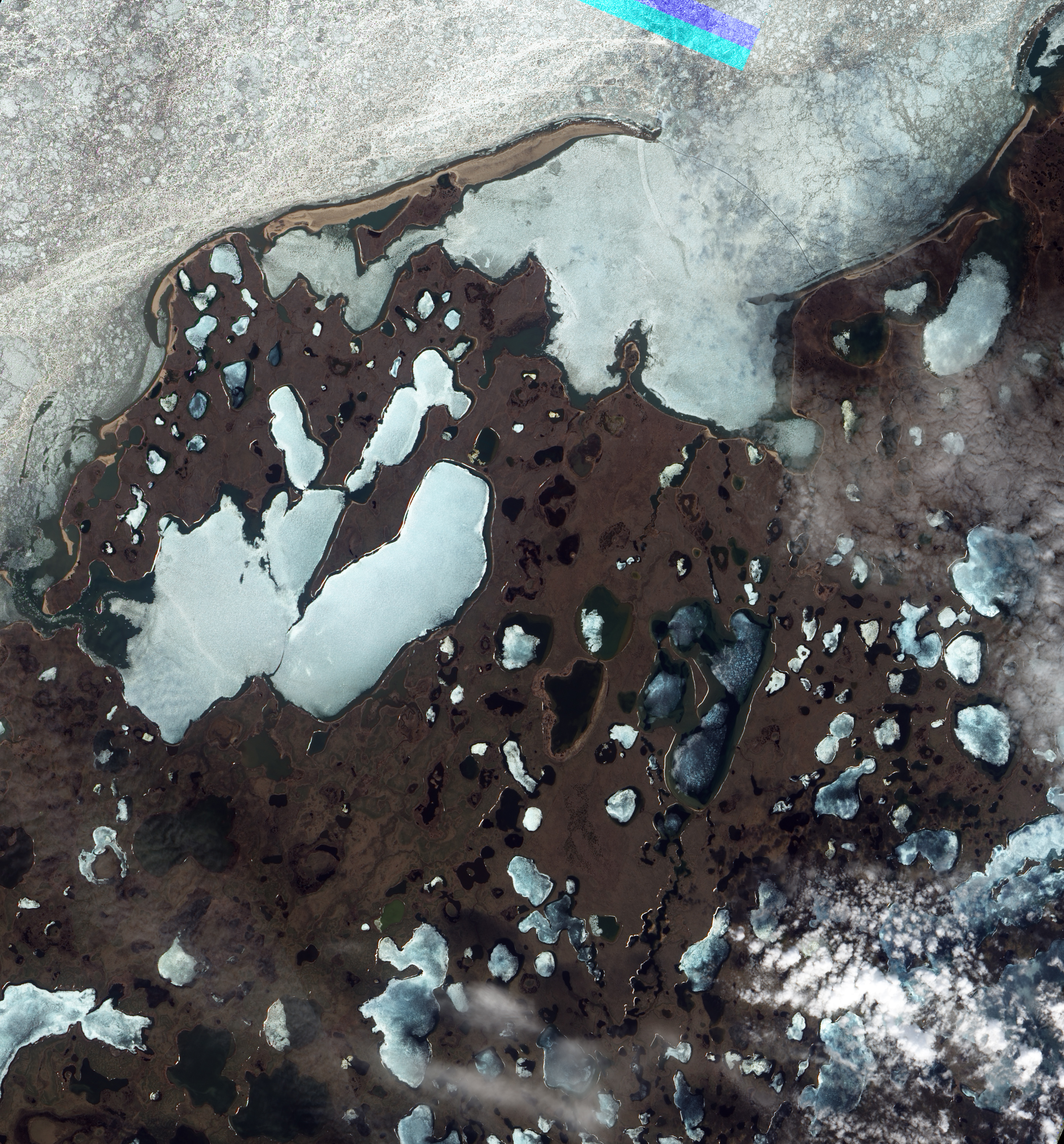
English: Image of a barrier island facing the Beaufort Sea, on the northern edge of Canada's Northwest Territories. The image was acquired before sea ice had melted or retreated in the summer thaw. The beach is tan and brown in the image, surrounded by ice in the ocean and the back bay. |
| Date | |
| Source | NASA Earth Observatory |
| Author | Jesse Allen and Robert Simmon |
Image captured by the Advanced Land Imager on NASA's Earth Observing-1 satellite. EO-1 ALI data provided courtesy of the NASA EO-1 team and the United States Geological Survey.
Licensing
[edit]
| This file is in the public domain in the United States because it was solely created by NASA. NASA copyright policy states that "NASA material is not protected by copyright unless noted". (See Template:PD-USGov, NASA copyright policy page or JPL Image Use Policy.) | ||
 |
Warnings:
|
File history
Click on a date/time to view the file as it appeared at that time.
| Date/Time | Thumbnail | Dimensions | User | Comment | |
|---|---|---|---|---|---|
| current | 10:20, 16 June 2011 | | 2,792 × 3,000 (4.11 MB) | Originalwana (talk | contribs) | {{Information |Description ={{en|1=Image of a barrier island facing the Beaufort Sea, on the northern edge of Canada's Northwest Territories. The image was acquired before sea ice had melted or retre |
You cannot overwrite this file.
File usage on Commons
There are no pages that use this file.