File:Bargis Scala Mola.jpg
Jump to navigation
Jump to search

Size of this preview: 800 × 600 pixels. Other resolutions: 320 × 240 pixels | 640 × 480 pixels | 1,024 × 768 pixels | 1,280 × 960 pixels | 2,560 × 1,920 pixels | 3,072 × 2,304 pixels.
Original file (3,072 × 2,304 pixels, file size: 3.47 MB, MIME type: image/jpeg)
Captions
Captions
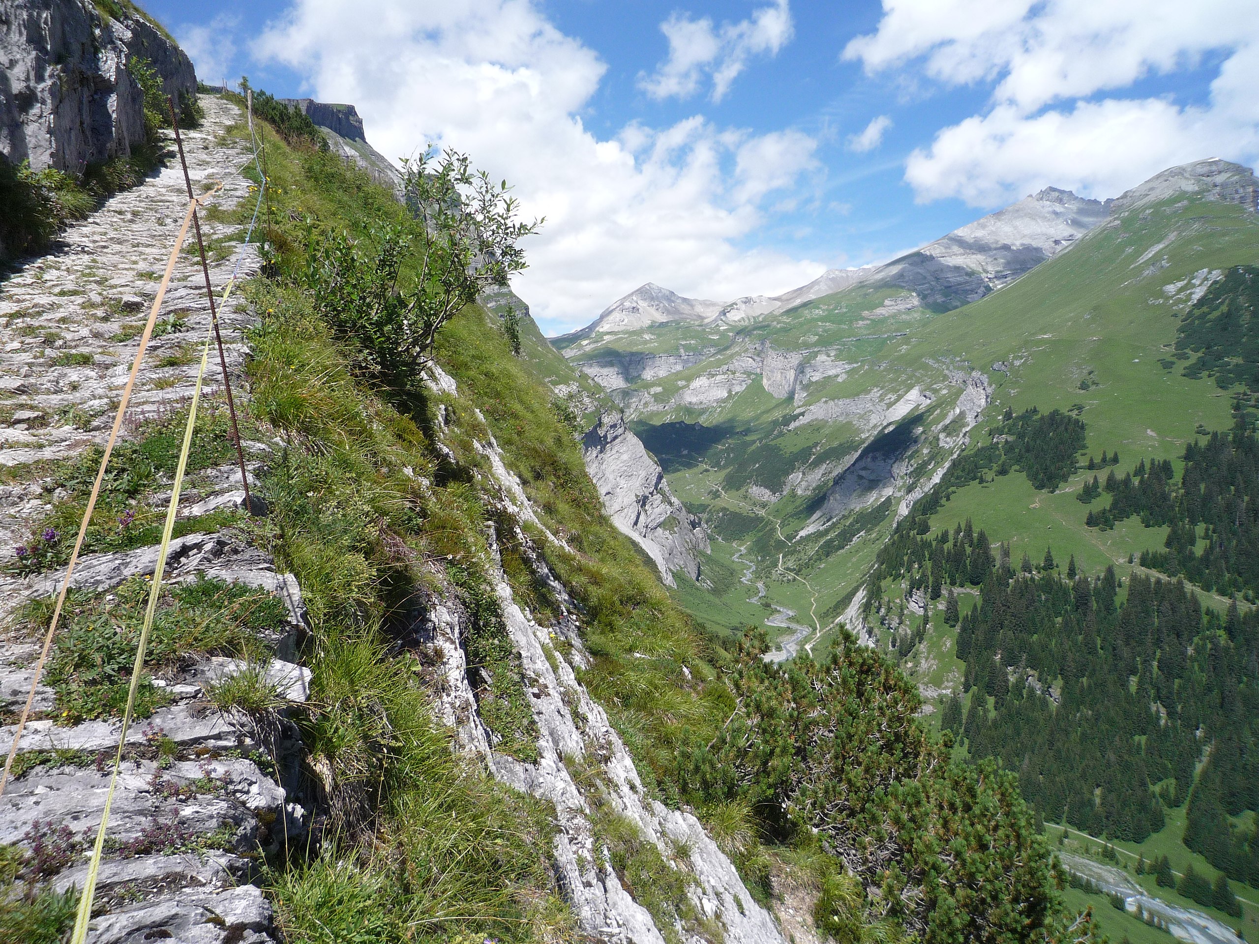
new path Scala Mola dating 1867/1868
Summary
[edit]
| Description |
English: The new path Scala Mola dating 1867/1868 from Bargis to the Flims Alps on Flimserstein
Deutsch: Der neuere Weg der Scala Mola aus den Jahren 1867/1868 führt von Bargis auf die Alp auf dem Flimserstein. Vor diesem mit Sprengstoff erstellten Weg wurde ein Weg aus dem 17. Jahrhundert begangen, auf welchem nach alten Berichten jährlich Tiere zu Tode stürzten. |
| Date | |
| Source | Own work |
| Author | Caumasee |
| Camera location | | View this and other nearby images on: OpenStreetMap |
|---|
Licensing
[edit]
I, the copyright holder of this work, hereby publish it under the following license:
This file is licensed under the Creative Commons Attribution-Share Alike 4.0 International license.
- You are free:
- to share – to copy, distribute and transmit the work
- to remix – to adapt the work
- Under the following conditions:
- attribution – You must give appropriate credit, provide a link to the license, and indicate if changes were made. You may do so in any reasonable manner, but not in any way that suggests the licensor endorses you or your use.
- share alike – If you remix, transform, or build upon the material, you must distribute your contributions under the same or compatible license as the original.
File history
Click on a date/time to view the file as it appeared at that time.
| Date/Time | Thumbnail | Dimensions | User | Comment | |
|---|---|---|---|---|---|
| current | 15:49, 25 July 2019 | | 3,072 × 2,304 (3.47 MB) | Caumasee (talk | contribs) | User created page with UploadWizard |
You cannot overwrite this file.
File usage on Commons
The following 2 pages use this file: