File:Barbrook Reservoir - geograph.org.uk - 1585458.jpg
Barbrook_Reservoir_-_geograph.org.uk_-_1585458.jpg (640 × 480 pixels, file size: 72 KB, MIME type: image/jpeg)
Captions
Captions
Summary
[edit]
| Description |
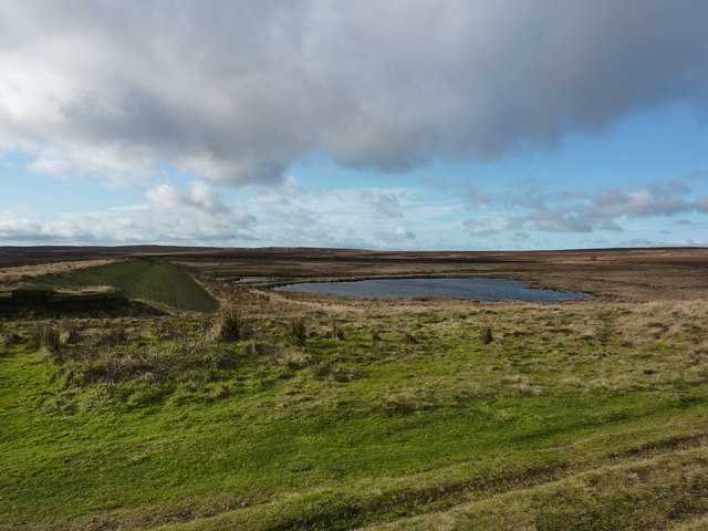
English: Barbrook Reservoir This reservoir lies on Big Moor, which is the huge tract of moorland between the Owler Bar to Froggatt Road and the Owler Bar to Baslow Road. Recently the water has been drained off and the dam wall breached. This is because the reservoir has not been used as a water supply source for many years. To comply with current safety legislations, it has been necessary to drain and formally discontinue' the structure to ensure that it can no longer retain significant volumes of water.
The still' or pond reservoir was originally constructed by impounding the Bar Brook, which rises on Totley Moss and eventually joins the River Derwent at Baslow, by Chesterfield RDC Waterworks Department in about 1882. Subsequently, in 1908 or 1910 a new dam wall was constructed to encompass some 30 acres and hold 100 million gallons of water; at it's deepest the new reservoir was 34 feet deep. The embankments were constructed from materials dug from the reservoir basin and although the supply works were demolished in 1999, the reservoir continued to hold water but the integral iron and steel structures became so severely corroded that the safe operation of the draw-off valves was no longer possible. Consultants were retained in 2001 to draw up a scheme for restoration of the area, facilitate the establishment of new habitats. Key species are twite, snipe and curlew, reptiles and invertebrates. Under those plans it is intended that the streams would be re-established. Just below the main reservoir is a small still' reservoir and here I have seen large numbers of dragonflies. This is part of an article by Brian Edwards, which appeared in "Bradway Bugle" |
| Date | |
| Source | From geograph.org.uk |
| Author | Peter Barr |
| Attribution (required by the license) | Peter Barr / Barbrook Reservoir / |
| Camera location | | View this and other nearby images on: OpenStreetMap |
|---|
_heading:225.00&language=en)
| Object location | | View this and other nearby images on: OpenStreetMap |
|---|
_heading:225.00&language=en)
Licensing
[edit]

|
This image was taken from the Geograph project collection. See this photograph's page on the Geograph website for the photographer's contact details. The copyright on this image is owned by Peter Barr and is licensed for reuse under the Creative Commons Attribution-ShareAlike 2.0 license.
|
- You are free:
- to share – to copy, distribute and transmit the work
- to remix – to adapt the work
- Under the following conditions:
- attribution – You must give appropriate credit, provide a link to the license, and indicate if changes were made. You may do so in any reasonable manner, but not in any way that suggests the licensor endorses you or your use.
- share alike – If you remix, transform, or build upon the material, you must distribute your contributions under the same or compatible license as the original.
File history
Click on a date/time to view the file as it appeared at that time.
| Date/Time | Thumbnail | Dimensions | User | Comment | |
|---|---|---|---|---|---|
| current | 23:12, 3 March 2011 | | 640 × 480 (72 KB) | GeographBot (talk | contribs) | == {{int:filedesc}} == {{Information |description={{en|1=Barbrook Reservoir This reservoir lies on Big Moor, which is the huge tract of moorland between the Owler Bar to Froggatt Road and the Owler Bar to Baslow Road. Recently the water has been drained o |
You cannot overwrite this file.
File usage on Commons
There are no pages that use this file.