File:Baluchistan States Map.png
Jump to navigation
Jump to search
No higher resolution available.
Baluchistan_States_Map.png (700 × 600 pixels, file size: 12 KB, MIME type: image/png)
Captions
Captions
Add a one-line explanation of what this file represents
Summary
[edit]
| Description |
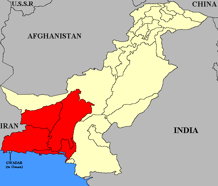
English: This map shows the relative position of the former Baluchistan States Union in Pakistan until it was dissolved in 1955. |
| Date | 6 February 2006 (original upload date) |
| Source | Transferred from en.wikipedia to Commons. |
| Author | Green Giant at English Wikipedia |
Licensing
[edit]
Green Giant at English Wikipedia, the copyright holder of this work, hereby publishes it under the following license:
This file is licensed under the Creative Commons Attribution-Share Alike 4.0 International license.
Attribution: Green Giant at English Wikipedia
- You are free:
- to share – to copy, distribute and transmit the work
- to remix – to adapt the work
- Under the following conditions:
- attribution – You must give appropriate credit, provide a link to the license, and indicate if changes were made. You may do so in any reasonable manner, but not in any way that suggests the licensor endorses you or your use.
- share alike – If you remix, transform, or build upon the material, you must distribute your contributions under the same or compatible license as the original.
Original upload log
[edit]
The original description page was here. All following user names refer to en.wikipedia.
- 2006-02-06 04:13 Green Giant 700×600× (11894 bytes) == Summary == This map shows the relative position of the former [[Baluchistan States Union]] in Pakistan until it was dissolved in 1955. == Licencing == {{PD-self|Green_Giant}}
Original upload log
[edit]
| Date/Time | Dimensions | User | Comment |
|---|---|---|---|
| 1 August 2012, 08:40:08 | 700 × 600 (11894 bytes) | Slb nsk (talk · contribs) |
File history
Click on a date/time to view the file as it appeared at that time.
| Date/Time | Thumbnail | Dimensions | User | Comment | |
|---|---|---|---|---|---|
| current | 10:04, 23 August 2014 | | 700 × 600 (12 KB) | GifTagger (talk | contribs) | Bot: Converting file to superior PNG file. (Source: Baluchistan_States_Map.gif). This GIF was problematic due to non-greyscale color table. |
You cannot overwrite this file.
File usage on Commons
The following 2 pages use this file:
- File:Baluchistan States Map.gif (file redirect)
- Category:Baluchistan States Union
File usage on other wikis
The following other wikis use this file:
- Usage on ca.wikipedia.org
- Usage on en.wikipedia.org
- Usage on es.wikipedia.org
- Usage on hu.wikipedia.org
- Usage on pnb.wikipedia.org
- Usage on ru.wikipedia.org
- Usage on simple.wikipedia.org
- Usage on www.wikidata.org