File:Baltic countries.png
Jump to navigation
Jump to search

Size of this preview: 800 × 486 pixels. Other resolutions: 320 × 194 pixels | 640 × 389 pixels | 932 × 566 pixels.
Original file (932 × 566 pixels, file size: 37 KB, MIME type: image/png)
Captions
Captions
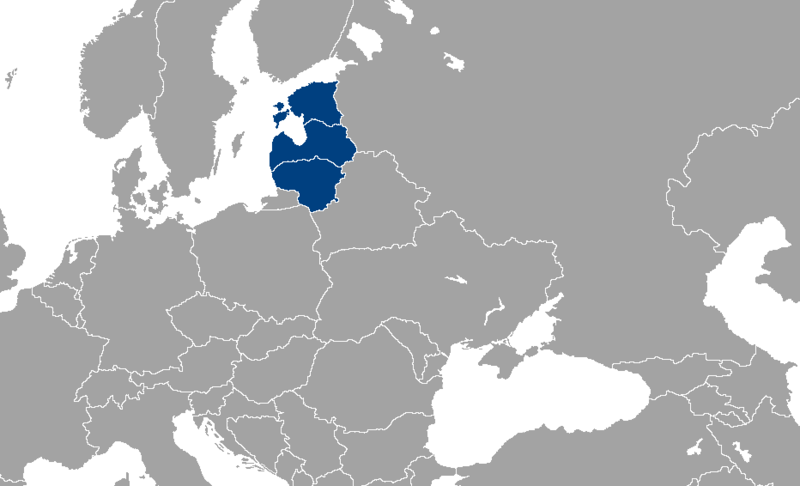
Map of the en:Baltic countries.
Summary
[edit]
| Description |
English: Map of the Baltic countries.
Español: Mapa de los países bálticos.
Source: Carte effectuée par Statu: fr:GFDL. fr:nl:Afbeelding:LocationPaysBalte.png |
| Date | 9 December 2003 (original upload date) |
| Source | Transferred from fr.wikipedia to Commons. |
| Author | The original uploader was Aoineko at French Wikipedia. |
Licensing
[edit]

|
Permission is granted to copy, distribute and/or modify this document under the terms of the GNU Free Documentation License, Version 1.2 or any later version published by the Free Software Foundation; with no Invariant Sections, no Front-Cover Texts, and no Back-Cover Texts. A copy of the license is included in the section entitled GNU Free Documentation License. |
| This file is licensed under the Creative Commons Attribution-Share Alike 3.0 Unported license. | ||
| ||
| This licensing tag was added to this file as part of the GFDL licensing update. |
Original upload log
[edit]
The original description page was here. All following user names refer to fr.wikipedia.
- 2003-12-09 07:36 Aoineko 250×115×8 (7128 bytes) '''Description''': Emplacement des [[Pays baltes]]<br>'''Source''': Carte effectuée par [[:en:User:Vardion]]<br>'''Statu''': [[GFDL]]
File history
Click on a date/time to view the file as it appeared at that time.
| Date/Time | Thumbnail | Dimensions | User | Comment | |
|---|---|---|---|---|---|
| current | 08:24, 27 January 2012 | | 932 × 566 (37 KB) | Fobos92 (talk | contribs) | . |
| 20:45, 27 May 2010 |  | 248 × 113 (3 KB) | Ras67 (talk | contribs) | cropped | |
| 05:41, 5 April 2008 |  | 250 × 115 (6 KB) | Hoshie (talk | contribs) | added Montenegro! | |
| 13:58, 8 August 2007 |  | 250 × 115 (7 KB) | J. Schwerdtfeger~commonswiki (talk | contribs) | {{Information |Description='''Description''': Map of the en:Baltic countries<br />'''Source''': Carte effectuée par <br />'''Statu''': fr:GFDL fr:nl:Afbeelding:LocationPaysBalte.png |Source=Originally from [http://fr.wikipedia.org fr.w |
You cannot overwrite this file.
File usage on Commons
The following page uses this file:
File usage on other wikis
The following other wikis use this file:
- Usage on ast.wikipedia.org
- Usage on el.wikipedia.org
- Usage on en.wikipedia.org
- Usage on es.wikipedia.org
- Usage on fo.wikipedia.org
- Usage on fr.wikipedia.org
- Usage on ga.wikipedia.org
- Usage on he.wikivoyage.org
- Usage on hi.wikivoyage.org
- Usage on it.wikivoyage.org
- Usage on ko.wikipedia.org
- Usage on pt.wikipedia.org
- Usage on sl.wikipedia.org
- Usage on sw.wikipedia.org
- Usage on tl.wikipedia.org
- Usage on www.wikidata.org
- Usage on zh-min-nan.wikipedia.org