File:Balkon - altes Brauhaus, Schrems 2021-06.jpg
From Wikimedia Commons, the free media repository
Jump to navigation
Jump to search
Size of this preview: 800 × 579 pixels. Other resolutions: 320 × 231 pixels | 640 × 463 pixels | 1,024 × 741 pixels | 1,280 × 926 pixels | 2,560 × 1,851 pixels | 5,000 × 3,616 pixels.
Original file (5,000 × 3,616 pixels, file size: 16.49 MB, MIME type: image/jpeg)
File information
Structured data
Captions
Summary
[edit]DescriptionBalkon - altes Brauhaus, Schrems 2021-06.jpg |
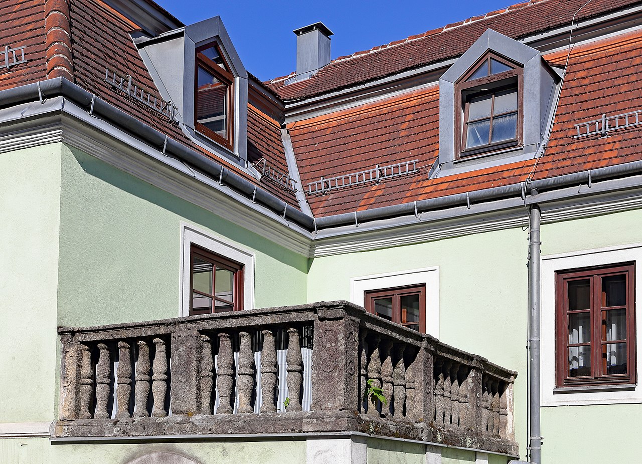
Deutsch: Balkon am ehemaligen Brauhaus. In diesem Gebäude befand sich bis 1905 die bereits 1410 urkundlich erwähnte Brauerei in Schrems. Es überstand die beiden Großbrände in den Jahren 1772 und 1871 und ist daher das älteste Gebäude der Stadt.
|
Date | |
Source | Own work |
Author | Duke of W4 |
Camera location | 48° 47′ 37.72″ N, 15° 04′ 05.19″ E | View this and other nearby images on: OpenStreetMap | 48.793810; 15.068108 |
---|
Licensing
[edit]I, the copyright holder of this work, hereby publish it under the following license:
This file is licensed under the Creative Commons Attribution-Share Alike 4.0 International license.
- You are free:
- to share – to copy, distribute and transmit the work
- to remix – to adapt the work
- Under the following conditions:
- attribution – You must give appropriate credit, provide a link to the license, and indicate if changes were made. You may do so in any reasonable manner, but not in any way that suggests the licensor endorses you or your use.
- share alike – If you remix, transform, or build upon the material, you must distribute your contributions under the same or compatible license as the original.
Diese Datei wurde im Rahmen von WikiDaheim 2021 in Österreich erstellt und hochgeladen. Sie wurde dem Themenbereich Denkmalschutz zugeordnet. |
File history
Click on a date/time to view the file as it appeared at that time.
Date/Time | Thumbnail | Dimensions | User | Comment | |
---|---|---|---|---|---|
current | 06:31, 30 July 2021 | 5,000 × 3,616 (16.49 MB) | Duke of W4 (talk | contribs) | Uploaded own work with UploadWizard |
You cannot overwrite this file.
File usage on Commons
There are no pages that use this file.
Metadata
This file contains additional information such as Exif metadata which may have been added by the digital camera, scanner, or software program used to create or digitize it. If the file has been modified from its original state, some details such as the timestamp may not fully reflect those of the original file. The timestamp is only as accurate as the clock in the camera, and it may be completely wrong.
Camera manufacturer | Canon |
---|---|
Camera model | Canon EOS 6D |
Author | Duke of W4 |
Copyright holder |
|
Exposure time | 1/400 sec (0.0025) |
F-number | f/11 |
ISO speed rating | 500 |
Date and time of data generation | 08:45, 10 June 2021 |
Lens focal length | 50 mm |
Latitude | 48° 47′ 37.72″ N |
Longitude | 15° 4′ 5.19″ E |
Width | 5,472 px |
Height | 3,648 px |
Bits per component |
|
Pixel composition | RGB |
Orientation | Normal |
Number of components | 3 |
Horizontal resolution | 350 dpi |
Vertical resolution | 350 dpi |
Software used | Adobe Photoshop Elements 15.0 (Windows) |
File change date and time | 08:45, 10 June 2021 |
Y and C positioning | Centered |
Exif version | 2.3 |
Date and time of digitizing | 08:45, 10 June 2021 |
Meaning of each component |
|
APEX shutter speed | 8.625 |
APEX aperture | 7 |
APEX exposure bias | 1 |
Maximum land aperture | 4 APEX (f/4) |
Flash | Flash did not fire, compulsory flash suppression |
Supported Flashpix version | 1 |
Color space | sRGB |
Focal plane X resolution | 3,810.5849582173 |
Focal plane Y resolution | 3,815.89958159 |
Focal plane resolution unit | inches |
Custom image processing | Normal process |
Exposure mode | Auto exposure |
White balance | Auto white balance |
Scene capture type | Standard |
GPS time (atomic clock) | 08:45 |
Reference for direction of image | True direction |
Direction of image | 254.66 |
Geodetic survey data used | WGS-84 |
Latitude destination | 48° 47′ 37.64″ N |
Longitude of destination | 15° 4′ 4.77″ E |
GPS date | 10 June 2021 |
GPS tag version | 0.0.2.2 |
Lens used | EF24-70mm f/4L IS USM |
Owner of camera | Duke of W4 |
Serial number of camera | 223020001256 |
Date metadata was last modified | 10:17, 30 July 2021 |
Unique ID of original document | 3F6EEE3751D386634EDC57E05FAC9F81 |
IIM version | 49,873 |
Structured data
Items portrayed in this file
depicts
10 June 2021
48°47'37.72"N, 15°4'5.20"E
0.0025 second
11
50 millimetre
500
image/jpeg
03737a04c901060b4caa7631984e85b3ac1bb2bd
17,294,657 byte
3,616 pixel
5,000 pixel
Hidden categories:
- Cultural heritage monuments in Austria with known IDs
- CC-BY-SA-4.0
- Self-published work
- Media from WikiDaheim 2021 in Austria/all
- Media from WikiDaheim 2021 in Austria/Cultural heritage monuments
- Media from WikiDaheim 2021 in Austria not for prejury
- Cultural heritage monuments in Austria check done
- Uploaded via Campaign:wlm-at