File:Bali-Southeastern-Islands-Region-Map.png
Jump to navigation
Jump to search
Size of this preview: 800 × 455 pixels. Other resolutions: 320 × 182 pixels | 640 × 364 pixels | 1,024 × 582 pixels | 1,280 × 727 pixels | 3,008 × 1,709 pixels.
Original file (3,008 × 1,709 pixels, file size: 914 KB, MIME type: image/png)
Captions
Captions
Add a one-line explanation of what this file represents
Summary
[edit]
| Description |
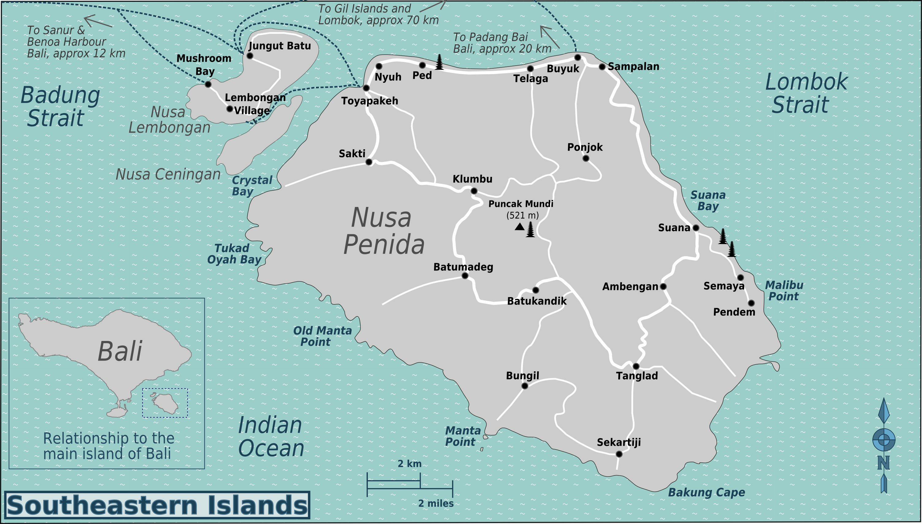
English: Map of Bali's Southeastern Islands. Map of Bali's Southeastern Islands, Bali. |
| Date | |
| Source | Bali-Southeastern-Islands-Region-Map.svg |
| Author | User:(WT-shared) Burmesedays User:(WT-shared) Peterfitzgerald OpenStreetMap |

|
File:Bali-Southeastern-Islands-Region-Map.svg is a vector version of this file. It should be used in place of this PNG file when not inferior.
File:Bali-Southeastern-Islands-Region-Map.png → File:Bali-Southeastern-Islands-Region-Map.svg
For more information, see Help:SVG. |
 |
Licensing
[edit]
This file is licensed under the Creative Commons Attribution-Share Alike 3.0 Unported license.
- You are free:
- to share – to copy, distribute and transmit the work
- to remix – to adapt the work
- Under the following conditions:
- attribution – You must give appropriate credit, provide a link to the license, and indicate if changes were made. You may do so in any reasonable manner, but not in any way that suggests the licensor endorses you or your use.
- share alike – If you remix, transform, or build upon the material, you must distribute your contributions under the same or compatible license as the original.
Original upload log
[edit]
| This file was imported from Wikivoyage WTS. |
The original description page was here. All following user names refer to wts.wikivoyage-old.
- 2010-02-11 08:17 (WT-shared) Burmesedays[dead link] 3008×1709 (900451 bytes) {{Imagecredit|credit=[[User:Burmesedays]] [[User:Peterfitzgerald]] [http://openstreetmap.org OpenStreetMap]|captureDate=11th February 2010|l (Import from wikitravel.org/shared)
- 2010-02-16 13:25 (WT-shared) Burmesedays[dead link] 3008×1709 (935533 bytes) added inset of main island (Import from wikitravel.org/shared)
File history
Click on a date/time to view the file as it appeared at that time.
| Date/Time | Thumbnail | Dimensions | User | Comment | |
|---|---|---|---|---|---|
| current | 05:34, 21 November 2012 | | 3,008 × 1,709 (914 KB) | OgreBot (talk | contribs) | (BOT): Reverting to most recent version before archival |
| 05:34, 21 November 2012 |  | 3,008 × 1,709 (879 KB) | OgreBot (talk | contribs) | (BOT): Uploading old version of file from wts.wikivoyage; originally uploaded on 2010-02-11 08:17:08 by (WT-shared) Burmesedays | |
| 22:20, 17 November 2012 |  | 3,008 × 1,709 (914 KB) | MGA73bot2 (talk | contribs) | {{BotMoveToCommons|wts.oldwikivoyage|year={{subst:CURRENTYEAR}}|month={{subst:CURRENTMONTHNAME}}|day={{subst:CURRENTDAY}}}} == {{int:filedesc}} == {{Information |description=Map of Bali's Southeastern Islands. Map of Bali's Southeastern Islands, Bali *... |
You cannot overwrite this file.
File usage on Commons
The following page uses this file:
File usage on other wikis
The following other wikis use this file:
- Usage on en.wikivoyage.org
- Usage on it.wikivoyage.org