File:Baist's real estate atlas of surveys of Denver, Col. (Plate 12) - DPLA - 2cf25813c60f8e2f7dbdb82d2e117cbd.jpg
Jump to navigation
Jump to search

Size of this preview: 800 × 558 pixels. Other resolutions: 320 × 223 pixels | 640 × 446 pixels | 1,024 × 714 pixels | 1,280 × 892 pixels | 2,560 × 1,785 pixels | 9,000 × 6,275 pixels.
Original file (9,000 × 6,275 pixels, file size: 9.72 MB, MIME type: image/jpeg)
Captions
Captions
Add a one-line explanation of what this file represents
Summary
[edit]This file was uploaded by the Digital Public Library of America, and the following item metadata was created by the contributing institution's staff.
Note: this data is being maintained by an automated bot, synced with the source data.
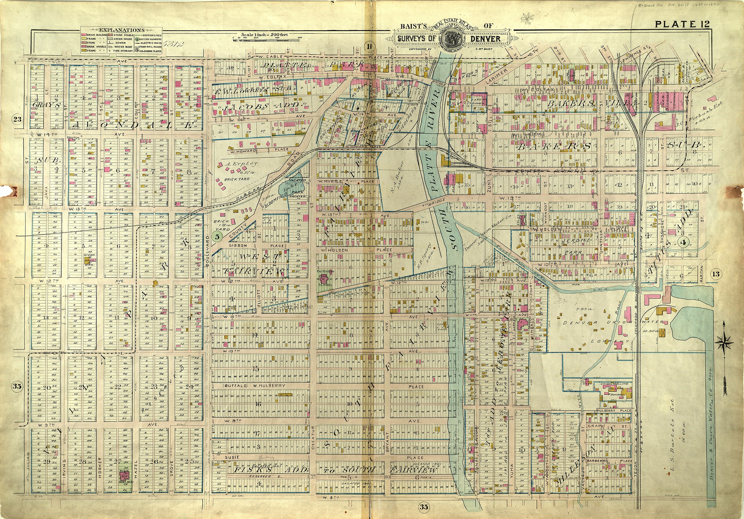
| Description | Historic map of Denver including West Colfax area. Compiled and published from official records, private plans and actual surveys". Includes index map, index to additions and subdivisions, and index to the streets and house numbers on the detail plans of the city of Denver., 1:200 | ||||||||||||||||||||
| Title | Baist's real estate atlas of surveys of Denver, Col. (Plate 12) | ||||||||||||||||||||
| Institution |
|
||||||||||||||||||||
| Subject | |||||||||||||||||||||
| Source |
Plains to Peaks Collective |
||||||||||||||||||||
| Author |
Baist, G. Wm. (George William), 1859-1927 |
||||||||||||||||||||
| Permission (Reusing this file) |
Copyright determination made by Denver Public Library (Q69470198) using RightsStatements.org
|
||||||||||||||||||||
| Partnership |
|
||||||||||||||||||||


_-_DPLA_-_2cf25813c60f8e2f7dbdb82d2e117cbd.jpg&action=edit§ion=1)
File history
Click on a date/time to view the file as it appeared at that time.
| Date/Time | Thumbnail | Dimensions | User | Comment | |
|---|---|---|---|---|---|
| current | 12:44, 18 December 2020 | | 9,000 × 6,275 (9.72 MB) | DPLA bot (talk | contribs) | Uploading DPLA ID 2cf25813c60f8e2f7dbdb82d2e117cbd |
You cannot overwrite this file.
File usage on Commons
There are no pages that use this file.
_-_DPLA_-_2cf25813c60f8e2f7dbdb82d2e117cbd.jpg&oldid=834953309)